
File:MarshallCourthouse.JPG
No higher resolution available.
MarshallCourthouse.JPG (360 × 283 pixels, file size: 23 KB, MIME type: image/jpeg)
| This is a file from the Wikimedia Commons. Information from its description page there is shown below. Commons is a freely licensed media file repository. You can help. |
Summary
| Description |
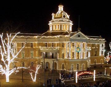
English: The Harrison County Courthouse located at 32.545° -94.3673° in Marshall, Texas, United States.
|
||
| Date | |||
| Source | Photograph created by User:Kar98, cropped by JCarriker | ||
| Author | User:Kar98 | ||
| Permission (Reusing this file) |
The copyright holder grants use of the image under the GFDL license shown below. |
| Camera location | | View this and other nearby images on: OpenStreetMap |
|---|
Licensing
| This file is licensed under the Creative Commons Attribution-Share Alike 3.0 Unported license. Subject to disclaimers. | ||
| ||
| This licensing tag was added to this file as part of the GFDL licensing update. |

|
Permission is granted to copy, distribute and/or modify this document under the terms of the GNU Free Documentation License, Version 1.2 or any later version published by the Free Software Foundation; with no Invariant Sections, no Front-Cover Texts, and no Back-Cover Texts. A copy of the license is included in the section entitled GNU Free Documentation License. Subject to disclaimers. |
File history
Click on a date/time to view the file as it appeared at that time.
| Date/Time | Thumbnail | Dimensions | User | Comment | |
|---|---|---|---|---|---|
| current | 10:39, 6 December 2005 | | 360 × 283 (23 KB) | JCarriker~commonswiki | taken by Kar98, cropped by JCarriker |
File usage
The following pages on the English Wikipedia use this file (pages on other projects are not listed):
- Christmas lights
- Harrison County, Texas
- Northeast Texas
- Old Harrison County Courthouse (Texas)
- Wikipedia:Recent additions/2005/November
- Wikipedia:Today's featured article/August 2005
- Wikipedia:Today's featured article/August 3, 2005
- Portal:Texas/Cities
- Portal:Texas/Cities/3
- Portal:Texas/Featured article
- Portal:Texas/Selected article archive
- Portal:Texas/Selected picture archive
Global file usage
The following other wikis use this file:
- Usage on ar.wikipedia.org
- Usage on de.wikipedia.org
- Usage on en.wikivoyage.org
- Usage on fr.wikipedia.org
- Usage on he.wikipedia.org
- Usage on hr.wikipedia.org
- Usage on it.wikipedia.org
- Usage on ja.wikipedia.org
- Usage on la.wikipedia.org
- Usage on nl.wikipedia.org
- Usage on no.wikipedia.org
- Usage on pl.wikipedia.org
- Usage on ro.wikipedia.org
- Usage on ru.wikipedia.org
- Usage on sr.wikipedia.org
- Usage on uk.wikipedia.org
- Usage on vi.wikipedia.org
- Usage on zh.wikipedia.org