
File:Milford Sound NZ. (16944937040).jpg

Size of this preview: 800 × 438 pixels. Other resolutions: 320 × 175 pixels | 640 × 351 pixels | 1,024 × 561 pixels | 1,280 × 701 pixels | 2,266 × 1,241 pixels.
Original file (2,266 × 1,241 pixels, file size: 2.21 MB, MIME type: image/jpeg)
| This is a file from the Wikimedia Commons. Information from its description page there is shown below. Commons is a freely licensed media file repository. You can help. |
.jpg)
Summary
| Description |
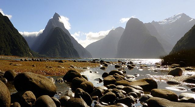
Milford Sound (Māori: Piopiotahi) is a fiord in the south west of New Zealand's South Island, within Fiordland National Park, Piopiotahi (Milford Sound) Marine Reserve, and the Te Wahipounamu World Heritage site. It has been judged the world's top travel destination in an international survey (the 2008 Travelers' Choice Destinations Awards by TripAdvisor) and is acclaimed as New Zealand's most famous tourist destination. Rudyard Kipling had previously called it the eighth Wonder of the World. Milford Sound is incorrectly named, as a sound is in fact a large sea or ocean inlet larger than a bay, deeper than a bight, and wider than a fjord, while Milford Sound is formed by the actions of glaciers. |
| Date | |
| Source | Milford Sound NZ. |
| Author | Bernard Spragg. NZ from Christchurch, New Zealand |
| Camera location | | View this and other nearby images on: OpenStreetMap |
|---|
.jpg¶ms=-44.669751_N_0167.921476_E_globe:Earth_type:camera_source:Flickr_&language=en)
Licensing
| This file is made available under the Creative Commons CC0 1.0 Universal Public Domain Dedication. | |
| The person who associated a work with this deed has dedicated the work to the public domain by waiving all of their rights to the work worldwide under copyright law, including all related and neighboring rights, to the extent allowed by law. You can copy, modify, distribute and perform the work, even for commercial purposes, all without asking permission.
|
| This image was originally posted to Flickr by Bernard Spragg at https://flickr.com/photos/88123769@N02/16944937040. It was reviewed on 14 January 2017 by FlickreviewR and was confirmed to be licensed under the terms of the cc-zero. |
File history
Click on a date/time to view the file as it appeared at that time.
| Date/Time | Thumbnail | Dimensions | User | Comment | |
|---|---|---|---|---|---|
| current | 21:23, 14 January 2017 | | 2,266 × 1,241 (2.21 MB) | Holly Cheng | Transferred from Flickr via Flickr2Commons |
File usage
The following pages on the English Wikipedia use this file (pages on other projects are not listed):
Global file usage
The following other wikis use this file:
- Usage on ar.wikipedia.org
- Usage on es.wikipedia.org
- Usage on it.wikivoyage.org
- Usage on sl.wikipedia.org
- Usage on sr.wikipedia.org
- Usage on zh-yue.wikipedia.org
.jpg)