
File:Mine, what mine^ - geograph.org.uk - 823553.jpg
No higher resolution available.
Mine,_what_mine^_-_geograph.org.uk_-_823553.jpg (640 × 417 pixels, file size: 70 KB, MIME type: image/jpeg)
| This is a file from the Wikimedia Commons. Information from its description page there is shown below. Commons is a freely licensed media file repository. You can help. |
Summary
| Description |
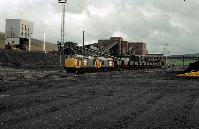
English: A pair of British Railways Class37 locomotives load coal on to an MGR train at the already closed Abernant Colliery "super pit" in the River Amman Valley. A reminder of South Wales once great Industrial past. Coal mines such as this were once found all over. Now there are no deep mines at all in South Wales. The colliery closed in 1988, and this location has been razed to the ground and the railway removed |
| Date | |
| Source | From geograph.org.uk |
| Author | roger geach |
| Attribution (required by the license) | roger geach / Mine, what mine? / |
| Camera location | | View this and other nearby images on: OpenStreetMap |
|---|
_heading:202.00&language=en)
| Object location | | View this and other nearby images on: OpenStreetMap |
|---|
_heading:202.00&language=en)
Licensing

|
This image was taken from the Geograph project collection. See this photograph's page on the Geograph website for the photographer's contact details. The copyright on this image is owned by roger geach and is licensed for reuse under the Creative Commons Attribution-ShareAlike 2.0 license.
|
This file is licensed under the Creative Commons Attribution-Share Alike 2.0 Generic license.
Attribution: roger geach
- You are free:
- to share – to copy, distribute and transmit the work
- to remix – to adapt the work
- Under the following conditions:
- attribution – You must give appropriate credit, provide a link to the license, and indicate if changes were made. You may do so in any reasonable manner, but not in any way that suggests the licensor endorses you or your use.
- share alike – If you remix, transform, or build upon the material, you must distribute your contributions under the same or compatible license as the original.
File history
Click on a date/time to view the file as it appeared at that time.
| Date/Time | Thumbnail | Dimensions | User | Comment | |
|---|---|---|---|---|---|
| current | 16:15, 20 February 2011 | | 640 × 417 (70 KB) | GeographBot | == {{int:filedesc}} == {{Information |description={{en|1=Mine, what mine? A reminder of South Wales once great Industrial past. Coal mines such as this were once found all over. Now there are no deep mines at all in South Wales. This location has been raz |
File usage
The following pages on the English Wikipedia use this file (pages on other projects are not listed):
Global file usage
The following other wikis use this file:
- Usage on www.wikidata.org