
File:Mormon Bridge in 2022-a.jpg

Size of this preview: 800 × 600 pixels. Other resolutions: 320 × 240 pixels | 640 × 480 pixels | 1,024 × 768 pixels | 1,280 × 960 pixels | 2,560 × 1,920 pixels | 4,032 × 3,024 pixels.
Original file (4,032 × 3,024 pixels, file size: 3.76 MB, MIME type: image/jpeg)
| This is a file from the Wikimedia Commons. Information from its description page there is shown below. Commons is a freely licensed media file repository. You can help. |
Summary
| Description |
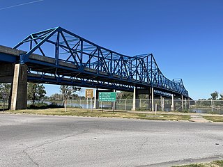
English: The Mormon Bridge seen form the south on the Nebraska side of the Missouri river. |
| Date | |
| Source | Own work |
| Author | Declan M Martin |
| Camera location | | View this and other nearby images on: OpenStreetMap |
|---|
Licensing
| I, the copyright holder of this work, release this work into the public domain. This applies worldwide. In some countries this may not be legally possible; if so: I grant anyone the right to use this work for any purpose, without any conditions, unless such conditions are required by law. |
| ⧼If being used for commerical purposes, crediting "Declan M Martin" is appreciated but not mandatory.⧽ |
The depicted structure situated in or visible from public space (e.g. a building, a bridge, an overpass) in the
|
 |

File history
Click on a date/time to view the file as it appeared at that time.
| Date/Time | Thumbnail | Dimensions | User | Comment | |
|---|---|---|---|---|---|
| current | 00:24, 10 August 2022 | | 4,032 × 3,024 (3.76 MB) | Dmartin969 | Uploaded a work by Declan M Martin from Own work with UploadWizard |
File usage
The following pages on the English Wikipedia use this file (pages on other projects are not listed):