
File:NASA Wallops Flight Facility, 2010.jpg
Original file (1,024 × 683 pixels, file size: 557 KB, MIME type: image/jpeg)
| This is a file from the Wikimedia Commons. Information from its description page there is shown below. Commons is a freely licensed media file repository. You can help. |
Summary
| Description |
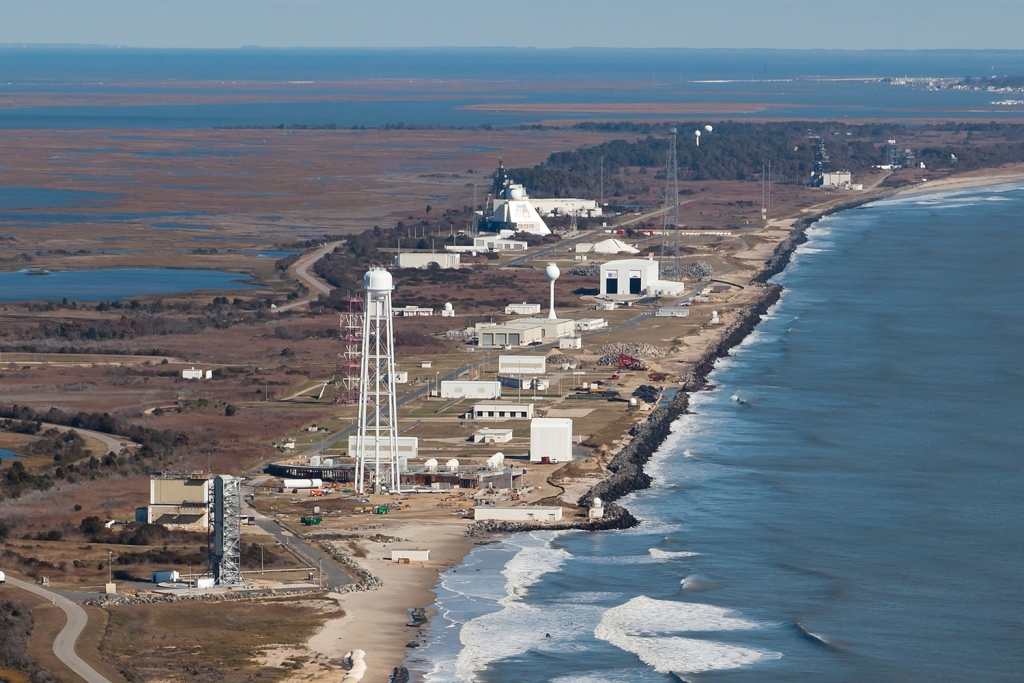
English: NASA Goddard Space Flight Center's Wallops Flight Facility, located on Virginia's Eastern Shore, was established in 1945 by the National Advisory Committee for Aeronautics, as a center for aeronautic research.
Wallops is now NASA's principal facility for management and implementation of suborbital research programs. The Wallops Mission Plan includes the following objectives: • To help achieve NASA's strategic objectives for scientific and educational excellence through cost efficient integration, launch, and operations of suborbital and small orbital payloads. • To enable scientific, educational, and economic advancement by providing the facilities and expertise to enable frequent flight opportunities for a diverse customer base. • To serve as a key facility for operational test, integration, and certification of NASA and commercial next-generation, low-cost orbital launch technologies. • To pioneer productive and innovative government, industry, and academic partnerships. The research and responsibilities of Wallops Flight Facility are centered around the philosophy of providing a fast, low cost, highly flexible and safe response to meet the needs of the United States' aerospace technology interests and science research. The 1,000 full-time Civil Service and contractor NASA Wallops employees act as a team to accomplish our mission in the spirit of this philosophy. NASA also opens its unique facilities to industry for space and aeronautics research. Wallops expects an increase in commercial launch activity in the very near future. |
| Date | |
| Source | NASA Wallops Flight Facility |
| Author | NASA/Wallops Flight Facility |
| Camera location | | View this and other nearby images on: OpenStreetMap |
|---|
Licensing
| This file is in the public domain in the United States because it was solely created by NASA. NASA copyright policy states that "NASA material is not protected by copyright unless noted". (See Template:PD-USGov, NASA copyright policy page or JPL Image Use Policy.) | ||
 |
Warnings:
|
File history
Click on a date/time to view the file as it appeared at that time.
| Date/Time | Thumbnail | Dimensions | User | Comment | |
|---|---|---|---|---|---|
| current | 20:41, 31 August 2011 | | 1,024 × 683 (557 KB) | File Upload Bot (Magnus Manske) | {{Information |Description=NASA Goddard Space Flight Center's Wallops Flight Facility, located on Virginia's Eastern Shore, was established in 1945 by the National Advisory Committee for Aeronautics, as a center for aeronautic research. Wallops is now N |
File usage
Global file usage
The following other wikis use this file:
- Usage on ca.wikipedia.org
- Usage on ceb.wikipedia.org
- Usage on eo.wikipedia.org
- Usage on fa.wikipedia.org
- Usage on fi.wikipedia.org
- Usage on gl.wikipedia.org
- Usage on he.wikipedia.org
- Usage on it.wikipedia.org
- Usage on ja.wikipedia.org
- Usage on pt.wikipedia.org
- Usage on ru.wikipedia.org
- Usage on sk.wikipedia.org
- Usage on uk.wikipedia.org
- Usage on www.wikidata.org