
File:NUTS 3 regions of central and southern Scotland map.svg

Size of this PNG preview of this SVG file: 418 × 401 pixels. Other resolutions: 250 × 240 pixels | 500 × 480 pixels | 801 × 768 pixels | 1,067 × 1,024 pixels | 2,135 × 2,048 pixels.
Original file (SVG file, nominally 418 × 401 pixels, file size: 666 KB)
| This is a file from the Wikimedia Commons. Information from its description page there is shown below. Commons is a freely licensed media file repository. You can help. |
Summary
| Description |
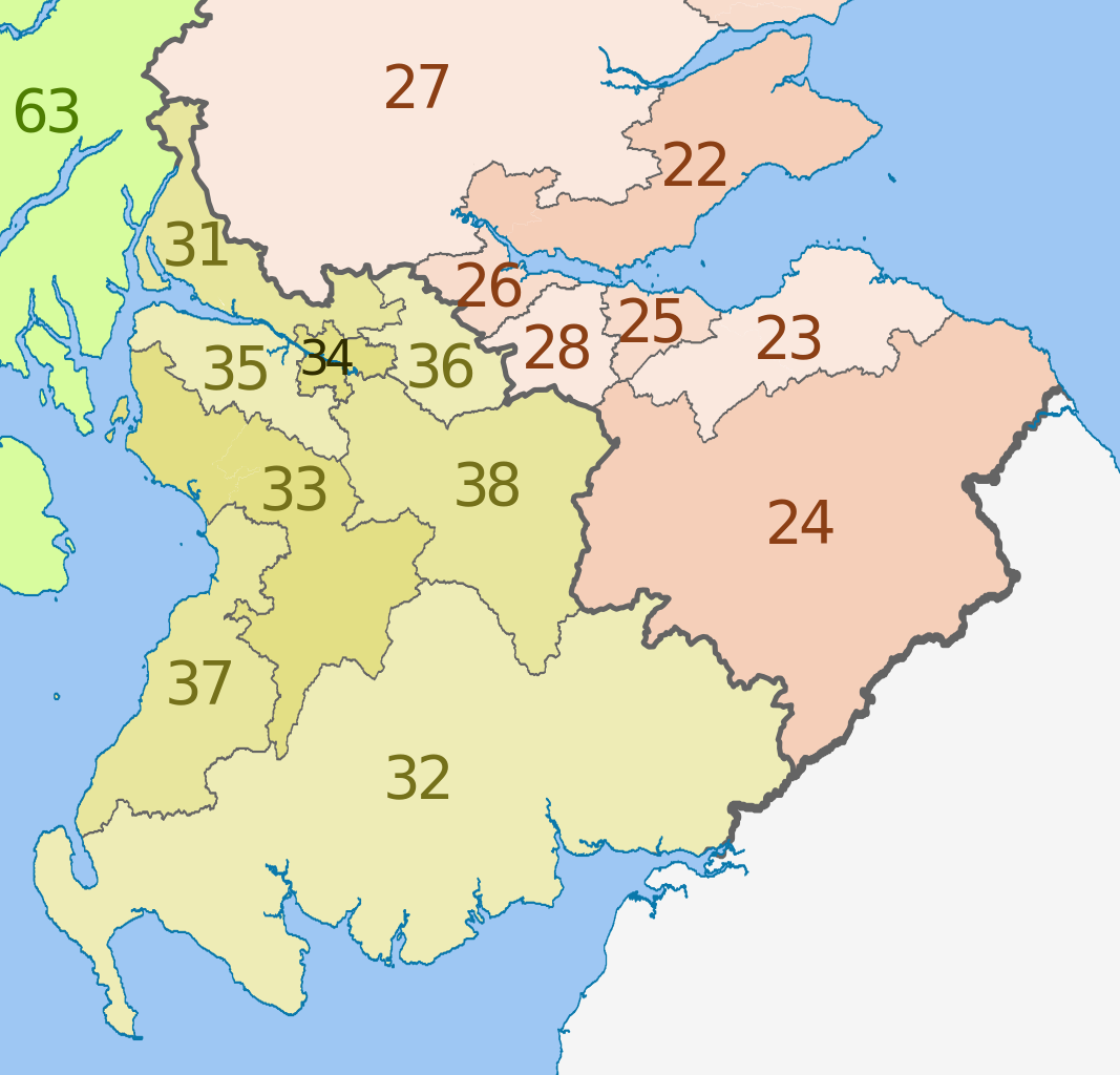
English: Map of the NUTS 3 regions of Scotland in 2011.
This is an enlargement from File:NUTS 3 regions of Scotland map.svg showing southern and central Scotland only. See that file for list of region codes. |
| Date | (UTC) |
| Source |
This file was derived from: |
| Author |
|
| Other versions | File:NUTS 3 regions of Scotland map.svg shows the whole of Scotland and lists the NUTs codes |


Licensing
This file is licensed under the Creative Commons Attribution-Share Alike 3.0 Unported license.
Attribution: Dr Greg, Nilfanion & XrysD. Contains Ordnance Survey data © Crown copyright and database right 2011
- You are free:
- to share – to copy, distribute and transmit the work
- to remix – to adapt the work
- Under the following conditions:
- attribution – You must give appropriate credit, provide a link to the license, and indicate if changes were made. You may do so in any reasonable manner, but not in any way that suggests the licensor endorses you or your use.
- share alike – If you remix, transform, or build upon the material, you must distribute your contributions under the same or compatible license as the original.
Original upload log
This image is a derivative work of the following images:
- File:Scottish_council_areas_2011.svg licensed with Cc-by-sa-3.0
- 2011-05-01T19:21:40Z Nilfanion 1023x1345 (3008417 Bytes) {{Information |Description=Map showing the [[w:Council areas of Scotland|Council areas of Scotland]] in 2011. Equirectangular map projection on WGS 84 datum, with N/S stretched 170% Geographic limits: *West: 8.8W *East: 0.4
- File:Scotland_Administrative_Map_1947.png licensed with Cc-by-sa-3.0-migrated, FAL, GFDL
- 2009-06-14T12:39:08Z XrysD 2000x3479 (2679270 Bytes) Corrected typo
- 2009-06-14T12:04:54Z XrysD 2000x3479 (2679081 Bytes) {{Information |Description={{en|1=Administrative map of Scotland in 1947. Showing Counties and Districts, Counties of Cities, Large and Smal Burghs}} |Source=Own work by uploader |Author=[[User:XrysD|XrysD]] |Date=2009-06-14
Uploaded with derivativeFX
File history
Click on a date/time to view the file as it appeared at that time.
| Date/Time | Thumbnail | Dimensions | User | Comment | |
|---|---|---|---|---|---|
| current | 13:25, 5 June 2012 | | 418 × 401 (666 KB) | Dr Greg | == {{int:filedesc}} == {{Information |Description={{en|Map of the NUTS 3 regions of Scotland in 2011. This is an enlargement from File:NUTS 3 regions of Scotland map.svg sh... |
File usage
The following pages on the English Wikipedia use this file (pages on other projects are not listed):
Global file usage
The following other wikis use this file:
- Usage on ar.wikipedia.org
- Usage on de.wikipedia.org
- Usage on fi.wikipedia.org
- Usage on it.wikipedia.org
- Usage on lt.wikipedia.org
- Usage on ru.wikipedia.org
- Usage on zh.wikipedia.org