
File:Nautical Chart 11537-April 2013.jpg
Size of this preview: 800 × 555 pixels. Other resolutions: 320 × 222 pixels | 640 × 444 pixels | 1,024 × 711 pixels | 1,289 × 895 pixels.
Original file (1,289 × 895 pixels, file size: 1.24 MB, MIME type: image/jpeg)
| This is a file from the Wikimedia Commons. Information from its description page there is shown below. Commons is a freely licensed media file repository. You can help. |
Summary
| Description |
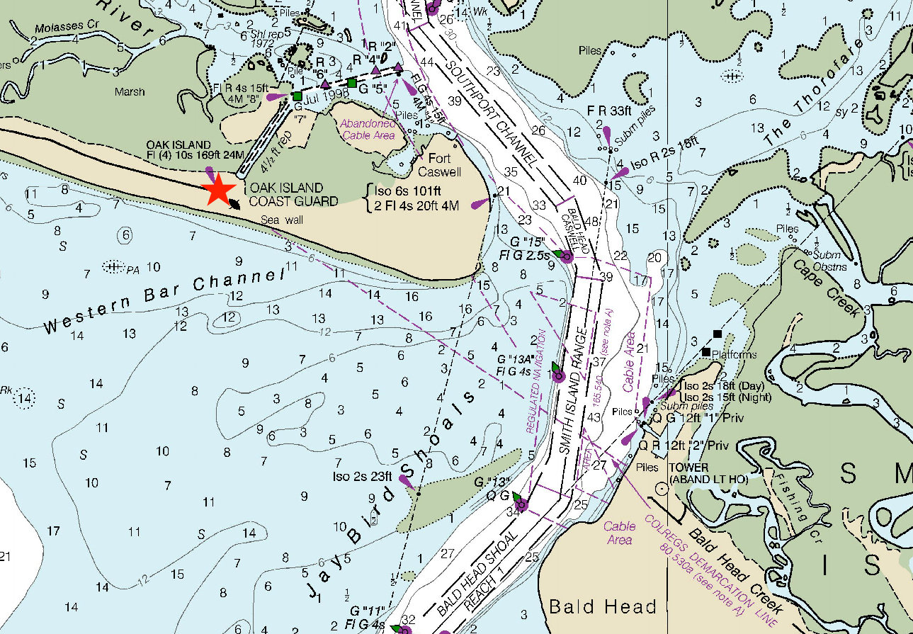
English: Portion of the nautical chart that shows the location of the Oak Island Light. |
| Date | |
| Source | NOAA Office of Coastal Survey |
| Author | Francisbausch |
Licensing
This image is in the public domain because it contains materials that originally came from the U.S. National Oceanic and Atmospheric Administration, taken or made as part of an employee's official duties.
|
File history
Click on a date/time to view the file as it appeared at that time.
| Date/Time | Thumbnail | Dimensions | User | Comment | |
|---|---|---|---|---|---|
| current | 10:08, 24 April 2018 | | 1,289 × 895 (1.24 MB) | Francisbausch | Location of lighthouse highlighted |
| 11:10, 27 March 2018 |  | 1,289 × 895 (1.22 MB) | Francisbausch | User created page with UploadWizard |
File usage
The following pages on the English Wikipedia use this file (pages on other projects are not listed):