
File:Niigata KitaKambara-gun.png
Niigata_KitaKambara-gun.png (405 × 325 pixels, file size: 8 KB, MIME type: image/png)
| This is a file from the Wikimedia Commons. Information from its description page there is shown below. Commons is a freely licensed media file repository. You can help. |
Summary
| Description |
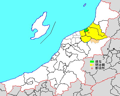
日本語: 新潟県北蒲原郡の県内位置図(2000年)
File:Niigata-pref_2000.pngを元にMndが作成 2005年9月1日以降はja:聖籠町(File:Seiro-town_Niigata.png)の一郡一町となる |
||
| Source | File:Japan map.png | ||
| Author |
|
||
| Permission (Reusing this file) |
|
Licensing

|
Permission is granted to copy, distribute and/or modify this document under the terms of the GNU Free Documentation License, Version 1.2 or any later version published by the Free Software Foundation; with no Invariant Sections, no Front-Cover Texts, and no Back-Cover Texts. A copy of the license is included in the section entitled GNU Free Documentation License. |
- You are free:
- to share – to copy, distribute and transmit the work
- to remix – to adapt the work
- Under the following conditions:
- attribution – You must give appropriate credit, provide a link to the license, and indicate if changes were made. You may do so in any reasonable manner, but not in any way that suggests the licensor endorses you or your use.
- share alike – If you remix, transform, or build upon the material, you must distribute your contributions under the same or compatible license as the original.
Original upload log
| This file was moved from Japanese Wikipedia.
See below for original file information. | ||||||||||||||||||||||||||||||||||||||||||||||||||||||||
| ||||||||||||||||||||||||||||||||||||||||||||||||||||||||
|
| ||||||||||||||||||||||||||||||||||||||||||||||||||||||||
File history
Click on a date/time to view the file as it appeared at that time.
| Date/Time | Thumbnail | Dimensions | User | Comment | |
|---|---|---|---|---|---|
| current | 06:43, 11 June 2020 | | 405 × 325 (8 KB) | Fgg13 | Uploaded a work by {{original uploader|検見川町|wikipedia|ja}} from ja:File:Niigata_KitaKambara-gun.png, based on ja:File:Japan map.png with UploadWizard |
| 09:40, 30 October 2012 |  | 405 × 325 (8 KB) | 検見川町 | 全面改訂。 | |
| 07:43, 31 August 2005 |  | 405 × 326 (8 KB) | Mnd | 新潟県北蒲原郡の県内位置図(2000年) | |
| 02:58, 8 May 2005 |  | 405 × 326 (8 KB) | Mnd | 新潟県北蒲原郡の県内位置図 画像:Niigata-pref.pngに着色 {{GFDL}} |
File usage
Global file usage
The following other wikis use this file:
- Usage on ja.wikipedia.org
- Usage on ko.wikipedia.org
- Usage on vi.wikipedia.org