File:NodeGUR-2006-03-26.png

Page contents not supported in other languages.
This is a file from the Wikimedia Commons
From Wikipedia, the free encyclopedia

Original file(800 × 800 pixels, file size: 111 KB, MIME type: image/png)

Summary

Description

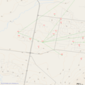
This is an image of a section of the Melbourne Wireless mapping database, rendered at 9:00PM AEDST Tuesday, 19th June. At the centre is node GUR, in Rowville.

As one of the web developers responsible for creating and maintaining the system used to generate such images, I release it under the Creative Commons CC-BY-SA-2.5, with the intent to use it as a demonstration of the website.
Date 26 March 2006 (original upload date)
Source No machine-readable source provided. Own work assumed (based on copyright claims).
Author No machine-readable author provided. GummAY assumed (based on copyright claims).

Licensing

I, the copyright holder of this work, hereby publish it under the following license:
w:en:Creative Commons
attribution share alike
This file is licensed under the Creative Commons Attribution-Share Alike 2.5 Generic license.
You are free:
  • to share – to copy, distribute and transmit the work
  • to remix – to adapt the work
Under the following conditions:
  • attribution – You must give appropriate credit, provide a link to the license, and indicate if changes were made. You may do so in any reasonable manner, but not in any way that suggests the licensor endorses you or your use.
  • share alike – If you remix, transform, or build upon the material, you must distribute your contributions under the same or compatible license as the original.

Captions

Add a one-line explanation of what this file represents

Items portrayed in this file

depicts

File history

Click on a date/time to view the file as it appeared at that time.

Date/TimeThumbnailDimensionsUserComment
current11:02, 19 June 2007Thumbnail for version as of 11:02, 19 June 2007800 × 800 (111 KB)GummAYThis is an image of a section of the Melbourne Wireless mapping database, rendered at 9:00PM AEDST Tuesday, 19th June. At the centre is node GUR, in Rowville. As one of the web developers responsible for creating and maintaining the system used to genera
02:51, 26 March 2006Thumbnail for version as of 02:51, 26 March 2006800 × 800 (43 KB)GummAYThis is an image of a section of the Melbourne Wireless mapping database, rendered at 1:45PM AEDST Sunday, 26th March. At the centre is node GUR, in Rowville. As one of the web developers responsible for creating and maintaining the system used to genera
The following pages on the English Wikipedia use this file (pages on other projects are not listed):