
File:Ogasawara islands.png
Size of this preview: 760 × 600 pixels. Other resolutions: 304 × 240 pixels | 608 × 480 pixels | 1,011 × 798 pixels.
Original file (1,011 × 798 pixels, file size: 296 KB, MIME type: image/png)
| This is a file from the Wikimedia Commons. Information from its description page there is shown below. Commons is a freely licensed media file repository. You can help. |
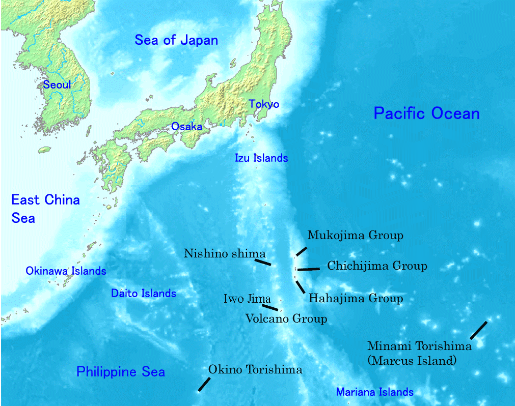
Map of Ogasawara Islands. Created by Map of ogasawara islands.png
This image is in the public domain because it came from the site https://www.demis.nl/products/web-map-server/examples/ and was released by the copyright holder. Permission is granted to copy, distribute and/or modify this map since it is based on free of copyright images from: www.demis.nl. See also approval email on de.wp and its clarification.
|
| This work has been released into the public domain by its copyright holder, www.demis.nl. This applies worldwide. In some countries this may not be legally possible; if so: www.demis.nl grants anyone the right to use this work for any purpose, without any conditions, unless such conditions are required by law.
|
File history
Click on a date/time to view the file as it appeared at that time.
| Date/Time | Thumbnail | Dimensions | User | Comment | |
|---|---|---|---|---|---|
| current | 22:01, 31 December 2007 | | 1,011 × 798 (296 KB) | Sagredo | Created by [http://commons.wikimedia.org/wiki/Image:Map_of_ogasawara_islands.png Map of ogasawara islands.png] {{Information |Description=Map of Ogasawara Islands. |Source= |Date= |Author= |Permission={{demis-pd}} }} |
| 05:29, 30 April 2006 |  | 1,011 × 798 (260 KB) | Tdk~commonswiki | Map of Ogasawara Islands. Created by [Image:Map of ogasawara islands.png] {{demis-pd}} |
File usage
The following pages on the English Wikipedia use this file (pages on other projects are not listed):
- Bonin Islands
- Bonin white-eye
- Geography of Japan
- Geography of the Bonin Islands
- Japanese archipelago
- List of governors of the Nanpō Islands
- List of islands of Japan
- Nanpō Islands
- Ogasawara, Tokyo
- Ogasawara Subprefecture
- Tokyo
- Wandering Island
- Wikipedia:Graphics Lab/Images to improve/Archive/Jan 2008
- Portal:Japan
Global file usage
The following other wikis use this file:
- Usage on ar.wikipedia.org
- Usage on ast.wikipedia.org
- Usage on az.wikipedia.org
- Usage on ban.wikipedia.org
- Usage on ca.wikipedia.org
- Usage on cs.wikipedia.org
- Usage on cy.wikipedia.org
- Usage on eo.wikipedia.org
- Usage on es.wikipedia.org
- Usage on eu.wikipedia.org
- Usage on fa.wikipedia.org
- Usage on fi.wikipedia.org
- Usage on fr.wikipedia.org
- Usage on gl.wikipedia.org
- Usage on he.wikipedia.org
- Usage on hr.wikipedia.org
- Usage on hy.wikipedia.org
- Usage on id.wikipedia.org
- Usage on ilo.wikipedia.org
- Usage on io.wikipedia.org
- Usage on it.wikipedia.org
- Usage on jv.wikipedia.org
- Usage on ka.wikipedia.org
- Usage on km.wikipedia.org
- Usage on lt.wikipedia.org
- Usage on ml.wikipedia.org
- Usage on ms.wikipedia.org
- Usage on nl.wikipedia.org
View more global usage of this file.