
File:Ohio and Mississippi River Flooding May 2011 Landsat comparison.jpg

Size of this preview: 800 × 590 pixels. Other resolutions: 320 × 236 pixels | 640 × 472 pixels | 1,024 × 755 pixels | 1,234 × 910 pixels.
Original file (1,234 × 910 pixels, file size: 826 KB, MIME type: image/jpeg)
| This is a file from the Wikimedia Commons. Information from its description page there is shown below. Commons is a freely licensed media file repository. You can help. |
Summary
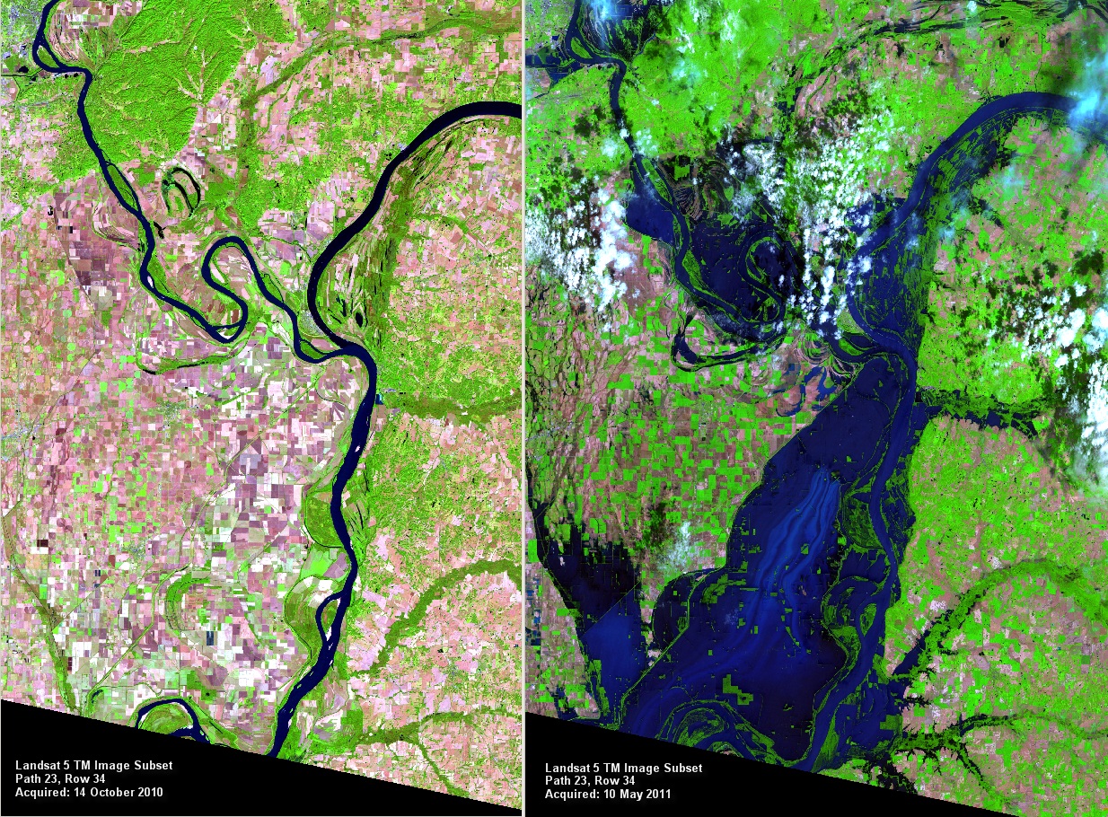
| Description | USGS Landsat images of Ohio/Mississippi River confluence before and during floods of 2011 |
| Date | |
| Source | http://water.usgs.gov/floods/events/2011/BPNM/images/BPNM_Landsat.jpg from http://water.usgs.gov/floods/events/2011/BPNM/ |
| Author | USGS |
| Permission (Reusing this file) |
PD-USGS |
Licensing
This image is in the public domain in the United States because it only contains materials that originally came from the United States Geological Survey, an agency of the United States Department of the Interior. For more information, see the official USGS copyright policy.
|
File history
Click on a date/time to view the file as it appeared at that time.
| Date/Time | Thumbnail | Dimensions | User | Comment | |
|---|---|---|---|---|---|
| current | 00:41, 23 November 2016 | | 1,234 × 910 (826 KB) | Dual Freq | {{Information |Description=USGS Landsat images of Ohio/Mississippi River confluence before and during floods of 2011 |Source=http://water.usgs.gov/floods/events/2011/BPNM/images/BPNM_Landsat.jpg from http://water.usgs.gov/floods/events/2011/BPNM/ |Date... |
File usage
The following pages on the English Wikipedia use this file (pages on other projects are not listed):