
File:Old Oswestry profile.jpg
No higher resolution available.
Old_Oswestry_profile.jpg (636 × 372 pixels, file size: 58 KB, MIME type: image/jpeg)
| This is a file from the Wikimedia Commons. Information from its description page there is shown below. Commons is a freely licensed media file repository. You can help. |
Summary
| Description |
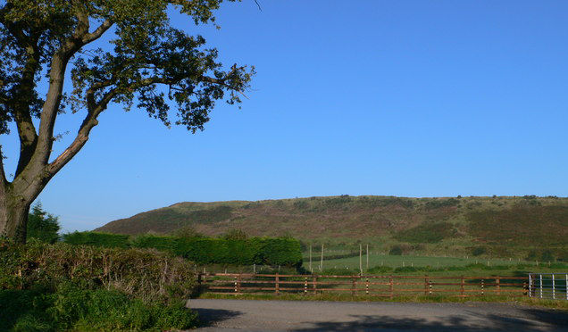
English: Old Oswestry. It is more than 2,000 years since this low hill was first fortified. Old Oswestry is described as 'the most hugely impressive Iron Age Hill Fort on the Welsh Borders'. |
| Date | |
| Source |
This file was derived from: Old Oswestry - geograph.org.uk - 973647.jpg |
| Author |
|
| Camera location | | View this and other nearby images on: OpenStreetMap |
|---|
_heading:292.00&language=en)
| Object location | | View this and other nearby images on: OpenStreetMap |
|---|
_heading:292.00&language=en)
| This is a retouched picture, which means that it has been digitally altered from its original version. Modifications: cut much of the yawning the tarmac off the bottom. The original can be viewed here: Old Oswestry - geograph.org.uk - 973647.jpg:
|
Licensing
This file is licensed under the Creative Commons Attribution-Share Alike 2.0 Generic license.
Attribution: Eiran Evans
- You are free:
- to share – to copy, distribute and transmit the work
- to remix – to adapt the work
- Under the following conditions:
- attribution – You must give appropriate credit, provide a link to the license, and indicate if changes were made. You may do so in any reasonable manner, but not in any way that suggests the licensor endorses you or your use.
- share alike – If you remix, transform, or build upon the material, you must distribute your contributions under the same or compatible license as the original.
Original upload log
This image is a derivative work of the following images:
- File:Old_Oswestry_-_geograph.org.uk_-_973647.jpg licensed with Cc-by-sa-2.0, Geograph
- 2011-02-22T21:01:12Z GeographBot 640x480 (68764 Bytes) == {{int:filedesc}} == {{Information |description={{en|1=Old Oswestry It's more than 2,000 years since this low hill was first fortified. Old Oswestry is described as 'the most hugely impressive Iron Age Hill Fort on the Wels
Uploaded with derivativeFX
File history
Click on a date/time to view the file as it appeared at that time.
| Date/Time | Thumbnail | Dimensions | User | Comment | |
|---|---|---|---|---|---|
| current | 20:54, 6 December 2011 | | 636 × 372 (58 KB) | Hogweard | == {{int:filedesc}} == {{Information |Description={{en|1=Old Oswestry It's more than 2,000 years since this low hill was first fortified. Old Oswestry is described as 'the most hugely impressive Iron Age Hill Fort on the Welsh Borders'.}} |date=2008-09-21 |
File usage
The following pages on the English Wikipedia use this file (pages on other projects are not listed):
Global file usage
The following other wikis use this file:
- Usage on azb.wikipedia.org