
File:Ophir Chasma.jpg
Size of this preview: 569 × 600 pixels. Other resolutions: 228 × 240 pixels | 455 × 480 pixels | 729 × 768 pixels | 972 × 1,024 pixels | 2,438 × 2,569 pixels.
Original file (2,438 × 2,569 pixels, file size: 778 KB, MIME type: image/jpeg)
| This is a file from the Wikimedia Commons. Information from its description page there is shown below. Commons is a freely licensed media file repository. You can help. |
Summary
| Description |
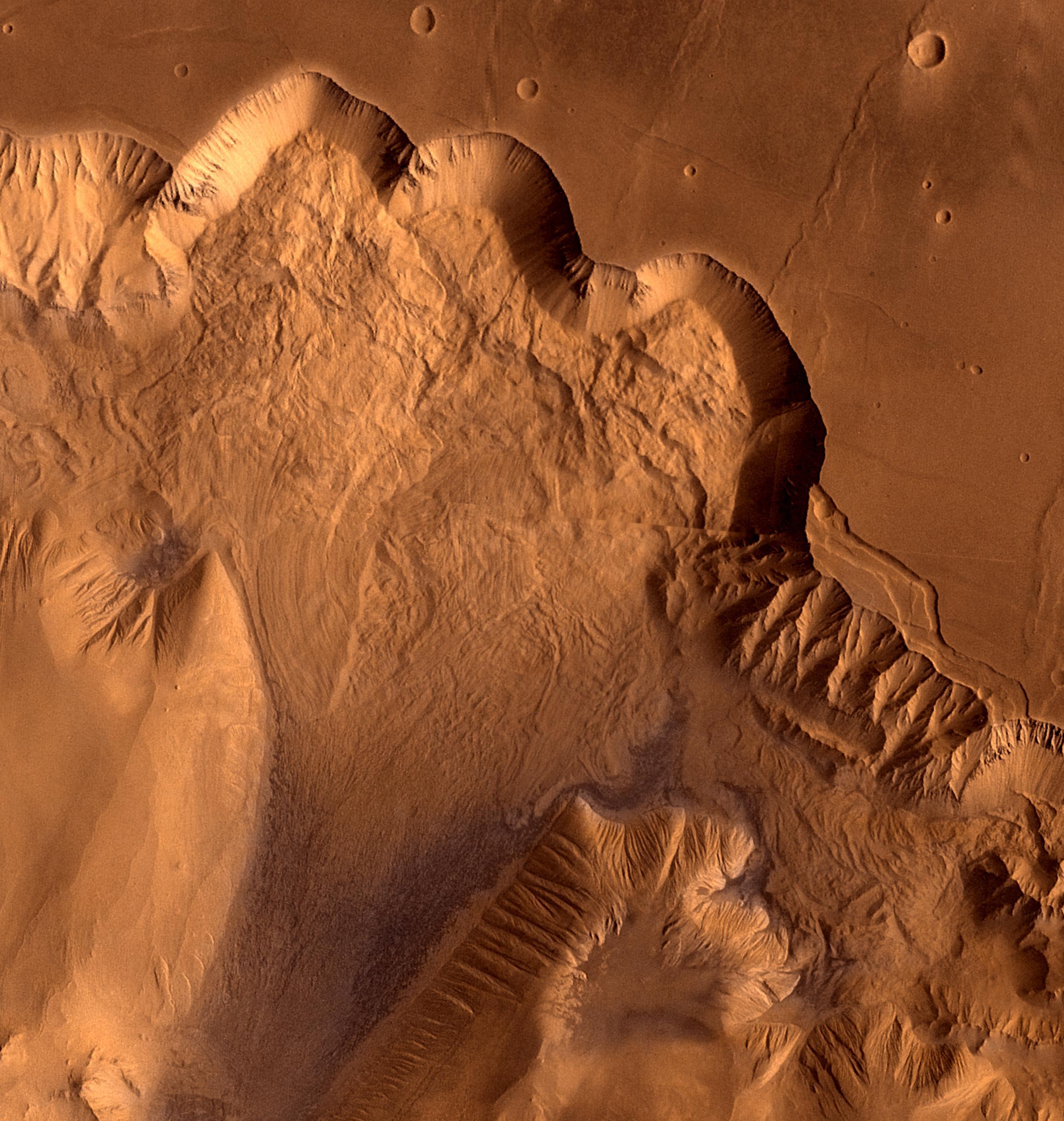
English: This synthetic oblique view shows Ophir Chasma, the northern most one of the connected valleys of Valles Marineris. For scale, the large impact crater in the right corner is about 30 km wide.
Ophir Chasma is a large west-northwest-trending trough about 100 km wide. The Chasma is bordered by high-walled cliffs, most likely faults, that show spur-and-gully morphology and smooth sections. The walls have been dissected by landslides forming re-entrants. The volume of the landslide debris is more than 1,000 times greater than that from the May 18, 1980, debris avalanche from Mount St. Helens. The longitudinal grooves seen in the foreground are thought to be due to differential shear and lateral spreading at high velocities. |
| Date | |
| Source | NASA Image of the Day |
| Author | NASA/JPL/USGS |
Licensing
| This file is in the public domain in the United States because it was solely created by NASA. NASA copyright policy states that "NASA material is not protected by copyright unless noted". (See Template:PD-USGov, NASA copyright policy page or JPL Image Use Policy.) | ||
 |
Warnings:
|
File history
Click on a date/time to view the file as it appeared at that time.
| Date/Time | Thumbnail | Dimensions | User | Comment | |
|---|---|---|---|---|---|
| current | 18:54, 22 August 2011 | | 2,438 × 2,569 (778 KB) | Originalwana | {{Information |Description ={{en|1=This synthetic oblique view shows Ophir Chasma, the northern most one of the connected valleys of Valles Marineris. For scale, the large impact crater in lower right corner is about 30 km wide. Ophir Chasma is a larg |
File usage
The following pages on the English Wikipedia use this file (pages on other projects are not listed):
Global file usage
The following other wikis use this file:
- Usage on it.wikipedia.org
- Usage on www.wikidata.org
- Usage on zh.wikipedia.org