
File:Pakistan Administrative Divisions.jpg
Size of this preview: 444 × 599 pixels. Other resolutions: 178 × 240 pixels | 356 × 480 pixels | 569 × 768 pixels | 759 × 1,024 pixels | 1,971 × 2,659 pixels.
Original file (1,971 × 2,659 pixels, file size: 1.21 MB, MIME type: image/jpeg)
| This is a file from the Wikimedia Commons. Information from its description page there is shown below. Commons is a freely licensed media file repository. You can help. |
Summary
| Description |
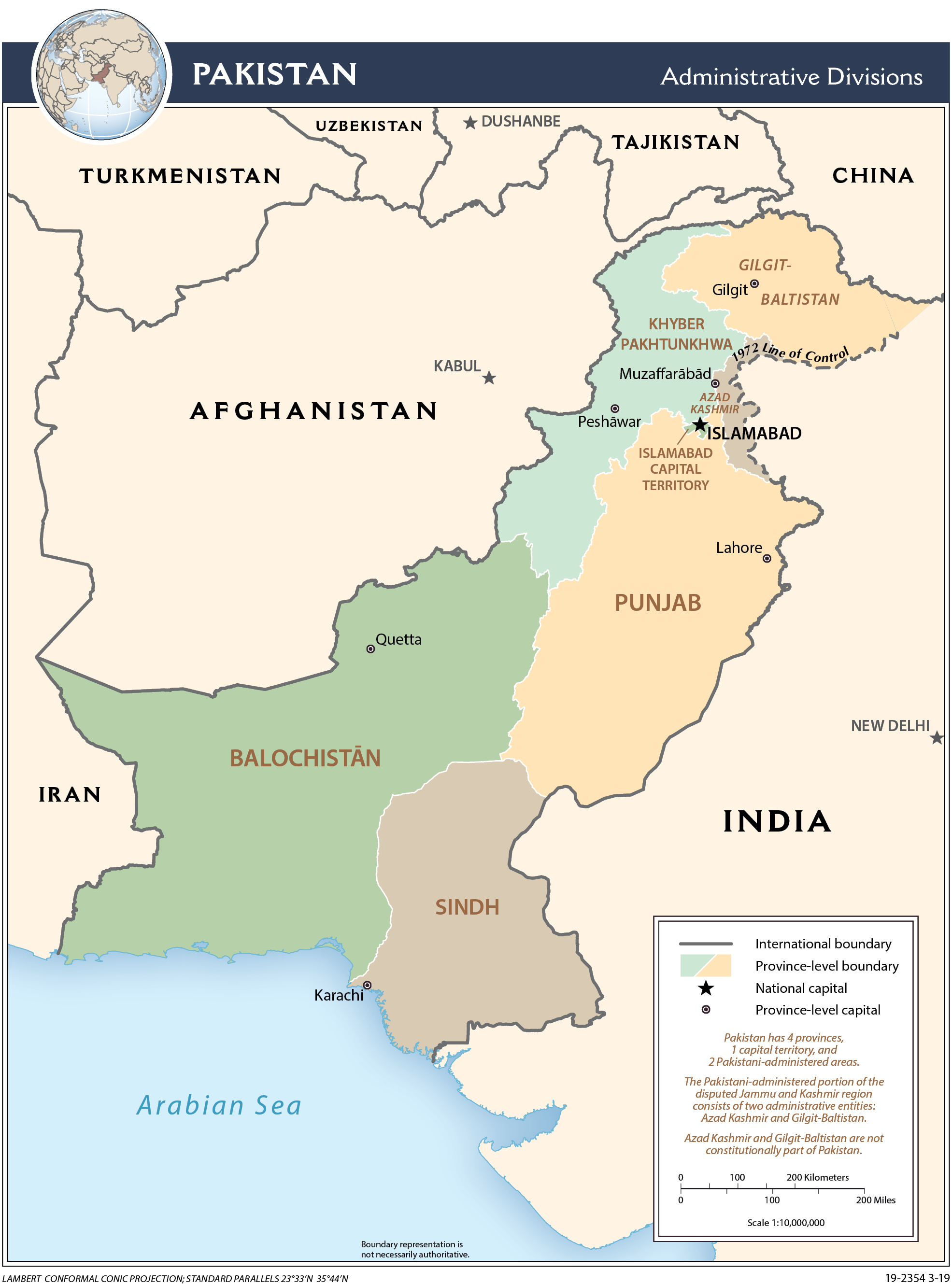
Українська: Територіально-адміністративний устрій Пакистану першого рівня, 2010 рік (англ.). |
| Date | |
| Source | Map from CIA World Factbook 2020. |
| Author | Gerald J. Coleman from Central Intelligence Agency (CIA). |
Licensing
This image is in the public domain because it contains materials that originally came from the United States Central Intelligence Agency's World Factbook.
|
 |
File history
Click on a date/time to view the file as it appeared at that time.
| Date/Time | Thumbnail | Dimensions | User | Comment | |
|---|---|---|---|---|---|
| current | 08:22, 6 February 2022 | | 1,971 × 2,659 (1.21 MB) | Бмхүн | Location Maps Published by CIA in August 21, 2020 The maps below print on 8.5″x11″ paper. If you modify maps for your own purposes, please remove the map number in the bottom, right corner. Administrative map of Pakistan. Pakistan Administrative 2020 |
| 15:12, 24 November 2017 |  | 2,008 × 2,657 (710 KB) | Dim Grits |
File usage
The following pages on the English Wikipedia use this file (pages on other projects are not listed):