
File:Pakistan Sindh relief map.svg

Size of this PNG preview of this SVG file: 499 × 599 pixels. Other resolutions: 200 × 240 pixels | 400 × 480 pixels | 640 × 768 pixels | 853 × 1,024 pixels | 1,706 × 2,048 pixels | 858 × 1,030 pixels.
Original file (SVG file, nominally 858 × 1,030 pixels, file size: 1.6 MB)
| This is a file from the Wikimedia Commons. Information from its description page there is shown below. Commons is a freely licensed media file repository. You can help. |
Summary
| Description |
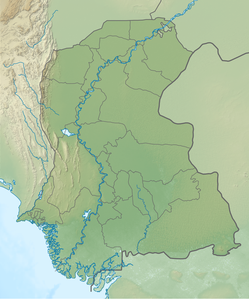
English: Relief map of Sindh. Elevation data from STRM |
| Date | |
| Source | File:Sindh Maps.svg |
| Author | Own work based on Kaleem Bhatti |
Licensing
This file is licensed under the Creative Commons Attribution-Share Alike 4.0 International license.
- You are free:
- to share – to copy, distribute and transmit the work
- to remix – to adapt the work
- Under the following conditions:
- attribution – You must give appropriate credit, provide a link to the license, and indicate if changes were made. You may do so in any reasonable manner, but not in any way that suggests the licensor endorses you or your use.
- share alike – If you remix, transform, or build upon the material, you must distribute your contributions under the same or compatible license as the original.
File history
Click on a date/time to view the file as it appeared at that time.
| Date/Time | Thumbnail | Dimensions | User | Comment | |
|---|---|---|---|---|---|
| current | 16:32, 8 September 2021 | | 858 × 1,030 (1.6 MB) | C1MM | Corrected Karachi districts |
| 06:01, 6 September 2021 |  | 858 × 1,030 (1.6 MB) | C1MM | Better relief shading | |
| 23:25, 24 October 2020 |  | 1,000 × 1,200 (2.48 MB) | C1MM | Changed image | |
| 22:31, 18 April 2020 |  | 1,000 × 1,200 (2.46 MB) | C1MM | Opaquified Sindh | |
| 22:25, 18 April 2020 |  | 1,000 × 1,200 (1.39 MB) | C1MM | Uploaded a work by Own work based on Kaleem Bhatti from File:Sindh Maps.svg with UploadWizard |
File usage
The following pages on the English Wikipedia use this file (pages on other projects are not listed):
- 2014 Pakistan earthquake
- Agham Kot
- Ahmed Rajo
- Akai, Sindh
- Alipur, Tando Muhammad Khan
- Aror
- Babarlo
- Bhadmi
- Bhugra Memon
- Boat Basin
- Bokhi
- Bubak, Sindh
- Chanesri
- Chanri
- Chaudhro
- Chinna Creek
- Chotiari Dam
- Chukhi
- Darawat Dam
- Dasarki
- Dumbalo
- Gharo, Shaheed Fazil Rahu, Badin
- Ghotana
- Hadero Lake
- Haleji Lake
- Hamal Lake
- Hussain Khan Thoro
- Jarki, Badin
- Jhalar, Sindh
- Johi, Dadu
- Kadanwari gas field
- Kahu-Jo-Darro
- Kalankar Lake
- Kamaro, Badin, Badin
- Kamaro, Tando Bago, Badin
- Karampur
- Keenjhar Lake
- Khairpur, Badin
- Khathar
- Khorwah
- Lake Manchar
- Luari Sharif
- Mena, Badin
- Mohenjo-daro
- Nango Shah
- Narejani
- Paat
- Rip, Talhar, Badin
- Rohri Hills
- Saidpur, Badin
- Saidpur, Tando Muhammad Khan
- Sann, Sindh
- Sawan gas field
- Shah Hasan, Sindh
- Shahbandar (Pakistan)
- Shaikh Bhirkio
- Singari, Pakistan
- Sirani, Pakistan
- Sonhar
- Talti, Sindh
- Tando Bago Tehsil
- Tarai, Badin
- Unarpur
- Module:Location map/data/Pakistan Sindh
- Module:Location map/data/Pakistan Sindh/doc
- Module:Location map/data/Sindh
Global file usage
The following other wikis use this file:
- Usage on as.wikipedia.org
- Usage on de.wikipedia.org
- Usage on eo.wikipedia.org
- Karaĉio
- Mohenĝo-daro
- Sindo
- Ĝamŝoro
- Sukur (Pakistano)
- Larkana
- Navabŝah
- Mirpur Ĥas
- Ĝakobabad
- Ŝikarpur
- Kotri
- Ĥairpur
- Ŝablono:Situo sur mapo Pakistano Sindo
- Tando Alahjar
- Tando Adam
- Umerkot
- Ŝahdadkot
- Tando Muhamad Ĥan
- Gotki
- Kamber Ali Ĥan
- Mirpur Matelo
- Kandĥot
- Sadikabad (Pakistana Panĝabo)
- Mazar-e-Kaid
- Pastro-Reĝo (skulptaĵo)
- Nacia Muzeo de Pakistano
- Domego Vazir
- Muzeo de la Pakistana Aerarmeo
- Domego de Quaid-e-Azam
- Muzeo pri la Pakistana Mararmeo
- Centro MagnifiScience
- Mansuro (Sindo)
- Usage on es.wikipedia.org
- Usage on fr.wikipedia.org
- Usage on he.wikipedia.org
- Usage on mt.wikipedia.org
- Usage on ne.wikipedia.org
- Usage on os.wikipedia.org
- Usage on si.wikipedia.org
View more global usage of this file.