
File:Parris Island.gif
Size of this preview: 437 × 599 pixels. Other resolutions: 175 × 240 pixels | 455 × 624 pixels.
Original file (455 × 624 pixels, file size: 134 KB, MIME type: image/gif)
| This is a file from the Wikimedia Commons. Information from its description page there is shown below. Commons is a freely licensed media file repository. You can help. |
Summary
| Description |
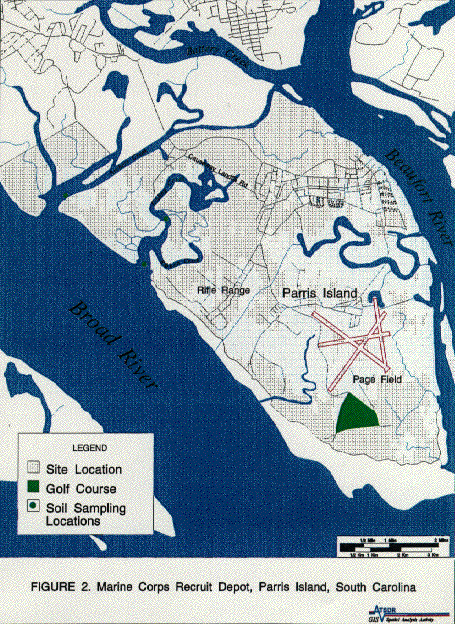
English: A map of w:Parris Island, South Carolina used in a report for the w:Center for Disease Control on the public health of the island. |
| Source | http://www.atsdr.cdc.gov/HAC/PHA/parris/par-f2.gif |
| Author | CDC |
Licensing
This image is a work of the Centers for Disease Control and Prevention, part of the United States Department of Health and Human Services, taken or made as part of an employee's official duties. As a work of the U.S. federal government, the image is in the public domain.
|
Original upload log
Transferred from en.wikipedia to Commons by FastilyClone using MTC!.
The original description page was here. All following user names refer to en.wikipedia.
| Date/Time | Dimensions | User | Comment |
|---|---|---|---|
| 2006-06-29 13:38:52 | 455× 624× | Palm dogg | A map of [[Parris Island, South Carolina]] used in a report for the [[Center for Disease Control]] on the public health of the island. Source: http://www.atsdr.cdc.gov/HAC/PHA/parris/par-f2.gif |
File history
Click on a date/time to view the file as it appeared at that time.
| Date/Time | Thumbnail | Dimensions | User | Comment | |
|---|---|---|---|---|---|
| current | 19:57, 17 November 2016 | | 455 × 624 (134 KB) | FastilyClone | Transferred from en.wikipedia (MTC!) |
File usage
The following pages on the English Wikipedia use this file (pages on other projects are not listed):
Global file usage
The following other wikis use this file:
- Usage on fr.wikipedia.org
- Usage on it.wikipedia.org