
File:Playa del Rey Motordrome Location on USGS Map CA Venice 301113 1934 24000 geo.jpg

Size of this preview: 800 × 585 pixels. Other resolutions: 320 × 234 pixels | 640 × 468 pixels | 1,024 × 749 pixels | 1,280 × 936 pixels | 2,560 × 1,873 pixels | 5,120 × 3,745 pixels.
Original file (5,120 × 3,745 pixels, file size: 12.02 MB, MIME type: image/jpeg)
| This is a file from the Wikimedia Commons. Information from its description page there is shown below. Commons is a freely licensed media file repository. You can help. |
Summary
| Description |
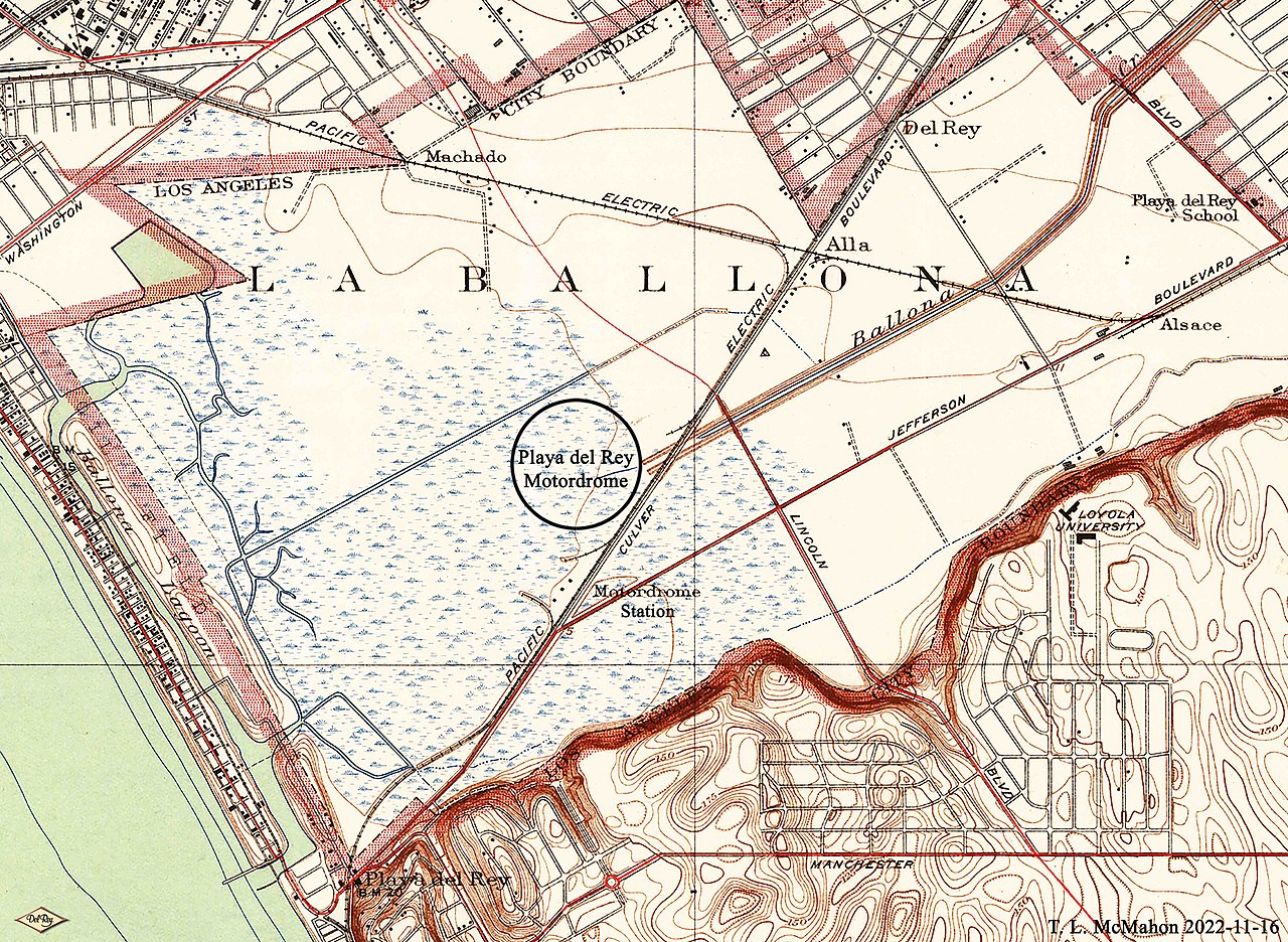
English: Playa del Rey Motordrome Location Relative to Unchannelized Ballona Creek and Wetlands area" |
| Date | |
| Source | Own work |
| Author | Thomas L. McMahon |
Before the channelization of Ballona Creek.
Licensing
I, the copyright holder of this work, hereby publish it under the following license:
This file is licensed under the Creative Commons Attribution-Share Alike 4.0 International license.
- You are free:
- to share – to copy, distribute and transmit the work
- to remix – to adapt the work
- Under the following conditions:
- attribution – You must give appropriate credit, provide a link to the license, and indicate if changes were made. You may do so in any reasonable manner, but not in any way that suggests the licensor endorses you or your use.
- share alike – If you remix, transform, or build upon the material, you must distribute your contributions under the same or compatible license as the original.
File history
Click on a date/time to view the file as it appeared at that time.
| Date/Time | Thumbnail | Dimensions | User | Comment | |
|---|---|---|---|---|---|
| current | 14:44, 18 November 2022 | | 5,120 × 3,745 (12.02 MB) | TLM2TLM | Uploaded own work with UploadWizard |
File usage
The following pages on the English Wikipedia use this file (pages on other projects are not listed):