
File:Pontesbury railway station (site), Shropshire (geograph 7100686).jpg
Size of this preview: 800 × 600 pixels. Other resolutions: 320 × 240 pixels | 640 × 480 pixels | 1,024 × 768 pixels | 1,280 × 960 pixels | 1,600 × 1,200 pixels.
Original file (1,600 × 1,200 pixels, file size: 758 KB, MIME type: image/jpeg)
| This is a file from the Wikimedia Commons. Information from its description page there is shown below. Commons is a freely licensed media file repository. You can help. |
,_Shropshire_(geograph_7100686).jpg)
Summary
| Description |
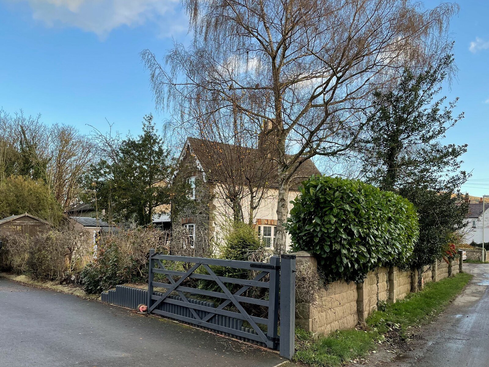
English: Pontesbury railway station (site), Shropshire Opened in 1861 by the London & North Western Railway on the short branch line from Hanwood to Minsterley, this station closed to passengers in 1951 and completely in 1967. View north east towards Plealey Road and Shrewsbury. The single railway line crossed left to right in front of the house, now a private residence, and across the road by a level crossing. The single platform was in front of the house, hidden from view. The former goods shed was still extant when this image was taken, and can just be seen behind the trees. |
| Date | |
| Source | From geograph.org.uk |
| Author | Nigel Thompson |
| Permission (Reusing this file) |
Creative Commons Attribution Share-alike license 2.0 |
| Attribution (required by the license) | Nigel Thompson / Pontesbury railway station (site), Shropshire / |
| Camera location | | View this and other nearby images on: OpenStreetMap |
|---|
,_Shropshire_(geograph_7100686).jpg¶ms=052.651424_N_-002.892628_E_globe:Earth_type:camera_source:geograph-osgb36(SJ39710634)_heading:90.00&language=en)
| Object location | | View this and other nearby images on: OpenStreetMap |
|---|
,_Shropshire_(geograph_7100686).jpg¶ms=052.651340_N_-002.892180_E_globe:Earth_class:object_type:object_source:geograph-osgb36(SJ39740633)_heading:90.00&language=en)
Licensing

|
This image was taken from the Geograph project collection. See this photograph's page on the Geograph website for the photographer's contact details. The copyright on this image is owned by Nigel Thompson and is licensed for reuse under the Creative Commons Attribution-ShareAlike 2.0 license.
|
This file is licensed under the Creative Commons Attribution-Share Alike 2.0 Generic license.
Attribution: Nigel Thompson
- You are free:
- to share – to copy, distribute and transmit the work
- to remix – to adapt the work
- Under the following conditions:
- attribution – You must give appropriate credit, provide a link to the license, and indicate if changes were made. You may do so in any reasonable manner, but not in any way that suggests the licensor endorses you or your use.
- share alike – If you remix, transform, or build upon the material, you must distribute your contributions under the same or compatible license as the original.
File history
Click on a date/time to view the file as it appeared at that time.
| Date/Time | Thumbnail | Dimensions | User | Comment | |
|---|---|---|---|---|---|
| current | 14:44, 2 April 2022 | | 1,600 × 1,200 (758 KB) | Lamberhurst | == {{int:filedesc}} == {{Information |Description={{en|1=<b>Pontesbury railway station (site), Shropshire</b><br>Opened in 1861 by the London & North Western Railway on the short branch line from Hanwood to Minsterley, this station closed to passengers in 1951 and completely in 1967. View north east towards Plealey Road and Shrewsbury. The single railway line crossed left to right in front of the house, now a private residence, and across the road by a level crossing. The single platform was... |
File usage
The following pages on the English Wikipedia use this file (pages on other projects are not listed):
,_Shropshire_(geograph_7100686).jpg)