
File:Puente "Rayito de Sol" Lima, Perú..jpg
Original file (5,456 × 3,632 pixels, file size: 9.76 MB, MIME type: image/jpeg)
| This is a file from the Wikimedia Commons. Information from its description page there is shown below. Commons is a freely licensed media file repository. You can help. |
Summary
| Description |
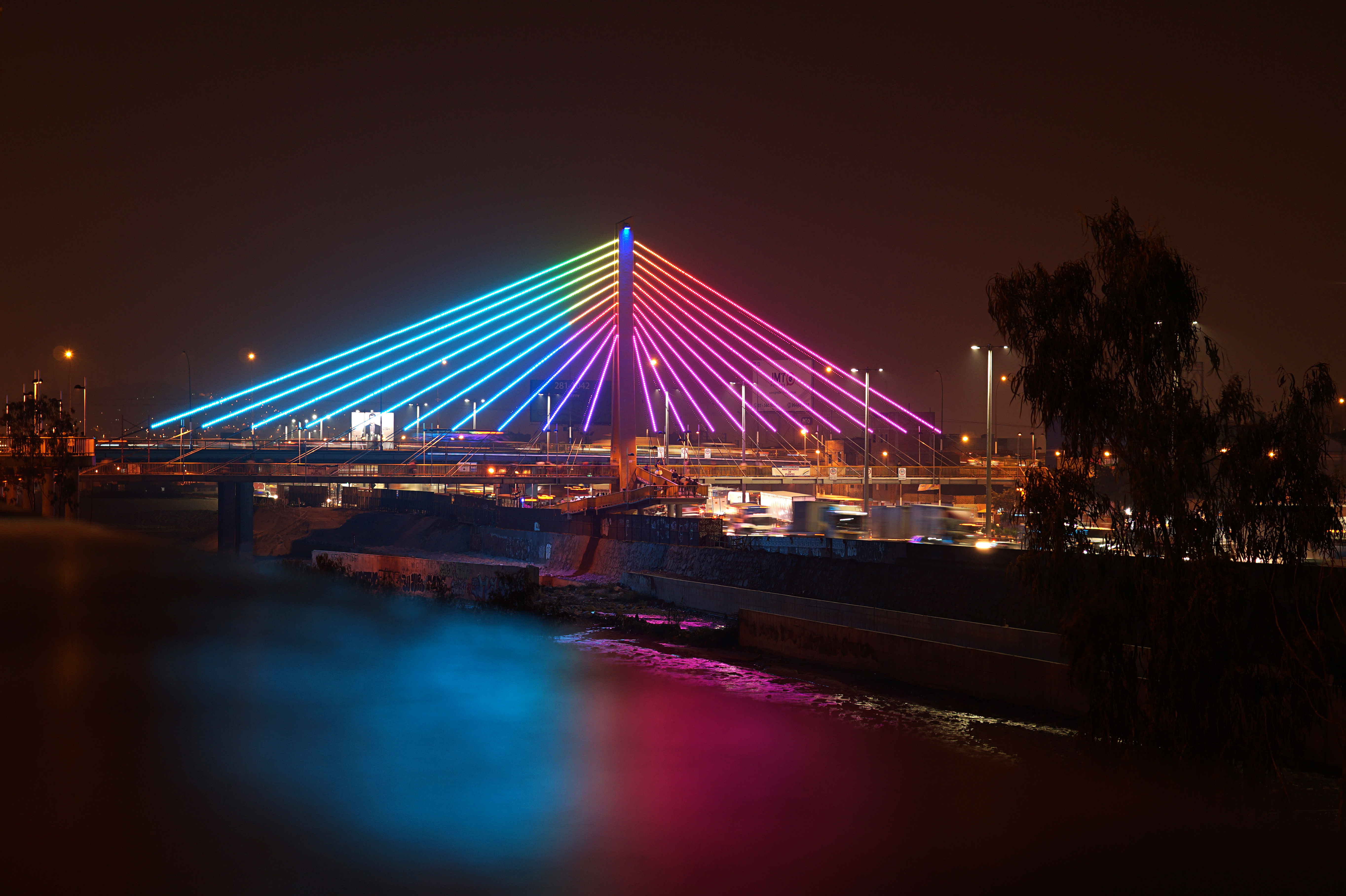
El martes 10 de mayo de 2016, la comuna metropolitana inauguró la nueva iluminaria en el puente "Rayito de Sol" que se levanta entre el río Rímac y la vía de Evitamiento. El sistema instalado en el puente está compuesto de cerca de 7.000 puntos de tipo LED colocados sobre los 1.500 metros de estructuras atirantadas que sostienen el puente. Con dichas luces se podrá proyectar mensajes determinados. En tanto, el mástil del puente de 30 metros de altura, también quedó iluminado en ambas caras con reflectores de alta potencia. "Rayito de sol" es una estructura de 220 metros de longitud por donde transitan a diario más de 50 mil personas. Inversión total de la nueva iluminación es de: S/ 381 mil soles ($ 115.003 USD. € 102.008 EUR). El pero, el inconveniente, la pega es que ese dinero hubiera sido invertido mejor en algo que es un flagelo para los ciudadanos de a pie; en más seguridad contra la delincuencia local y foránea que cada día aumenta en Lima, en todo el Perú. Esta bien la mejora del ornato de la ciudad, pero la seguridad y la integridad física de las personas es primordial y más urgente. Empezando por los más de 50 mil transeúntes diarios que usan el puente "Rayito de sol". Twitter: DiNoBokeh Instagram: artdino_ Sitio web: Perú Generación XXI Facebook: ArtDiNo15 |
| Date | |
| Source | Puente "Rayito de Sol" Lima, Perú. |
| Author | Art DiNo from Lima, Perú |
| Camera location | | View this and other nearby images on: OpenStreetMap |
|---|
Licensing
- You are free:
- to share – to copy, distribute and transmit the work
- to remix – to adapt the work
- Under the following conditions:
- attribution – You must give appropriate credit, provide a link to the license, and indicate if changes were made. You may do so in any reasonable manner, but not in any way that suggests the licensor endorses you or your use.
- share alike – If you remix, transform, or build upon the material, you must distribute your contributions under the same or compatible license as the original.
| This image was originally posted to Flickr by Art DiNo at https://flickr.com/photos/26589989@N02/27019572201 (archive). It was reviewed on 27 August 2018 by FlickreviewR 2 and was confirmed to be licensed under the terms of the cc-by-sa-2.0. |
File history
Click on a date/time to view the file as it appeared at that time.
| Date/Time | Thumbnail | Dimensions | User | Comment | |
|---|---|---|---|---|---|
| current | 10:08, 27 August 2018 | | 5,456 × 3,632 (9.76 MB) | MiguelAlanCS | =={{int:filedesc}}== {{Information |Description=El martes 10 de mayo de 2016, la comuna metropolitana inauguró la nueva iluminaria en el puente "Rayito de Sol" que se levanta entre el río Rímac y la vía de Evitamiento. El sistema instalado en el puente está compuesto de cerca de 7.000 puntos de tipo LED colocados sobre los 1.500 metros de estructuras atirantadas que sostienen el puente. Con dichas luces se podrá proyectar mensajes determinados. En tanto, el mástil del puente de 30 metros de... |
File usage
Global file usage
The following other wikis use this file:
- Usage on es.wikipedia.org
- Usage on www.wikidata.org