
File:Quaker's Yard Tunnel - geograph.org.uk - 243894.jpg
Size of this preview: 457 × 599 pixels. Other resolutions: 183 × 240 pixels | 480 × 629 pixels.
Original file (480 × 629 pixels, file size: 58 KB, MIME type: image/jpeg)
| This is a file from the Wikimedia Commons. Information from its description page there is shown below. Commons is a freely licensed media file repository. You can help. |
Summary
| Description |
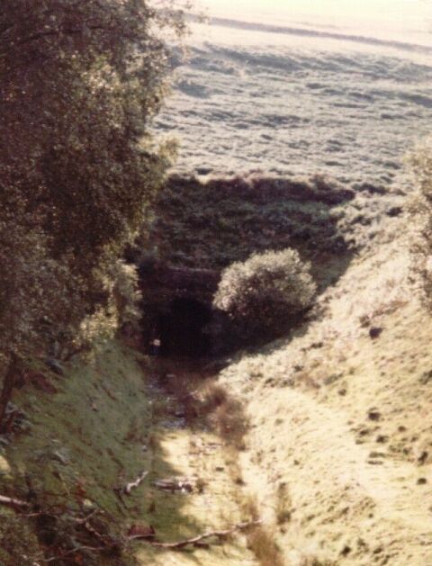
English: Quaker's Yard Tunnel. Eastern portal of the 703yd, double track Quaker's Yard tunnel on the former GW line between Penrhiwceiber and Quaker's Yard (High Level), taken in 1981. The white dot to the left of the tunnel mouth is my mate Dave, who didn't fancy the climb up the embankment to take the photo! |
| Date | |
| Source | From geograph.org.uk |
| Author | Bill Blair |
| Attribution (required by the license) | Bill Blair / Quaker's Yard Tunnel / |
| Camera location | | View this and other nearby images on: OpenStreetMap |
|---|
_heading:157.00&language=en)
| Object location | | View this and other nearby images on: OpenStreetMap |
|---|
_heading:157.00&language=en)
Licensing

|
This image was taken from the Geograph project collection. See this photograph's page on the Geograph website for the photographer's contact details. The copyright on this image is owned by Bill Blair and is licensed for reuse under the Creative Commons Attribution-ShareAlike 2.0 license.
|
This file is licensed under the Creative Commons Attribution-Share Alike 2.0 Generic license.
Attribution: Bill Blair
- You are free:
- to share – to copy, distribute and transmit the work
- to remix – to adapt the work
- Under the following conditions:
- attribution – You must give appropriate credit, provide a link to the license, and indicate if changes were made. You may do so in any reasonable manner, but not in any way that suggests the licensor endorses you or your use.
- share alike – If you remix, transform, or build upon the material, you must distribute your contributions under the same or compatible license as the original.
File history
Click on a date/time to view the file as it appeared at that time.
| Date/Time | Thumbnail | Dimensions | User | Comment | |
|---|---|---|---|---|---|
| current | 16:08, 1 February 2010 | | 480 × 629 (58 KB) | GeographBot | == {{int:filedesc}} == {{Information |description={{en|1=Quaker's Yard Tunnel. Eastern portal of the 703yd, double track Quaker's Yard tunnel on the former GW line between Penrhiwceiber and Quaker's Yard (High Level), taken in 1981. The white dot to the |
File usage
The following pages on the English Wikipedia use this file (pages on other projects are not listed):