
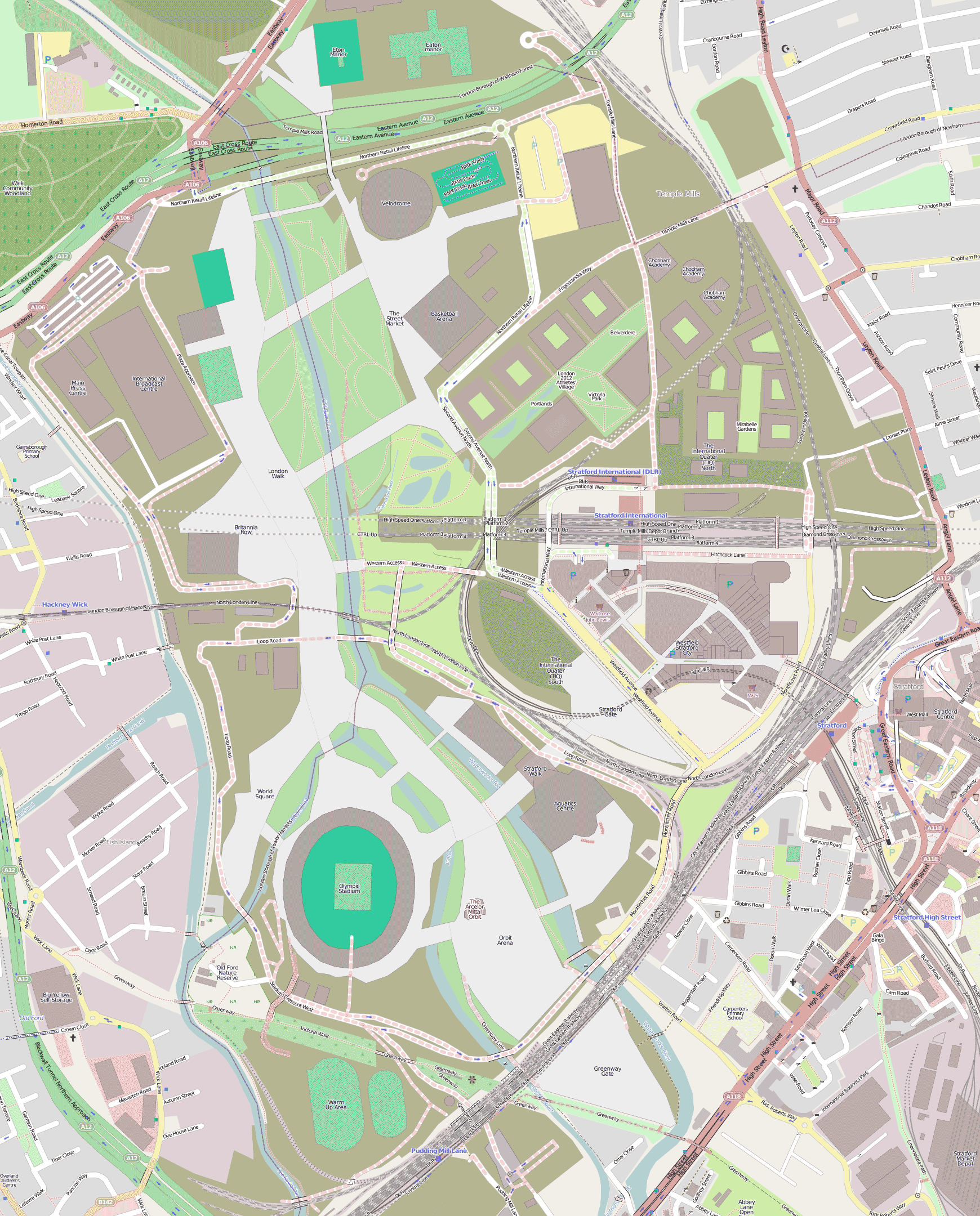
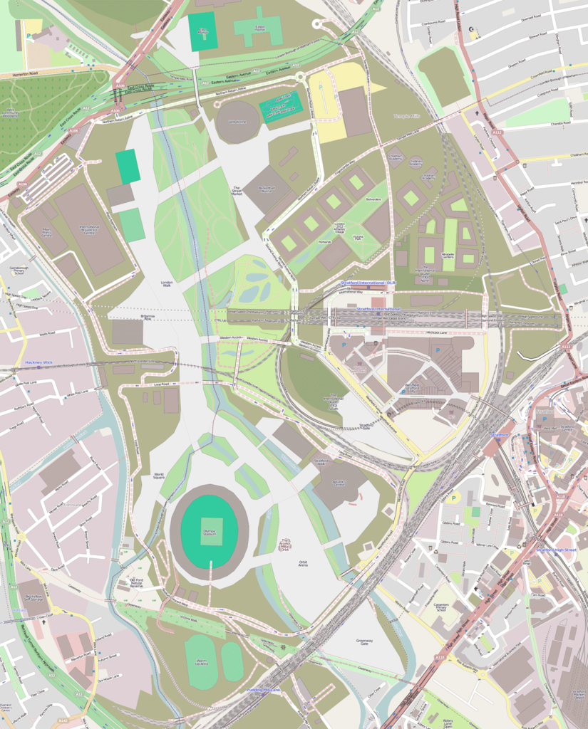
File:Queen Elizabeth Olympic Park map.png
Size of this preview: 483 × 600 pixels. Other resolutions: 193 × 240 pixels | 387 × 480 pixels | 619 × 768 pixels | 825 × 1,024 pixels | 1,740 × 2,160 pixels.
Original file (1,740 × 2,160 pixels, file size: 847 KB, MIME type: image/png)
| This is a file from the Wikimedia Commons. Information from its description page there is shown below. Commons is a freely licensed media file repository. You can help. |
| Description | |
| Date | |
| Source | OpenStreetMap |
| Author | OpenStreetMap contributors |
| Permission (Reusing this file) |
This file is licensed under the Creative Commons Attribution 2.0 Generic license.
|
| Other versions |
|
.png)
File history
Click on a date/time to view the file as it appeared at that time.
| Date/Time | Thumbnail | Dimensions | User | Comment | |
|---|---|---|---|---|---|
| current | 07:32, 3 May 2012 | | 1,740 × 2,160 (847 KB) | Voyager | {{Information |Description={{en|1=Map of w:en:Queen Elizabeth Olympic Park in East London (shown here as "Olympic Park, London")}} |Source=[http://www.openstreetmap.org/?lat=51.5449&lon=-0.0091&zoom=14&layers=M OpenStreetMap] |Author=OpenStreetMap ... |
| 13:35, 6 December 2010 |  | 678 × 878 (630 KB) | MrWeeble | {{Information |Description={{en|1=Map of w:en:Queen Elizabeth Olympic Park in East London (shown here as "Olympic Park, London")}} |Source=OpenStreetMap |Author=OpenStreetMap contributors |Date= |Permission={{cc-by-2.0}} |other_versions= }} From http: |
File usage
The following pages on the English Wikipedia use this file (pages on other projects are not listed):
Global file usage
The following other wikis use this file:
- Usage on af.wikipedia.org
- Usage on azb.wikipedia.org
- Usage on bg.wikipedia.org
- Usage on cs.wikipedia.org
- Usage on de.wikipedia.org
- Usage on es.wikipedia.org
- Usage on et.wikipedia.org
- Usage on fa.wikipedia.org
- Usage on fi.wikipedia.org
- Usage on fr.wikipedia.org
- Usage on id.wikipedia.org
- Usage on it.wikipedia.org
- Usage on ja.wikipedia.org
- Usage on mk.wikipedia.org
- Usage on nl.wikipedia.org
- Usage on sh.wikipedia.org
- Usage on sr.wikipedia.org
- Usage on ta.wikipedia.org
- Usage on th.wikipedia.org
- Usage on tr.wikipedia.org
- Usage on www.wikidata.org