
File:RainbowBridge (Texas).jpg
Size of this preview: 800 × 600 pixels. Other resolutions: 320 × 240 pixels | 640 × 480 pixels | 1,024 × 768 pixels | 1,280 × 960 pixels | 2,576 × 1,932 pixels.
Original file (2,576 × 1,932 pixels, file size: 1.21 MB, MIME type: image/jpeg)
| This is a file from the Wikimedia Commons. Information from its description page there is shown below. Commons is a freely licensed media file repository. You can help. |
.jpg)
Summary
|
This is an image of a place or building that is listed on the National Register of Historic Places in the United States of America. Its reference number is 96001127. |
| Description |
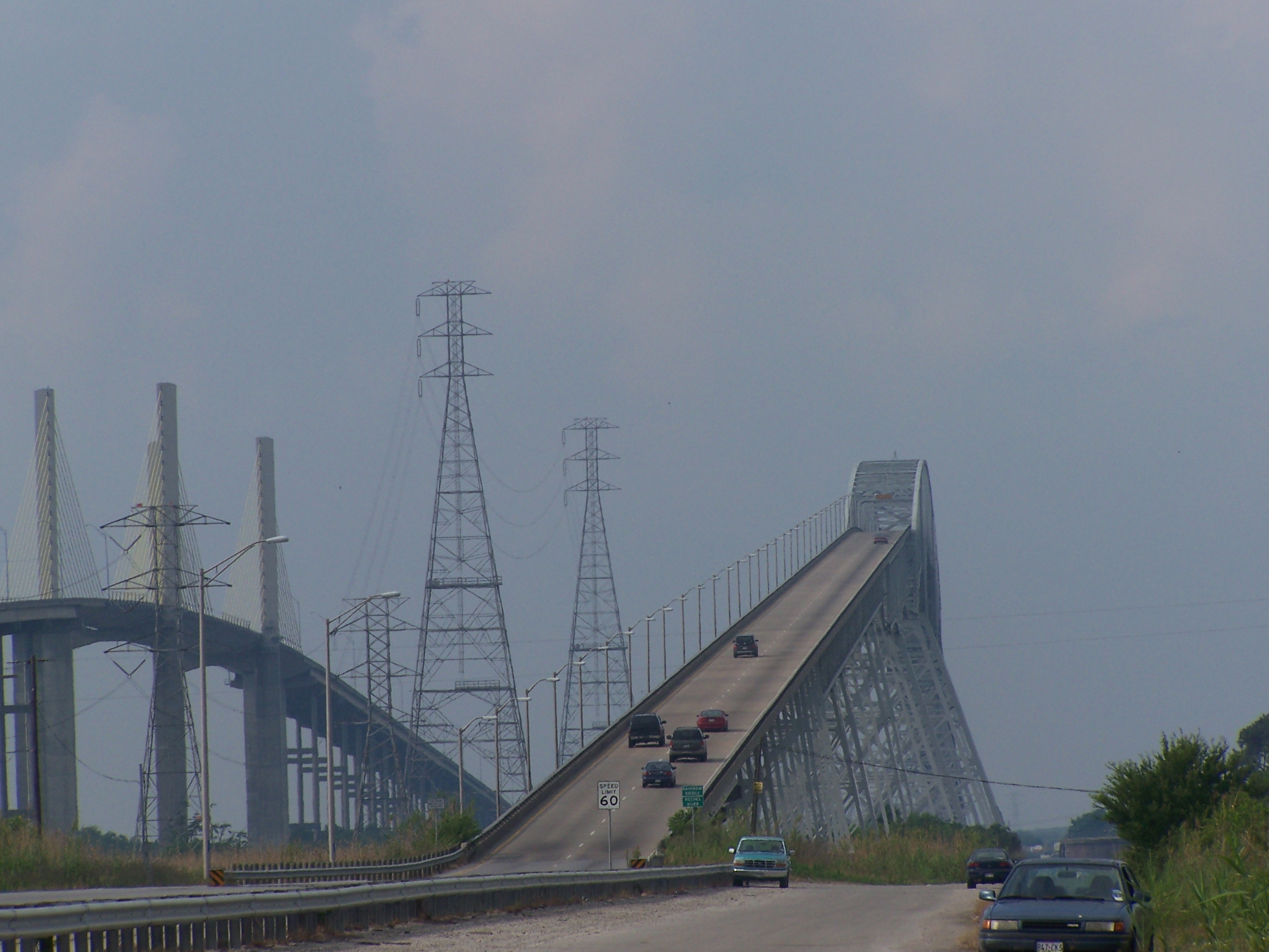
English: View of the westbound approach to Rainbow Bridge in Orange County, Texas. Veterans Memorial Bridge, opened in 1990, is seen to the left. |
| Date |
21 April 2006 (original upload date) |
| Source | http://people.smu.edu/acambre/blog/2005/06/01/MemorialDayTrip.aspx |
| Author | Aren Cambre |
| Permission (Reusing this file) |
(Released under the Creative Commons license shown below by Aren Cambre (Novasource)) |
| Object location | | View this and other nearby images on: OpenStreetMap |
|---|
.jpg¶ms=029.979722_N_-093.871667_E_globe:Earth_class:object_region:US_type:landmark_scale:1500_&language=en)
Licensing
This file is licensed under the Creative Commons Attribution-Share Alike 2.5 Generic license.
- You are free:
- to share – to copy, distribute and transmit the work
- to remix – to adapt the work
- Under the following conditions:
- attribution – You must give appropriate credit, provide a link to the license, and indicate if changes were made. You may do so in any reasonable manner, but not in any way that suggests the licensor endorses you or your use.
- share alike – If you remix, transform, or build upon the material, you must distribute your contributions under the same or compatible license as the original.
Original upload log
Transferred from en.wikipedia to Commons by Oxyman using CommonsHelper.
The original description page was here. All following user names refer to en.wikipedia.
- 2006-04-21 15:43 Novasource 2576×1932× (1272383 bytes) Replaced with the full-sized original.
- 2006-03-07 19:10 Novasource 775×581× (32338 bytes) {{Information| |Description = Westbound approach to Rainbow Bridge in Orange County, TX. |Source = http://people.smu.edu/acambre/ |Date = 2005-05-28 |Author = Aren Cambre }} {{cc-by-sa-2.5}}
File history
Click on a date/time to view the file as it appeared at that time.
| Date/Time | Thumbnail | Dimensions | User | Comment | |
|---|---|---|---|---|---|
| current | 01:31, 4 April 2024 | | 2,576 × 1,932 (1.21 MB) | Novasource | Reverted to version as of 02:15, 18 November 2008 (UTC). The edited version was inauthentically modified to edit out a Ford truck parked on the side road, next to where the main road begins its ascent. |
| 13:50, 5 June 2021 |  | 2,161 × 1,574 (1.31 MB) | Jim Evans | lightened, increased contrast, cropped to subject | |
| 02:15, 18 November 2008 |  | 2,576 × 1,932 (1.21 MB) | File Upload Bot (Magnus Manske) | {{BotMoveToCommons|en.wikipedia}} {{Information |Description={{en|Westbound approach to en:Rainbow Bridge in Orange County, TX.}} |Source=Transferred from [http://en.wikipedia.org en.wikipedia]; transferred to Commons by User:Oxyman using [http: |
File usage
The following pages on the English Wikipedia use this file (pages on other projects are not listed):
- National Register of Historic Places listings in Jefferson County, Texas
- National Register of Historic Places listings in Orange County, Texas
- National Register of Historic Places listings in the Southeast region of Texas
- Neches River
- Rainbow Bridge & Veterans Memorial Bridge (Texas)
- User:Clariosophic/sandbox12
Global file usage
The following other wikis use this file:
- Usage on bg.wikipedia.org
- Usage on de.wikipedia.org
- Usage on fa.wikipedia.org
- Usage on www.wikidata.org
.jpg)