
File:Riksveier Hordaland.svg

Size of this PNG preview of this SVG file: 526 × 554 pixels. Other resolutions: 228 × 240 pixels | 456 × 480 pixels | 729 × 768 pixels | 972 × 1,024 pixels | 1,944 × 2,048 pixels.
Original file (SVG file, nominally 526 × 554 pixels, file size: 197 KB)
| This is a file from the Wikimedia Commons. Information from its description page there is shown below. Commons is a freely licensed media file repository. You can help. |
Summary
| Description |
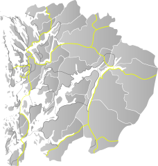
English: Locator base map for roads in Hordaland |
| Date | |
| Source | Own work by uploader, based on NO 1232 Eidfjord.svg |
| Author | BjørnN |
Licensing
| I, the copyright holder of this work, release this work into the public domain. This applies worldwide. In some countries this may not be legally possible; if so: I grant anyone the right to use this work for any purpose, without any conditions, unless such conditions are required by law. |
File history
Click on a date/time to view the file as it appeared at that time.
| Date/Time | Thumbnail | Dimensions | User | Comment | |
|---|---|---|---|---|---|
| current | 15:59, 24 January 2010 | | 526 × 554 (197 KB) | BjørnN | missing road added |
| 15:58, 24 January 2010 |  | 526 × 554 (197 KB) | BjørnN | new highway system | |
| 17:41, 30 May 2009 |  | 526 × 554 (197 KB) | BjørnN | coloring corrected | |
| 17:28, 29 May 2009 |  | 526 × 554 (196 KB) | BjørnN | coloring corrected | |
| 17:25, 29 May 2009 |  | 526 × 554 (196 KB) | BjørnN | Missing roads and ferries added | |
| 08:38, 29 May 2009 |  | 526 × 554 (186 KB) | BjørnN | {{Information |Description={{en|1=Locator base map for roads in Hordaland}} |Source=Own work by uploader, based on NO 1232 Eidfjord.svg |Author=BjørnN |Date=2009-05-29 |Permission= |other_versions= }} <!--{{ImageUpload|full}}--> [[Categ |
File usage
The following pages on the English Wikipedia use this file (pages on other projects are not listed):
Global file usage
The following other wikis use this file:
- Usage on nn.wikipedia.org
- Fylkesveg 545
- Fylkesveg 49
- Fylkesveg 542
- Fylkesveg 544
- Fylkesveg 541
- Fylkesveg 572
- Fylkesveg 48
- Fylkesveg 546
- Fylkesveg 550
- Fylkesveg 551
- Fylkesveg 552
- Riksveg 555
- Fylkesveg 556
- Fylkesveg 557
- Fylkesveg 558
- Fylkesveg 559
- Fylkesveg 561
- Fylkesveg 563
- Fylkesveg 564
- Fylkesveg 565
- Fylkesveg 566
- Fylkesveg 567
- Fylkesveg 568
- Fylkesveg 569
- Riksveg 580
- Fylkesveg 582
- Fylkesveg 585
- Fylkesveg 7
- Fylkesveg 540
- Fylkesveg 555
- Fylkesveg 562
- Fylkesveg 580
- Usage on no.wikipedia.org
View more global usage of this file.