
File:Santa Paula, California (21399016118).jpg

Original file (4,000 × 3,000 pixels, file size: 4.18 MB, MIME type: image/jpeg)
| This is a file from the Wikimedia Commons. Information from its description page there is shown below. Commons is a freely licensed media file repository. You can help. |
.jpg)
Summary
| Description |
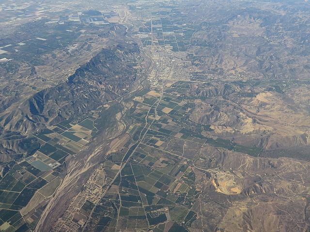
Santa Paula is a city in Ventura County, California, United States. Situated amidst the orchards of the fertile Santa Clara River Valley, the city advertises itself to tourists as the "Citrus Capital of the World." Santa Paula was one of the early centers of California's petroleum industry. The Union Oil Company Building, the founding headquarters of the Union Oil Company of California in 1890, now houses the California Oil Museum. The population was 29,321 at the 2010 census, up from 28,598 at the 2000 census. Santa Paula's economy is primarily agriculturally based, originally focusing on the growing of oranges and lemons. Santa Paula's mediterranean climate combined with an estimated 20 feet (6.1 m) of topsoil have made it a prime location for growing citrus. Avocado has also become a major crop and an avocado was added to the city's official seal (Calavo Growers, Inc. is headquartered here). The Santa Clara Valley represents one of the best preserved examples of a mature Southern California landscape of citrus groves. en.wikipedia.org/wiki/Santa_Paula,_California en.wikipedia.org/wiki/Wikipedia:Text_of_Creative_Commons_... |
| Date | |
| Source | Santa Paula, California |
| Author | Ken Lund from Reno, Nevada, USA |
| Camera location | | View this and other nearby images on: OpenStreetMap |
|---|
.jpg¶ms=034.424536_N_-118.938053_E_globe:Earth_type:camera_source:Flickr_&language=en)
Licensing
- You are free:
- to share – to copy, distribute and transmit the work
- to remix – to adapt the work
- Under the following conditions:
- attribution – You must give appropriate credit, provide a link to the license, and indicate if changes were made. You may do so in any reasonable manner, but not in any way that suggests the licensor endorses you or your use.
- share alike – If you remix, transform, or build upon the material, you must distribute your contributions under the same or compatible license as the original.
| This image was originally posted to Flickr by Ken Lund at https://flickr.com/photos/75683070@N00/21399016118. It was reviewed on 4 December 2015 by FlickreviewR and was confirmed to be licensed under the terms of the cc-by-sa-2.0. |
File history
Click on a date/time to view the file as it appeared at that time.
| Date/Time | Thumbnail | Dimensions | User | Comment | |
|---|---|---|---|---|---|
| current | 04:43, 4 December 2015 | | 4,000 × 3,000 (4.18 MB) | INeverCry | Transferred from Flickr via Flickr2Commons |
.jpg)