
File:SchreierstorenAmsterdamDusk.jpg
Size of this preview: 508 × 599 pixels. Other resolutions: 203 × 240 pixels | 407 × 480 pixels | 651 × 768 pixels | 868 × 1,024 pixels | 1,738 × 2,051 pixels.
Original file (1,738 × 2,051 pixels, file size: 2.41 MB, MIME type: image/jpeg)
| This is a file from the Wikimedia Commons. Information from its description page there is shown below. Commons is a freely licensed media file repository. You can help. |
Summary
| Description |
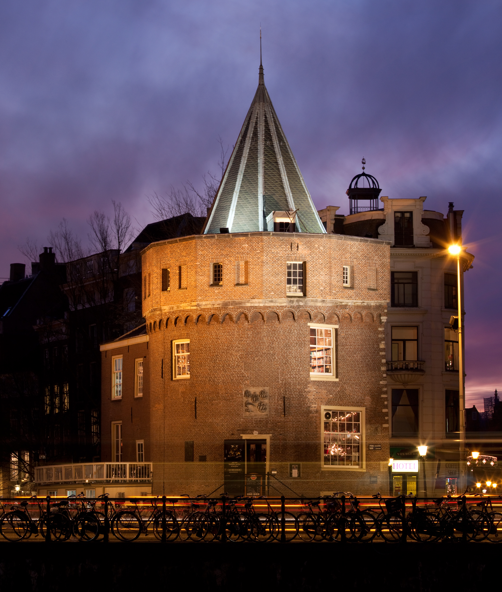
English: The Schreierstoren, originally part of the medieval city wall of Amsterdam, the Netherlands, was built in the 15th century. It was the location from which Henry Hudson set sail on his journey to Northern America. This expedition would lead to the discovery of the island of Manhattan among others.
Nederlands: De Schreierstoren, oorspronkelijk een deel van de middeleeuwse stadsmuur van Amsterdam, Nederland, is gebouwd in de 15de eeuw. Het was de plek waarvandaan Henry Hudson vertrok op zijn reis naar Noord-Amerika tijdens welke hij onder andere het eiland Manhattan zou ontdekken.
|
||
| Date | |||
| Source | Own work | ||
| Author | Massimo Catarinella | ||
| Permission (Reusing this file) |
See license, attribution required - contact me to discuss less restrictive commercial licensing terms by email Special:EmailUser/Massimo Catarinella or leave a message on my talk page | ||
| Other versions |
 |
| Camera location | | View this and other nearby images on: OpenStreetMap |
|---|
Licensing
I, the copyright holder of this work, hereby publish it under the following license:
This file is licensed under the Creative Commons Attribution 3.0 Unported license.
- You are free:
- to share – to copy, distribute and transmit the work
- to remix – to adapt the work
- Under the following conditions:
- attribution – You must give appropriate credit, provide a link to the license, and indicate if changes were made. You may do so in any reasonable manner, but not in any way that suggests the licensor endorses you or your use.
File history
Click on a date/time to view the file as it appeared at that time.
| Date/Time | Thumbnail | Dimensions | User | Comment | |
|---|---|---|---|---|---|
| current | 14:46, 17 December 2009 | | 1,738 × 2,051 (2.41 MB) | Massimo Catarinella | Different Crop |
| 12:00, 17 December 2009 |  | 1,738 × 2,278 (2.49 MB) | Massimo Catarinella | {{Information |Description={{en|1=e}} |Source={{own}} |Author=Massimo Catarinella |Date=15 December 2009 |Permission= |other_versions= }} |
File usage
The following pages on the English Wikipedia use this file (pages on other projects are not listed):
Global file usage
The following other wikis use this file:
- Usage on it.wikipedia.org