
File:Sept Iles 055.jpg

Size of this preview: 800 × 533 pixels. Other resolutions: 320 × 213 pixels | 640 × 427 pixels | 1,024 × 683 pixels | 1,280 × 853 pixels | 2,560 × 1,707 pixels | 3,456 × 2,304 pixels.
Original file (3,456 × 2,304 pixels, file size: 2.85 MB, MIME type: image/jpeg)
| This is a file from the Wikimedia Commons. Information from its description page there is shown below. Commons is a freely licensed media file repository. You can help. |
Summary
| Description |
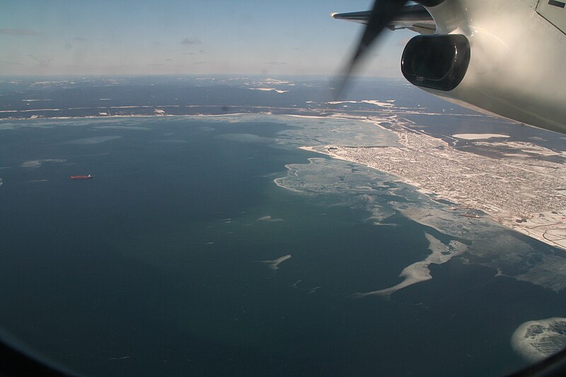
English: 50° 12' 14" N - 66° 27' 41" W, North Shore, MRC Sept-Rivières, gulf of the St. Lawrence River, Bay of Sept-Îles, Sept-Îles (City), aerial view, geolocation of an aircraft over the bay, Saturday, March 27, 2010.
Français : 50° 12' 14" N - 66° 27' 41" O, Côte-Nord, MRC Sept-Rivières, golfe du fleuve Saint-Laurent, baie des Sept-Îles, Sept-Îles (Ville), vue aérienne, géolocalisation d’un avion au-dessus de la baie, le samedi 27 mars 2010. |
| Date | |
| Source | Own work |
| Author | Nichole Ouellette/ouellette001.com |
More Info
- Vue aérienne de la baie des Sept Îles
- Section maritime du Saint-Laurent 1
- Section maritime du Saint-Laurent 2
- Portion du fleuve sous puissance des marées d’eau douce
Licensing
I, the copyright holder of this work, hereby publish it under the following license:
This file is licensed under the Creative Commons Attribution 4.0 International license.
- You are free:
- to share – to copy, distribute and transmit the work
- to remix – to adapt the work
- Under the following conditions:
- attribution – You must give appropriate credit, provide a link to the license, and indicate if changes were made. You may do so in any reasonable manner, but not in any way that suggests the licensor endorses you or your use.
File history
Click on a date/time to view the file as it appeared at that time.
| Date/Time | Thumbnail | Dimensions | User | Comment | |
|---|---|---|---|---|---|
| current | 10:44, 25 April 2024 | | 3,456 × 2,304 (2.85 MB) | Nichole Ouellette | Uploaded own work with UploadWizard |
File usage
The following pages on the English Wikipedia use this file (pages on other projects are not listed):