
File:Sheffield Victoria 2061975.jpg

Size of this preview: 800 × 491 pixels. Other resolutions: 320 × 196 pixels | 640 × 393 pixels | 1,000 × 614 pixels.
Original file (1,000 × 614 pixels, file size: 240 KB, MIME type: image/jpeg)
| This is a file from the Wikimedia Commons. Information from its description page there is shown below. Commons is a freely licensed media file repository. You can help. |
| Description |
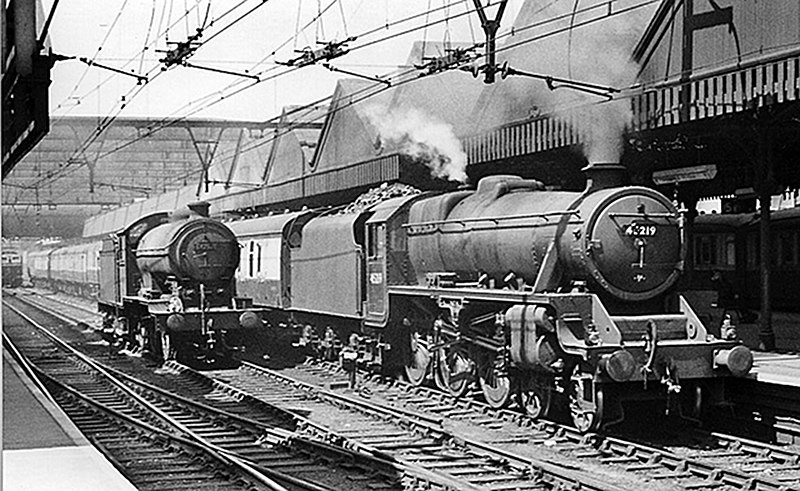
Sheffield Victoria Station, with train. |
||
| Date | Taken on 17 June 1957 | ||
| Source | Geograph Project | ||
| Author | Ben Brooksbank | ||
| Permission (Reusing this file) |
This file is licensed under the Creative Commons Attribution-Share Alike 2.0 Generic license. Attribution: Ben Brooksbank
|

| Camera location | | View this and other nearby images on: OpenStreetMap |
|---|
_heading:315.00&language=en)
| Object location | | View this and other nearby images on: OpenStreetMap |
|---|
_heading:315.00&language=en)
File history
Click on a date/time to view the file as it appeared at that time.
| Date/Time | Thumbnail | Dimensions | User | Comment | |
|---|---|---|---|---|---|
| current | 19:15, 8 October 2010 | | 1,000 × 614 (240 KB) | G-13114 | {{Information |Description= Sheffield Victoria Station, with train View NW, towards Penistone and Manchester (London Road); ex-Great Central Manchester - Sheffield main line. The route had been electrified since June 1954, but was still traversed from Pen |
File usage
The following pages on the English Wikipedia use this file (pages on other projects are not listed):
Global file usage
The following other wikis use this file:
- Usage on arz.wikipedia.org
- Usage on www.wikidata.org