
File:South-pacific-map.jpg

Size of this preview: 800 × 537 pixels. Other resolutions: 320 × 215 pixels | 640 × 430 pixels | 1,024 × 687 pixels | 1,280 × 859 pixels | 1,700 × 1,141 pixels.
Original file (1,700 × 1,141 pixels, file size: 944 KB, MIME type: image/jpeg)
| Description |
A map covering most of Oceania. | |||
|---|---|---|---|---|
| Source | ||||
| Date |
19:14, 23 February 2010 (UTC) | |||
| Author | ||||
| Permission (Reusing this file) |
|
.svg)
 | This file is a candidate to be copied to Wikimedia Commons.
Any user may perform this transfer; refer to Wikipedia:Moving files to Commons for details. If this file has problems with attribution, copyright, or is otherwise ineligible for Commons, then remove this tag and DO NOT transfer it; repeat violators may be blocked from editing. Other Instructions
| ||
| |||
File history
Click on a date/time to view the file as it appeared at that time.
| Date/Time | Thumbnail | Dimensions | User | Comment | |
|---|---|---|---|---|---|
| current | 18:15, 24 February 2010 | | 1,700 × 1,141 (944 KB) | Belleami (talk | contribs) | <ref>https://www.cia.gov/library/publications/cia-maps-publications/index.html</ref> |
| 18:09, 24 February 2010 | 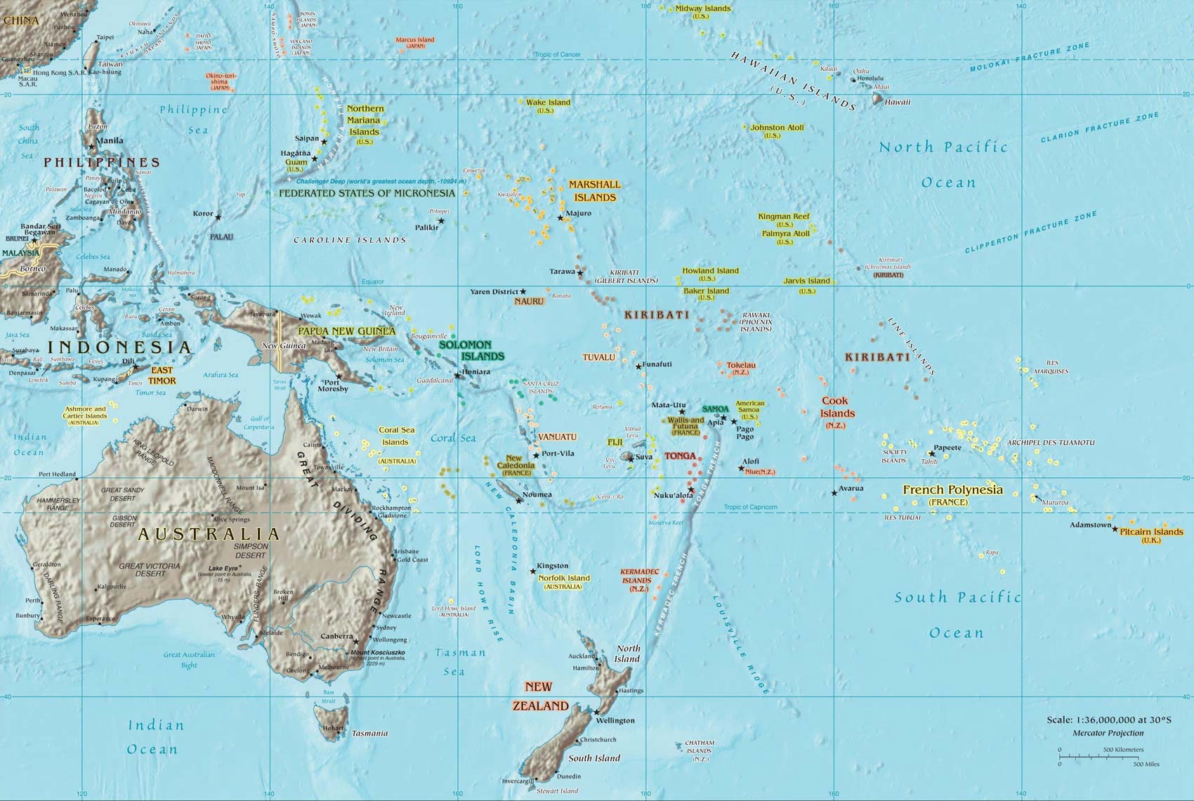 | 1,700 × 1,141 (244 KB) | Belleami (talk | contribs) | ||
| 19:14, 23 February 2010 |  | 1,700 × 1,141 (944 KB) | Belleami (talk | contribs) | {{Information |Description = |Source = |Date = ~~~~~ |Author = |Permission = |other_versions = }} |
You cannot overwrite this file.
File usage
The following pages on the English Wikipedia use this file (pages on other projects are not listed):