
File:Southdown Church - geograph.org.uk - 1222969.jpg
No higher resolution available.
Southdown_Church_-_geograph.org.uk_-_1222969.jpg (640 × 480 pixels, file size: 90 KB, MIME type: image/jpeg)
| This is a file from the Wikimedia Commons. Information from its description page there is shown below. Commons is a freely licensed media file repository. You can help. |
Summary
| Description |
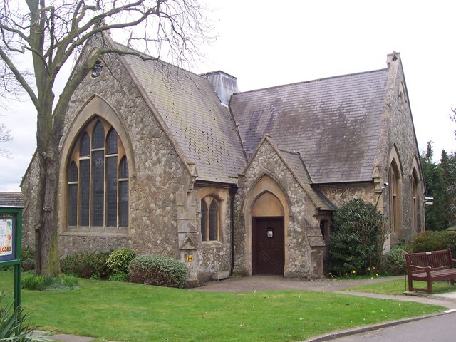
English: Southdown Church On junction of Gorringe Avenue (in front) and Victoria Drive (behind Church).
In Southdown Retirement Home Association village. Used by multi-denominations for use of the residents of the village. Has etched foundation stone near doorway which reads 'Home for Little Boys. Established in Totternham. This stone was laid by July 7th 1866 by Her Royal Highness the Princess of Wales'. |
| Date | |
| Source | From geograph.org.uk |
| Author | David Anstiss |
| Attribution (required by the license) | David Anstiss / Southdown Church / |
| Camera location | | View this and other nearby images on: OpenStreetMap |
|---|
_heading:247.00&language=en)
| Object location | | View this and other nearby images on: OpenStreetMap |
|---|
_heading:247.00&language=en)
Licensing

|
This image was taken from the Geograph project collection. See this photograph's page on the Geograph website for the photographer's contact details. The copyright on this image is owned by David Anstiss and is licensed for reuse under the Creative Commons Attribution-ShareAlike 2.0 license.
|
This file is licensed under the Creative Commons Attribution-Share Alike 2.0 Generic license.
Attribution: David Anstiss
- You are free:
- to share – to copy, distribute and transmit the work
- to remix – to adapt the work
- Under the following conditions:
- attribution – You must give appropriate credit, provide a link to the license, and indicate if changes were made. You may do so in any reasonable manner, but not in any way that suggests the licensor endorses you or your use.
- share alike – If you remix, transform, or build upon the material, you must distribute your contributions under the same or compatible license as the original.
File history
Click on a date/time to view the file as it appeared at that time.
| Date/Time | Thumbnail | Dimensions | User | Comment | |
|---|---|---|---|---|---|
| current | 10:55, 26 February 2011 | | 640 × 480 (90 KB) | GeographBot | == {{int:filedesc}} == {{Information |description={{en|1=Southdown Church On junction of Gorringe Avenue (in front) and Victoria Drive (behind Church). In Southdown Retirement Home Association village. Used by multi-denominations for use of the residents |
File usage
The following pages on the English Wikipedia use this file (pages on other projects are not listed):