
File:Stony Point State Park.jpg
Original file (3,591 × 2,539 pixels, file size: 3.16 MB, MIME type: image/jpeg)
| This is a file from the Wikimedia Commons. Information from its description page there is shown below. Commons is a freely licensed media file repository. You can help. |
|
This is an image of a place or building that is listed on the National Register of Historic Places in the United States of America. Its reference number is 66000567. |
| Description |
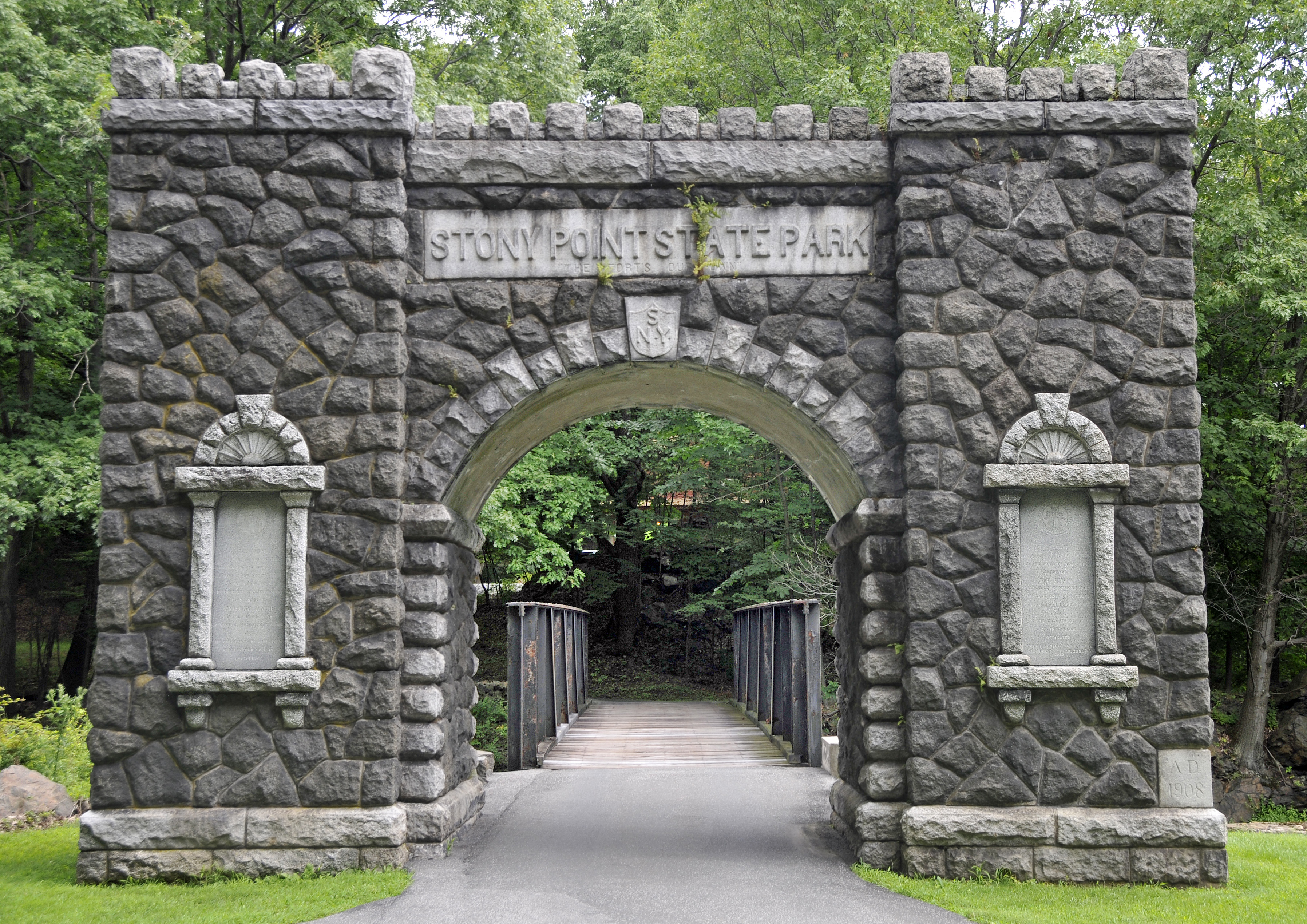
Visit the site of the Battle of Stony Point, one of the last major Revolutionary War battles in the northeastern colonies. This is where Brigadier General Anthony Wayne led his corps of Continental Light Infantry in a daring midnight attack on the British, seizing the site's fortifications and taking the British garrison as prisoners on July 16, 1779. By the late 1770s, the war had been raging for four years and both sides were eager for a conclusion. Sir Henry Clinton, commander of the British forces in America, attempted to coerce General George Washington into one decisive battle to control the Hudson River. As part of his strategy, Clinton fortified Stony Point. Washington devised a plan for Wayne to lead an attack on the fort. Armed with bayonets only, the infantry captured the fort in short order, ending British control of the river. The site features a museum, which offers exhibits on the battle and the 1826 Stony Point Lighthouse, as well as interpretive programs, such as reenactments highlighting 18th century military life, cannon and musket firings, cooking demonstrations, and children's activities. source: State of New York |
||
| Date | |||
| Source | originally posted to Flickr as Entrance to Stony Point State Park | ||
| Author | Tony | ||
| Permission (Reusing this file) |
This file is licensed under the Creative Commons Attribution 2.0 Generic license.
|
| Object location | | View this and other nearby images on: OpenStreetMap |
|---|
File history
Click on a date/time to view the file as it appeared at that time.
| Date/Time | Thumbnail | Dimensions | User | Comment | |
|---|---|---|---|---|---|
| current | 00:36, 3 September 2008 | | 3,591 × 2,539 (3.16 MB) | Flickr upload bot | Uploaded from http://flickr.com/photo/22714323@N06/2754499034 using Flickr upload bot |
File usage
Global file usage
The following other wikis use this file:
- Usage on ceb.wikipedia.org
- Usage on de.wikipedia.org
- Usage on en.wikivoyage.org
- Usage on es.wikipedia.org
- Usage on fr.wikipedia.org
- Usage on ja.wikipedia.org
- Usage on pt.wikipedia.org
- Usage on www.wikidata.org
- Usage on zh.wikipedia.org