
File:TC Ami 13 jan 2003 2200Z.jpg

Size of this preview: 461 × 599 pixels. Other resolutions: 184 × 240 pixels | 369 × 480 pixels | 591 × 768 pixels | 788 × 1,024 pixels | 1,575 × 2,048 pixels | 6,000 × 7,800 pixels.
Original file (6,000 × 7,800 pixels, file size: 4.32 MB, MIME type: image/jpeg)
| This is a file from the Wikimedia Commons. Information from its description page there is shown below. Commons is a freely licensed media file repository. You can help. |
Summary
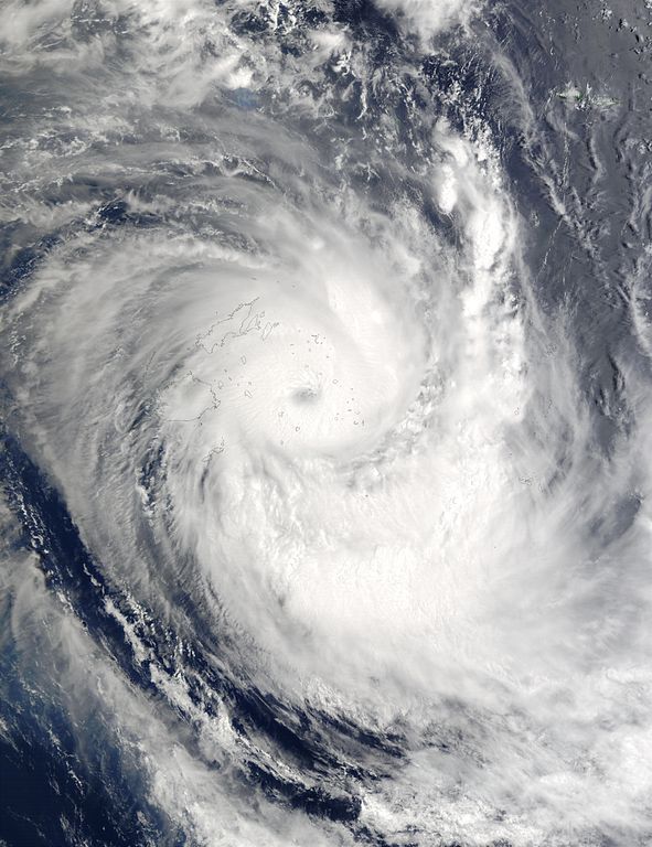
| Description |
With sustained winds of 104 mph (166 km/hr), Tropical Cyclone Ami has tracked southward at 14 mph (22 km/hr) and is now located approximately 98 miles (157 km) northeast of Suva, Fiji. The system is still expected to begin undergoing extratropical transition in the 12 to 24 hour time period as it interacts with a developing mid-latitude low near New Zealand. This true-color image of Tropical Cyclone Ami was captured by the Moderate Resolution Imaging Spectroradiometer (MODIS), flying aboard NASA's Terra satellite. |
|||||
| Date | ||||||
| Source | http://visibleearth.nasa.gov/view_rec.php?id=4504 | |||||
| Author | Jacques Descloitres, MODIS Rapid Response Team, NASA/GSFC | |||||
| Permission (Reusing this file) |
|

File history
Click on a date/time to view the file as it appeared at that time.
| Date/Time | Thumbnail | Dimensions | User | Comment | |
|---|---|---|---|---|---|
| current | 03:22, 11 October 2006 | | 6,000 × 7,800 (4.32 MB) | Good kitty | == Summary == {{Information |Description=On January 13, 2003, Tropical Cyclone Ami was located approximately 265 miles (307 km) northeast of Suva on Fiji and was packing winds of 89 mph (142 km/hr) with gusts to 104 mph (166 km/hr). Ami was expected to in |
File usage
The following pages on the English Wikipedia use this file (pages on other projects are not listed):