
File:Tshiuetin Rail Transportation map.png
No higher resolution available.
Tshiuetin_Rail_Transportation_map.png (714 × 566 pixels, file size: 456 KB, MIME type: image/png)
| This is a file from the Wikimedia Commons. Information from its description page there is shown below. Commons is a freely licensed media file repository. You can help. |
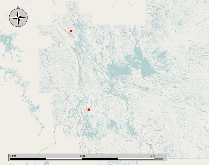
| Description |
English: Map showing the Tshiuetin Rail Transportation line from Schefferville Quebec to Emeril Junction, Labrador. The rail line runs between the two red dots as shown. |
|||
| Date | ||||
| Source | Own work | |||
| Author | Self-made by the uploader, using OpenStreetMaps and GIMP | |||
| Permission (Reusing this file) |
|
File history
Click on a date/time to view the file as it appeared at that time.
| Date/Time | Thumbnail | Dimensions | User | Comment | |
|---|---|---|---|---|---|
| current | 03:24, 7 January 2014 | | 714 × 566 (456 KB) | Oaktree b | {{Information |Description ={{en|1=Map showing the Tshiuetin Rail Transportation line from Schefferville Quebec to Emeril Junction, Labrador. The rail line runs between the two red dots as shown. }} |Source ={{own}} |Author =Self-mad... |
File usage
The following pages on the English Wikipedia use this file (pages on other projects are not listed):
Global file usage
The following other wikis use this file:
- Usage on fi.wikipedia.org
- Usage on fr.wikipedia.org