
File:US395 NSC Map.jpg
Size of this preview: 600 × 600 pixels. Other resolutions: 240 × 240 pixels | 480 × 480 pixels | 768 × 768 pixels | 1,024 × 1,024 pixels | 1,394 × 1,394 pixels.
Original file (1,394 × 1,394 pixels, file size: 207 KB, MIME type: image/jpeg)
| This is a file from the Wikimedia Commons. Information from its description page there is shown below. Commons is a freely licensed media file repository. You can help. |
Summary

|
This road map image could be re-created using vector graphics as an SVG file. This has several advantages; see Commons:Media for cleanup for more information. If an SVG form of this image is available, please upload it and afterwards replace this template with
{{vector version available|new image name}}.
It is recommended to name the SVG file “US395 NSC Map.svg”—then the template Vector version available (or Vva) does not need the new image name parameter. |


| Description |
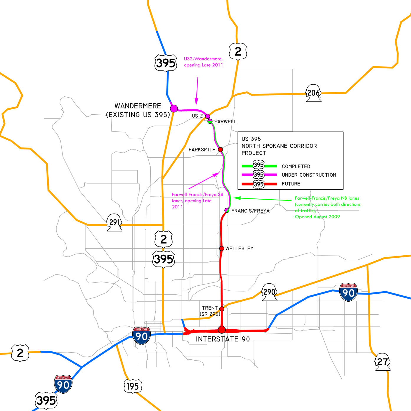
English: Map of the approved route of the US 395 North Spokane Corridor with surrounding context. |
| Date | (UTC) |
| Source | I (Jdubman (talk)) created this work entirely by myself. used :Image:Washington State Route 290.svg, :Image:US 395.svg, :Image:US 2.svg, :Image:US 195.svg, :Image:WA-290.svg, :Image:WA-291.svg, :Image:WA-27.svg, and :Image:I-90 (big).svg |
| Author | Jdubman (talk) |
.svg)
Licensing
| This work has been released into the public domain by its author, Jdubman at English Wikipedia. This applies worldwide. In some countries this may not be legally possible; if so: Jdubman grants anyone the right to use this work for any purpose, without any conditions, unless such conditions are required by law. |
Original upload log
Transferred from en.wikipedia to Commons by Jay8g using CommonsHelper.
The original description page was here. All following user names refer to en.wikipedia.
- 2010-05-30 21:19 Jdubman 1394×1394× (212318 bytes) Updated map to reflect opening, and additional construction.
- 2010-01-08 10:02 Jdubman 1000×1000× (115180 bytes) {{Information |Description = Map of the approved route of the US 395 [[North Spokane Corridor]] with surrounding context. |Source = I (~~~) created this work entirely by myself. used [[:Image:Washington State Route 290.svg]], [[:Image:US 3
File history
Click on a date/time to view the file as it appeared at that time.
| Date/Time | Thumbnail | Dimensions | User | Comment | |
|---|---|---|---|---|---|
| current | 04:03, 22 July 2011 | | 1,394 × 1,394 (207 KB) | File Upload Bot (Magnus Manske) | {{BotMoveToCommons|en.wikipedia|year={{subst:CURRENTYEAR}}|month={{subst:CURRENTMONTHNAME}}|day={{subst:CURRENTDAY}}}} {{Information |Description={{en|Map of the approved route of the US 395 en:North Spokane Corridor with surrounding context.}} |So |
File usage
The following pages on the English Wikipedia use this file (pages on other projects are not listed):
Global file usage
The following other wikis use this file:
- Usage on www.wikidata.org