
File:Union Mill,Milnsbridge - geograph.org.uk - 843452.jpg
No higher resolution available.
Union_Mill,Milnsbridge_-_geograph.org.uk_-_843452.jpg (640 × 480 pixels, file size: 82 KB, MIME type: image/jpeg)
| This is a file from the Wikimedia Commons. Information from its description page there is shown below. Commons is a freely licensed media file repository. You can help. |
Summary
| Description |
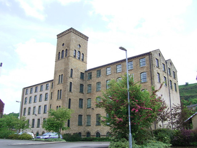
English: Union Mill,Milnsbridge What is left of it before 1980 you would not have been able to see in this view, because what you see is the back half of the mill. The front half came up to the road divided by a passage. The front was used as the dyehouse; the rear was the spinning when I started at Crowthers in 1966; the top floor was full of spinning mule frames. |
| Date | |
| Source | From geograph.org.uk |
| Author | Stanley Walker |
| Attribution (required by the license) | Stanley Walker / Union Mill,Milnsbridge / |
| Camera location | | View this and other nearby images on: OpenStreetMap |
|---|
_heading:112.00&language=en)
| Object location | | View this and other nearby images on: OpenStreetMap |
|---|
_heading:112.00&language=en)
Licensing

|
This image was taken from the Geograph project collection. See this photograph's page on the Geograph website for the photographer's contact details. The copyright on this image is owned by Stanley Walker and is licensed for reuse under the Creative Commons Attribution-ShareAlike 2.0 license.
|
This file is licensed under the Creative Commons Attribution-Share Alike 2.0 Generic license.
Attribution: Stanley Walker
- You are free:
- to share – to copy, distribute and transmit the work
- to remix – to adapt the work
- Under the following conditions:
- attribution – You must give appropriate credit, provide a link to the license, and indicate if changes were made. You may do so in any reasonable manner, but not in any way that suggests the licensor endorses you or your use.
- share alike – If you remix, transform, or build upon the material, you must distribute your contributions under the same or compatible license as the original.
File history
Click on a date/time to view the file as it appeared at that time.
| Date/Time | Thumbnail | Dimensions | User | Comment | |
|---|---|---|---|---|---|
| current | 00:33, 21 February 2011 | | 640 × 480 (82 KB) | GeographBot | == {{int:filedesc}} == {{Information |description={{en|1=Union Mill,Milnsbridge What is left of it before 1980 you would not have been able to see in this view, because what you see is the back half of the mill. The front half came up to the road divided |
File usage
The following pages on the English Wikipedia use this file (pages on other projects are not listed):