
File:West Philly.svg

Size of this PNG preview of this SVG file: 430 × 600 pixels. Other resolutions: 172 × 240 pixels | 344 × 480 pixels | 550 × 768 pixels | 734 × 1,024 pixels | 1,468 × 2,048 pixels | 1,824 × 2,544 pixels.
Original file (SVG file, nominally 1,824 × 2,544 pixels, file size: 13 KB)
| This is a file from the Wikimedia Commons. Information from its description page there is shown below. Commons is a freely licensed media file repository. You can help. |
Summary
| Description |
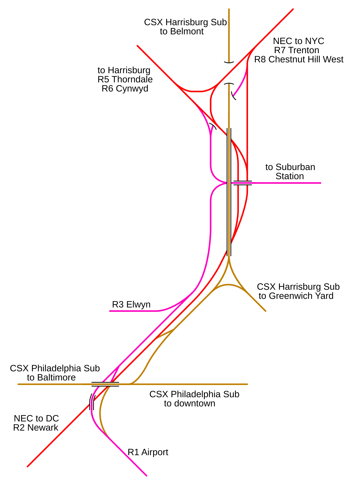
This is a map of the current rail lines in West Philadelphia, including Zoo Interlocking (the wye near the top).
|
| Date | 16 December 2006 (original upload date) |
| Source | No machine-readable source provided. Own work assumed (based on copyright claims). |
| Author | No machine-readable author provided. NE2 assumed (based on copyright claims). |
Licensing
| I, the copyright holder of this work, release this work into the public domain. This applies worldwide. In some countries this may not be legally possible; if so: I grant anyone the right to use this work for any purpose, without any conditions, unless such conditions are required by law. |
File history
Click on a date/time to view the file as it appeared at that time.
| Date/Time | Thumbnail | Dimensions | User | Comment | |
|---|---|---|---|---|---|
| current | 16:30, 16 December 2006 | | 1,824 × 2,544 (13 KB) | NE2 | Shifted text. |
| 16:27, 16 December 2006 |  | 1,824 × 2,544 (13 KB) | NE2 | Added a background and enlarged it. | |
| 16:24, 16 December 2006 |  | 219 × 307 (12 KB) | NE2 | This is a map of the current rail lines in West Philadelphia, including Zoo Interlocking (the wye near the top). *Red: Amtrak *Purple: SEPTA *Brown: freight Category:Maps |
File usage
The following pages on the English Wikipedia use this file (pages on other projects are not listed):