
File:Westenhanger Railway Station.jpg
No higher resolution available.
Westenhanger_Railway_Station.jpg (640 × 480 pixels, file size: 157 KB, MIME type: image/jpeg)
| This is a file from the Wikimedia Commons. Information from its description page there is shown below. Commons is a freely licensed media file repository. You can help. |
Summary
| Description |
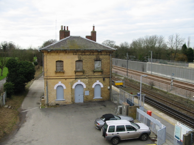
English: Westenhanger station house, now disused 1840 brought the London to Dover railway line into the area, and a station was planned for Sellindge, but the local traders objected and the station was built at Westenhanger. Some time later the tradesmen realised that the railway was bringing business and asked for a halt in the village, but this was turned down. |
| Date | |
| Source | From geograph.org.uk |
| Author | Nick Smith |
| Permission (Reusing this file) |
Creative Commons Attribution Share-alike license 2.0 |
| Camera location | | View this and other nearby images on: OpenStreetMap |
|---|
| Object location | | View this and other nearby images on: OpenStreetMap |
|---|
_region:GB-GBN_heading:292.00&language=en)
Licensing

|
This image was taken from the Geograph project collection. See this photograph's page on the Geograph website for the photographer's contact details. The copyright on this image is owned by Nick Smith and is licensed for reuse under the Creative Commons Attribution-ShareAlike 2.0 license.
|
This file is licensed under the Creative Commons Attribution-Share Alike 2.0 Generic license.
Attribution: Nick Smith
- You are free:
- to share – to copy, distribute and transmit the work
- to remix – to adapt the work
- Under the following conditions:
- attribution – You must give appropriate credit, provide a link to the license, and indicate if changes were made. You may do so in any reasonable manner, but not in any way that suggests the licensor endorses you or your use.
- share alike – If you remix, transform, or build upon the material, you must distribute your contributions under the same or compatible license as the original.
File history
Click on a date/time to view the file as it appeared at that time.
| Date/Time | Thumbnail | Dimensions | User | Comment | |
|---|---|---|---|---|---|
| current | 20:13, 17 January 2008 | | 640 × 480 (157 KB) | Lamberhurst | {{geograph|644783|Nick Smith}} Westenhanger Railway Station Category:Railway stations in Kent |
File usage
The following pages on the English Wikipedia use this file (pages on other projects are not listed):
Global file usage
The following other wikis use this file:
- Usage on arz.wikipedia.org
- Usage on nl.wikipedia.org
- Usage on www.wikidata.org