
File:Western Australia land districts.png
Size of this preview: 417 × 599 pixels. Other resolutions: 167 × 240 pixels | 334 × 480 pixels | 534 × 768 pixels | 1,200 × 1,725 pixels.
Original file (1,200 × 1,725 pixels, file size: 289 KB, MIME type: image/png)
| This is a file from the Wikimedia Commons. Information from its description page there is shown below. Commons is a freely licensed media file repository. You can help. |
Summary
| Description |
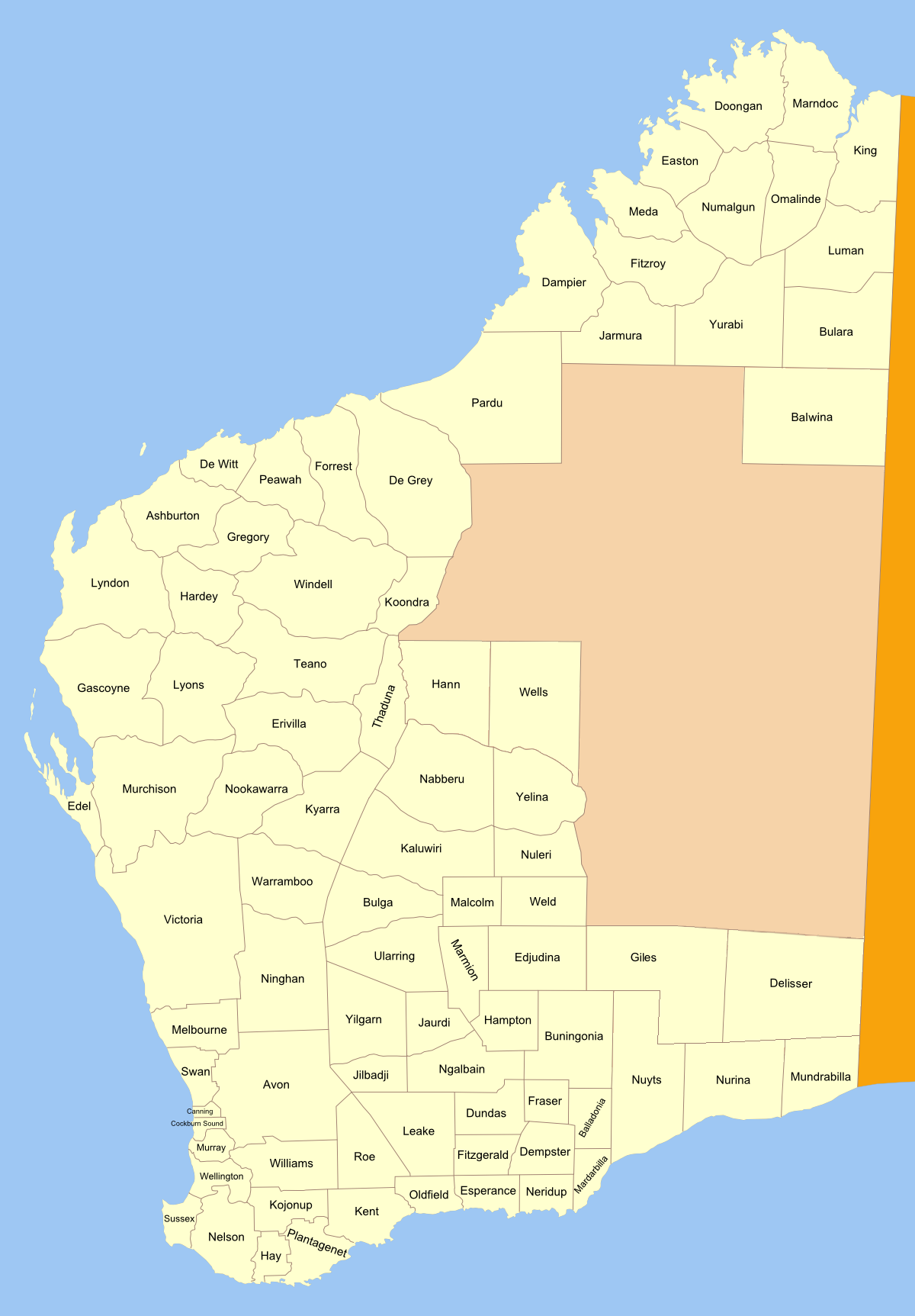
Map of land districts in Western Australia, as shown on old public domain 1909 map at the National Library. made from original svg See also: blank map for making locator maps |
| Date | 17 March 2007 (original upload date) |
| Source | No machine-readable source provided. Own work assumed (based on copyright claims). |
| Author | No machine-readable author provided. Roke~commonswiki assumed (based on copyright claims). |
Licensing
I, the copyright holder of this work, hereby publish it under the following license:

|
Permission is granted to copy, distribute and/or modify this document under the terms of the GNU Free Documentation License, Version 1.2 or any later version published by the Free Software Foundation; with no Invariant Sections, no Front-Cover Texts, and no Back-Cover Texts. A copy of the license is included in the section entitled GNU Free Documentation License. |
| This file is licensed under the Creative Commons Attribution-Share Alike 3.0 Unported license. | ||
| ||
| This licensing tag was added to this file as part of the GFDL licensing update. |
File history
Click on a date/time to view the file as it appeared at that time.
| Date/Time | Thumbnail | Dimensions | User | Comment | |
|---|---|---|---|---|---|
| current | 21:08, 3 December 2010 | | 1,200 × 1,725 (289 KB) | Orderinchaos | two more corrections, one new district |
| 20:47, 29 November 2010 |  | 1,200 × 1,725 (286 KB) | Orderinchaos | added Delisser, Giles and Wells; fixed Nuyts; corrected spelling of Koondra | |
| 00:31, 17 March 2007 |  | 1,200 × 1,725 (292 KB) | Roke~commonswiki | Map of land districts in Western Australia, as shown on old public domain [http://nla.gov.au/nla.map-db87 1909 map] at the National Library Category:Cadastral maps of Western Australia |
File usage
The following pages on the English Wikipedia use this file (pages on other projects are not listed):
- Balladonia Land District
- Balwina Land District
- Buningonia Land District
- Delisser Land District
- Doongan Land District
- Dundas Land District
- Easton Land District
- Edjudina Land District
- Esperance Land District
- Fitzgerald Land District
- Fraser Land District
- Giles Land District
- Hampton Land District
- Hann Land District
- Koondra Land District
- Lands administrative divisions of Australia
- Lands administrative divisions of Western Australia
- Malcolm Land District
- Mardarbilla Land District
- Milyuga Land District
- Mundrabilla Land District
- Murray Land District
- Neridup Land District
- Numalgun Land District
- Nurina Land District
- Nuyts Land District
- Oldfield Land District
- Roe Land District
- Thadoona Land District
- Tugaila Land District
- Wells Land District
- Williams Land District
- Windell Land District
- Yamarna Land District
- Yowalga Land District
Global file usage
The following other wikis use this file:
- Usage on fa.wikipedia.org
- Usage on pt.wikipedia.org