
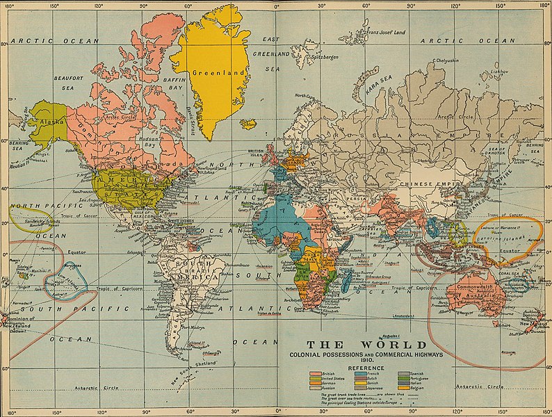
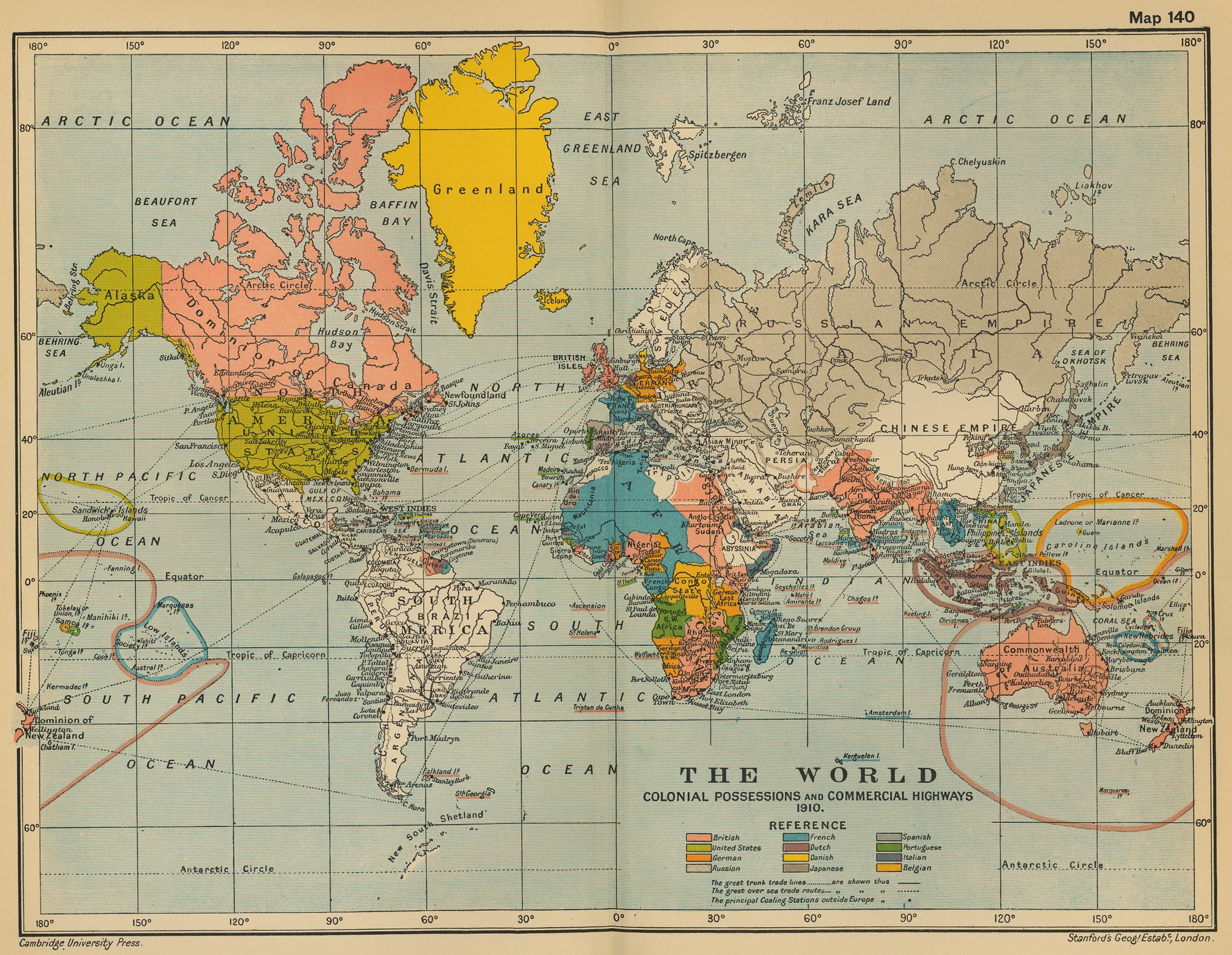
File:World 1910.jpg

Size of this preview: 794 × 600 pixels. Other resolutions: 318 × 240 pixels | 635 × 480 pixels | 1,017 × 768 pixels | 1,280 × 967 pixels | 2,124 × 1,605 pixels.
Original file (2,124 × 1,605 pixels, file size: 1.02 MB, MIME type: image/jpeg)
| This is a file from the Wikimedia Commons. Information from its description page there is shown below. Commons is a freely licensed media file repository. You can help. |
Summary
| Description | The World: Colonial Possesions and Commercial Highways, 1910 |
| Date | |
| Source |
University of Texas Libraries, Perry-Castañeda Library Map Collection: Historical Maps, Cambridge Modern History Atlas, 1912 |
| Author | Edited by Sir Adolphus William Ward, G.W. Prothero, Sir Stanley Mordaunt Leathes, and E.A. Benians. |
Licensing
This work is in the public domain in the United States because it was published (or registered with the U.S. Copyright Office) before January 1, 1929.
Public domain works must be out of copyright in both the United States and in the source country of the work in order to be hosted on the Commons. If the work is not a U.S. work, the file must have an additional copyright tag indicating the copyright status in the source country.
Note: This tag should not be used for sound recordings. |
File history
Click on a date/time to view the file as it appeared at that time.
| Date/Time | Thumbnail | Dimensions | User | Comment | |
|---|---|---|---|---|---|
| current | 16:16, 9 July 2011 | | 2,124 × 1,605 (1.02 MB) | Citypeek | turn and removal border |
| 02:31, 20 July 2006 |  | 2,201 × 1,705 (971 KB) | Roke~commonswiki | from [http://www.lib.utexas.edu/maps/historical/ward_1912/world_1910.jpg] Perry-Castañeda Library Map Collection Cambridge Modern History Atlas, 1912 Category: Old maps |
File usage
The following pages on the English Wikipedia use this file (pages on other projects are not listed):
Global file usage
The following other wikis use this file:
- Usage on ar.wikipedia.org
- Usage on as.wikipedia.org
- Usage on de.wikipedia.org
- Usage on fa.wikipedia.org
- Usage on fr.wikipedia.org
- Usage on he.wikiquote.org
- Usage on hi.wikipedia.org
- Usage on hr.wikipedia.org
- Usage on it.wikipedia.org
- Usage on pl.wikipedia.org
- Usage on pnb.wikipedia.org
- Usage on ta.wikipedia.org
- Usage on th.wikipedia.org
- Usage on uk.wikipedia.org
- Usage on ur.wikipedia.org
- Usage on vi.wikipedia.org
- Usage on zh.wikipedia.org