
Heiloo
Heiloo | |
|---|---|
Municipality and town | |
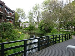
 Heiloo town centre | |
 Flag  Coat of arms | |
.svg) Location in North Holland | |
| Coordinates: 52°36′N 4°43′E / 52.600°N 4.717°E | |
| Country | Netherlands |
| Province | North Holland |
| Government | |
| • Body | Municipal council |
| • Mayor | Mascha ten Bruggencate (D66) |
| Area | |
| • Total | 19.01 km2 (7.34 sq mi) |
| • Land | 18.70 km2 (7.22 sq mi) |
| • Water | 0.31 km2 (0.12 sq mi) |
| Elevation | 3 m (10 ft) |
| Population (January 2021)[4] | |
| • Total | 24,144 |
| • Density | 1,291/km2 (3,340/sq mi) |
| Demonym(s) | Heilooënaar, Heilooër |
| Time zone | UTC+1 (CET) |
| • Summer (DST) | UTC+2 (CEST) |
| Postcode | 1850–1852 |
| Area code | 072 |
| Website | www |

Heiloo (Dutch pronunciation: [ɦɛiˈloː] ⓘ) is a municipality and town in the Netherlands, located in the province of North Holland. The community is part of the cooperation region Kennemerland and is located in the historical region of West Friesland. Heiloo had a population of 24,144 in 2021.
Origins of the name[edit]
Heiloo (from the Dutch heilige loo, "sacred forest") was given its name because Saint Willibrord was said to have performed a miracle there around 690 and created a church on a small hill.
Notable attractions[edit]
It has a town hall dating from 1926 and a church from the 12th century known as the Witte Kerk.[5] In the late Middle Ages, after a miracle, a Marian shrine came into being for Our Lady to Need (Onze Lieve Vrouwe ter Nood). The chapel was partially destroyed in 1573 during the Spanish Siege of Alkmaar, and it was completely demolished in 1637.[6] Before it was razed to the ground, the Alkmaar painter Gerrit Pietersz. de Jongh depicted a family on a pilgrimage at the ruins of the single wall left remaining after the siege.[7] Pilgrimage started to flourish again in 1713 when a spring started to sprout where the chapel had stood.[8][9] The Marian sanctuary, situated outside the village in a so-called procession park, is one of the major pilgrimage destinations in the Netherlands, attracting pilgrims mainly from the diocese of Haarlem-Amsterdam. In the 1950s and 1960s the population grew quickly as many residents of Amsterdam moved to the area. Many residents work and attend school in the neighbouring city of Alkmaar.
Sporting clubs[edit]
- FCC Boscrossers [10] – The local BMX club that has produced 5 World Champions,[11] 4 European Champions and many National Champions, the current (2013) 17-24-year-old Double World Champion for 20" and Cruiser Class is Robin Van Der Kolk,[12] who won both titles in Auckland New Zealand.
- AV Trias – The local athletics club that has produced 2 Olympic athletes, Lisanne de Witte and Laura de Witte.
Local government[edit]
The municipal council of Heiloo consists of 19 seats, which are divided as follows:
- Heiloo 2000 – 3 seats
- VVD – 4 seats
- CDA – 2 seats
- PvdA – 2 seats
- Heiloo Local – 2 seats
- GBH – 3 seats
- D66 - 3 seats
Current mayor: Mascha ten Bruggencate (D66).
Railway connections[edit]
Heiloo is connected to the Dutch railway network by Heiloo railway station. From this station there are many destinations available such as: Alkmaar, Hoorn, Uitgeest, Zaandam, Amsterdam, Utrecht, 's-Hertogenbosch, Eindhoven, The Hague, Weert, Roermond, Maastricht and Heerlen. For the Zaanse Schans, you should travel to Uitgeest and change onto a train to Koog-Zaandijk
There used to be a second stop on the railway line between Heiloo and Limmen. Until October 2013 it was used once a month to bring pilgrims to the nearby chapel. The name of both station and chapel is 'Onze lieve vrouwe ter nood' or 'Our Lady to Need'; the station was known as Runxputte until 1914. One of the platforms was demolished in 1997 for safety reasons.[13]
Notable residents[edit]

- Jos van Kemenade (1937-2020) politician and sociologist
- Jos Brink (1942–2007), television and theater personality [14]
- Guus Janssen (born 1951), composer and pianist
- Jacques Zoon (born 1961), flautist
- Maarten van Roozendaal (1962–2013) a Dutch singer, comedian and songwriter [15]
- Lars Oostveen (born 1976) stage name Lawrence Ray, is a Dutch presenter, producer and actor [16]

Sport[edit]
- Ron Zwerver (born 1967) a retired volleyball player, competed in three consecutive Summer Olympics
- Michael Duursma (born 1978), baseball player
- Laura de Witte (born 1995), sprinter
- Joris Kramer (born 1996) a Dutch footballer with over 100 club caps
- Thomas Ouwejan (born 1996) Dutch footballer currently playing for Schalke 04
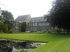
Gallery[edit]
-
 Sint Paulus, Heiloo
 -
 Brug tussen het hoekstuk en de vlei - Heiloo
 -
 S.M. Glorieux, Heiloo
 -
 Voorgevel en rechter zijgevel - Heiloo


References[edit]
- ^ "Samenstelling college" [Members of the board] (in Dutch). Gemeente Heiloo. Retrieved 6 March 2014.
- ^ "Kerncijfers wijken en buurten 2020" [Key figures for neighbourhoods 2020]. StatLine (in Dutch). CBS. 24 July 2020. Retrieved 19 September 2020.
- ^ "Postcodetool for 1851JA". Actueel Hoogtebestand Nederland (in Dutch). Het Waterschapshuis. Archived from the original on 21 September 2013. Retrieved 6 March 2014.
- ^ "Bevolkingsontwikkeling; regio per maand" [Population growth; regions per month]. CBS Statline (in Dutch). CBS. 1 January 2021. Retrieved 2 January 2022.
- ^ "Geschiedenis". Archived from the original on 7 January 2012. Retrieved 4 July 2012.
- ^ Thiers, Ottie (2005). 't Putje van Heiloo : bedevaarten naar O.L. Vrouw ter Nood. Hilversum: Verloren. pp. 20–23. ISBN 90-6550-858-9. OCLC 66467176.
- ^ "Adlib Internet Server 6 | Details". adlib.catharijneconvent.nl. Retrieved 19 January 2022.
- ^ Thiers, Ottie (2005). 't Putje van Heiloo : bedevaarten naar O.L. Vrouw ter Nood. Hilversum: Verloren. p. 31. ISBN 90-6550-858-9. OCLC 66467176.
- ^ "Adlib Internet Server 6 | Details". adlib.catharijneconvent.nl. Retrieved 19 January 2022.
- ^ www.boscrossers.nl
- ^ www.boscrossers.nl (2) Archived 19 March 2014 at the Wayback Machine
- ^ "Robin van der Kolk #186 :: Home". Archived from the original on 18 March 2014. Retrieved 18 March 2014.
- ^ "tijdelijke halte Onze Lieve Vrouwe ter Nood - foto's en omschrijving op stationsweb". Archived from the original on 17 May 2011. Retrieved 11 April 2008.
- ^ IMDb Database retrieved 25 January 2020
- ^ IMDb Database retrieved 25 January 2020
- ^ IMDb Database retrieved 25 January 2020
External links[edit]
 Media related to Heiloo at Wikimedia Commons
- Official website

| International | |
|---|---|
| National | |
| Geographic | |