Hilltop, Arizona
Hilltop, Arizona | |
|---|---|
| Coordinates: 31°59′40″N 109°16′39″W / 31.99444°N 109.27750°W | |
| Country | United States |
| State | Arizona |
| County | Cochise |
| Elevation | 5,702 ft (1,738 m) |
| Time zone | UTC-7 (Mountain (MST)) |
| • Summer (DST) | UTC-7 (MST) |
| Area code | 520 |
| FIPS code | 04-33070 |
| GNIS feature ID | 5831 |
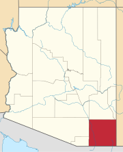
Hilltop is a ghost town situated in Cochise County, Arizona, United States.[2] Hilltop was established in the 1880s and was a successful mining town in the 1900s. Their economy declined steadily until the 1940s when it became a ghost town.[3] The Hilltop Post office was erected on June 26, 1920, serving the local community.[4] Hilltop has an estimated elevation of 5,702 feet (1,738 m) above sea level in the Chiricahua Mountains near the Arizona–New Mexico state line.[1]
References[edit]
- ^ a b "Feature Detail Report for: Hilltop". Geographic Names Information System. United States Geological Survey, United States Department of the Interior.
- ^ "Hilltop (in Cochise County, AZ) Populated Place Profile". AZ Hometown Locator. Retrieved November 25, 2016.
- ^ Varney, Philip (1980). "Eleven: The Chiricauhua Ghosts". Arizona's Best Ghost Towns. Flagstaff: Northland Press. pp. 118–121. ISBN 0873582179. LCCN 79-91724.
- ^ "Ghost Town Trails – Hilltop, Cochise County, Arizona". www.arizonaghosttowntrails.com. Retrieved January 20, 2022.
External links[edit]
 Ghost towns travel guide from Wikivoyage
- Hilltop – Ghost Town of the Month at azghosttowns.com


