
Joshua Tree, California
Joshua Tree, California | |
|---|---|
| Joshua Tree | |
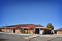
 Central Joshua Tree in 2013 | |
 Location in San Bernardino County and the state of California | |
 Joshua Tree, California Location in the United States | |
| Coordinates: 34°08′05″N 116°18′42″W / 34.13472°N 116.31167°W | |
| Country | |
| State | |
| County | |
| Area | |
| • Total | 37.044 sq mi (95.943 km2) |
| • Land | 37.044 sq mi (95.943 km2) |
| • Water | 0 sq mi (0 km2) 0% |
| Elevation | 2,923 ft (891 m) |
| Population (2010) | |
| • Total | 7,414 |
| • Density | 200/sq mi (77/km2) |
| Time zone | UTC−08:00 (PST) |
| • Summer (DST) | UTC−07:00 (PDT) |
| ZIP Code | 92252 |
| Area codes | 442/760 |
| FIPS code | 06-37554 |
| GNIS feature ID | 2408454[2] |
Joshua Tree is a census-designated place (CDP) in San Bernardino County, California, United States. The population was 7,414 at the 2010 census. At approximately 2,700 feet (820 meters) above sea level, Joshua Tree and its surrounding communities are located in the High Desert of California. The center of the business district in Joshua Tree is on California State Route 62.
Geography[edit]
Joshua Tree is located in the Mojave Desert.[3]
According to the United States Census Bureau, the CDP has a total land area of 95.9 km2 (37.0 mi2).
Joshua Tree is home to Joshua Tree National Park. Joshua Tree shares its eastern border with Twentynine Palms, its western border with Yucca Valley, and its northwestern border with Landers; it is bordered on the south by the Coachella Valley. The Bartlett Mountains are northwest of the community.
Demographics[edit]
| Census | Pop. | Note | %± |
|---|---|---|---|
| U.S. Decennial Census[4] | |||

2010[edit]
At the 2010 census Joshua Tree had a population of 7,414. The population density was 200.1 inhabitants per square mile (77.3/km2). The racial makeup of Joshua Tree was 6,176 (83.3%) White (73.9% Non-Hispanic White),[5] 234 (3.2%) African American, 84 (1.1%) Native American, 104 (1.4%) Asian, 18 (0.2%) Pacific Islander, 368 (5.0%) from other races, and 430 (5.8%) from two or more races. Hispanic or Latino of any race were 1,308 persons (17.6%).[6]
The census reported that 7,263 people (98.0% of the population) lived in households, 30 (0.4%) lived in non-institutionalized group quarters, and 121 (1.6%) were institutionalized.
There were 3,088 households, 862 (27.9%) had children under the age of 18 living in them, 1,209 (39.2%) were opposite-sex married couples living together, 431 (14.0%) had a female householder with no husband present, and 162 (5.2%) had a male householder with no wife present. There were 237 (7.7%) unmarried opposite-sex partnerships, and 30 (1.0%) same-sex married couples or partnerships. 1,018 households (33.0%) were one person and 358 (11.6%) had someone living alone who was 65 or older. The average household size was 2.35. There were 1,802 families (58.4% of households); the average family size was 2.97.
The age distribution was 1,626 people (21.9%) under the age of 18, 813 people (11.0%) aged 18 to 24, 1,756 people (23.7%) aged 25 to 44, 2,056 people (27.7%) aged 45 to 64, and 1,163 people (15.7%) who were 65 or older. The median age was 38.8 years. For every 100 females, there were 96.9 males. For every 100 females age 18 and over, there were 94.3 males.
There were 3,808 housing units at an average density of 102.8 per square mile, of the occupied units 1,872 (60.6%) were owner-occupied and 1,216 (39.4%) were rented. The homeowner vacancy rate was 3.9%; the rental vacancy rate was 9.8%. 4,178 people (56.4% of the population) lived in owner-occupied housing units and 3,085 people (41.6%) lived in rental housing units.
According to the 2010 United States Census, Joshua Tree had a median household income of $39,492, with 21.8% of the population living below the federal poverty line.[5]

2000[edit]
At the 2000 census there were 4,207 people, 1,765 households, and 1,057 families in the CDP. The population density was 265.4/km2 (687.5/mi2). There were 2,112 housing units at an average density of 133.2/km2 (345.1/mi2). The racial makeup of the CDP was 86.38% White, 1.76% African American, 1.57% Native American, 1.12% Asian, 0.62% Pacific Islander, 4.61% from other races, and 3.95% from two or more races. 12.36% of the population were Hispanic or Latino of any race.[9] Of the 1,765 households 30.0% had children under the age of 18 living with them, 38.8% were married couples living together, 16.0% had a female householder with no husband present, and 40.1% were non-families. 33.3% of households were one person and 15.4% were one person aged 65 or older. The average household size was 2.35 and the average family size was 2.98.
The age distribution was 27.5% under the age of 18, 7.7% from 18 to 24, 26.4% from 25 to 44, 20.1% from 45 to 64, and 18.3% 65 or older. The median age was 37 years. For every 100 females, there were 93.9 males. For every 100 females age 18 and over, there were 88.8 males.
The median household income was $26,535 and the median family income was $33,333. Males had a median income of $27,465 versus $29,375 for females. The per capita income for the CDP was $13,856. 21.2% of the population and 18.0% of families were below the poverty line. 31.5% of those under the age of 18 and 5.4% of those 65 and older were living below the poverty line.
Government[edit]
In the California State Legislature, Joshua Tree is in the 16th Senate District, represented by Democrat Melissa Hurtado, and in the 42nd Assembly District, represented by Democrat Jacqui Irwin.[10]
In the United States House of Representatives, Joshua Tree is located in California's 23rd congressional district,[11] which has a Cook PVI of R+10[12] and is represented by Republican Jay Obernolte.[13]
Joshua Tree is represented by San Bernardino County 3rd District Supervisor James Ramos – 2012.[14]
Attractions[edit]
The Joshua Tree Visitor Center for Joshua Tree National Park is located at the junction of Highway 62 and Park Boulevard in downtown Joshua Tree and the park's west entrance is located 5 mi (8.0 km) south.[15] The community of Joshua Tree is unincorporated and is represented by the Joshua Tree Municipal Advisory Counsel (MAC) as the official liaison between the community and the San Bernardino County government.
Noah Purifoy Desert Art Museum of Assemblage Art is 10 acres (4.0 ha) of sculptures, assemblages, and installations mostly made from found material by Noah Purifoy.[16] The World Famous Crochet Museum is also located in the area.
Notable people[edit]
Natives[edit]
People born in Joshua Tree:
- Less Bells, musician
- Brent Bolthouse, entrepreneur
- Josh Homme (born 1973), musician
- Phillip Carl Jablonski (1946-2019), serial killer
Inhabitants[edit]
People who live/lived in Joshua Tree:
- Alma Allen (born 1970), sculptor
- Tara Beier, singer
- Marjorie Cameron (1922-1995), actress
- Joey Castillo (born 1966), musician
- Dave Catching (born 1961), musician
- Edie Fake (born 1980), artist
- Lou Harrison (1917-2003), composer
- Conrad Lambert, musician known as "Merz"
- Myshkin, singer
- Johnette Napolitano, musician and artist
- Simon Rex (born 1974), actor
- Wayne Static (1965-2014), musician
- John Whooley, musician
- Charles M. Wysocki (1928-2002), painter
Deaths[edit]
People who died in Joshua Tree:
- Charles H. Gray (1921-2008), actor
- Ish Kabibble (1908-1994), comedian
- Art Kunkin (1928-2019), journalist
- John F. Logan (1946-2013), musician known as "Juke"
- Gram Parsons (1946-1973), musician
- Noah Purifoy (1917-2004), artist
- Tera Wray (1982-2016), pornographic actress
Gallery[edit]
-
 Joshua Tree Welcome sign off Highway 62
 -
 Southward view of Joshua Tree Town Center in front of the mountains of Joshua Tree National Park
 -
 Southwesterly view of the San Bernardino Mountains from Twenty-Nine Palms Highway (CA Route 62)
 -
 Downtown Joshua Tree looking southwest
 -
 Joshua Tree National Park Visitor Center
 -
 Southwesterly view of the Joshua Tree Retreat Center
 -
-
 Backcountry road off of Olympic Road in Joshua Tree


Climate[edit]
| Climate data for Joshua Tree, California. | |||||||||||||
|---|---|---|---|---|---|---|---|---|---|---|---|---|---|
| Month | Jan | Feb | Mar | Apr | May | Jun | Jul | Aug | Sep | Oct | Nov | Dec | Year |
| Record high °F (°C) | 79 (26) |
86 (30) |
90 (32) |
99 (37) |
102 (39) |
113 (45) |
115 (46) |
110 (43) |
105 (41) |
102 (39) |
86 (30) |
78 (26) |
115 (46) |
| Mean daily maximum °F (°C) | 62.2 (16.8) |
61.5 (16.4) |
69.8 (21.0) |
76.4 (24.7) |
86.0 (30.0) |
93.9 (34.4) |
101.1 (38.4) |
100.4 (38.0) |
95.8 (35.4) |
81.2 (27.3) |
69.1 (20.6) |
58.2 (14.6) |
79.6 (26.4) |
| Mean daily minimum °F (°C) | 37.9 (3.3) |
37.5 (3.1) |
41.0 (5.0) |
46.0 (7.8) |
53.4 (11.9) |
60.0 (15.6) |
70.8 (21.6) |
70.1 (21.2) |
65.8 (18.8) |
53.4 (11.9) |
43.0 (6.1) |
35.8 (2.1) |
51.2 (10.7) |
| Record low °F (°C) | 18 (−8) |
18 (−8) |
29 (−2) |
32 (0) |
36 (2) |
40 (4) |
55 (13) |
52 (11) |
46 (8) |
37 (3) |
26 (−3) |
17 (−8) |
17 (−8) |
| Average precipitation inches (mm) | 0.62 (16) |
0.48 (12) |
0.39 (9.9) |
0.13 (3.3) |
0.17 (4.3) |
0.01 (0.25) |
0.33 (8.4) |
0.50 (13) |
0.33 (8.4) |
0.33 (8.4) |
0.61 (15) |
0.79 (20) |
4.69 (119) |
| Average snowfall inches (cm) | 0.5 (1.3) |
0.0 (0.0) |
0.0 (0.0) |
0.0 (0.0) |
0.0 (0.0) |
0.0 (0.0) |
0.0 (0.0) |
0.0 (0.0) |
0.0 (0.0) |
0.0 (0.0) |
0.0 (0.0) |
1.6 (4.1) |
2.1 (5.3) |
| Source: The Western Regional Climate Center[17] | |||||||||||||
See also[edit]
- Yucca Valley, California
- Wonder Valley, California
- Pioneertown, California
- Twentynine Palms, California
References[edit]
- ^ "2010 Census U.S. Gazetteer Files – Places – California". United States Census Bureau.
- ^ a b U.S. Geological Survey Geographic Names Information System: Joshua Tree, California
- ^ "US Gazetteer files: 2010, 2000, and 1990". United States Census Bureau. February 12, 2011. Retrieved April 23, 2011.
- ^ "Census of Population and Housing". Census.gov. Retrieved June 4, 2016.
- ^ a b "Joshua Tree CDP, California". United States Census Bureau: State and County QuickFacts. May 28, 2015. Archived from the original on July 2, 2012. Retrieved July 20, 2015.
- ^ "2010 Census Interactive Population Search: CA - Joshua Tree CDP". U.S. Census Bureau. Archived from the original on July 15, 2014. Retrieved July 12, 2014.
- ^ "Trimming of western Joshua trees and removal of dead western Joshua trees". West Sacramento, California: California Department of Fish and Wildlife: Habitat Conservation Planning Branch. 2020.
- ^ Binkley, Jude (December 21, 2021). "Joshua trees are first plant to get California protections because of climate change". Cronkite News: Arizona PBS. Phoenix, Arizona.
- ^ "U.S. Census website". United States Census Bureau. Retrieved January 31, 2008.
- ^ "Statewide Database". Regents of the University of California. Archived from the original on February 1, 2015. Retrieved April 6, 2015.
- ^ "Current Status of Commission's Final Certified District Maps". California Citizens Redistricting Commission. Archived from the original on September 16, 2014. Retrieved September 23, 2014.
- ^ "Partisan Voting Index, Districts of the 113th Congress" (PDF). The Cook Political Report. Archived from the original (PDF) on June 5, 2013. Retrieved September 23, 2014.
- ^ "California's 8th Congressional District - Representatives & District Map". Civic Impulse, LLC.
- ^ "County of San Bernardino > Board of Supervisors > Third District". County of San Bernardino. Retrieved September 23, 2014.
- ^ "Visitor Centers - Joshua Tree National Park (U.S. National Park Service)". www.nps.gov. Retrieved November 18, 2020.
- ^ Williams, Maxwell (February 22, 2021). "What to Plan for on a Trip to Joshua Tree". Condé Nast Traveler. Retrieved February 23, 2021.
- ^ "Seasonal Temperature and Precipitation Information". Western Regional Climate Center. Retrieved November 9, 2014.
External links[edit]


| International | |
|---|---|
| National | |
| Geographic | |