
McMechen, West Virginia
McMechen, West Virginia | |
|---|---|
 Location of McMechen in Marshall County, West Virginia. | |
| Coordinates: 39°59′14″N 80°43′53″W / 39.98722°N 80.73139°W | |
| Country | |
| State | |
| County | |
| Government | |
| • Mayor | David Goddard |
| Area | |
| • Total | 0.84 sq mi (2.16 km2) |
| • Land | 0.57 sq mi (1.48 km2) |
| • Water | 0.27 sq mi (0.69 km2) |
| Elevation | 679 ft (207 m) |
| Population | |
| • Total | 1,714 |
| • Estimate (2021)[2] | 1,680 |
| • Density | 2,971.98/sq mi (1,147.92/km2) |
| Time zone | UTC-5 (Eastern (EST)) |
| • Summer (DST) | UTC-4 (EDT) |
| ZIP code | 26040 |
| Area code | 304 |
| FIPS code | 54-50260[3] |
| GNIS feature ID | 1543032[4] |
| Website | cityofmcmechen |
McMechen is a city in Marshall County, West Virginia, United States, situated along the Ohio River. It is part of the Wheeling, West Virginia Metropolitan Statistical Area. The population was 1,714 at the 2020 census.[2]
History[edit]
McMechen is named after William McMechen and his family, pioneer settlers.[5]
The McMechen Lockmaster Houses on the Ohio River were listed on the National Register of Historic Places in 1992.[6]
McMechen was incorporated in 1905.[7]
Geography[edit]
McMechen is located at 39°59′14″N 80°43′53″W / 39.98722°N 80.73139°W (39.987201, -80.731348).[8]
According to the United States Census Bureau, the city has a total area of 0.84 square miles (2.18 km2), of which 0.57 square miles (1.48 km2) is land and 0.27 square miles (0.70 km2) is water.[9]
Climate[edit]
The climate in this area is characterized by relatively high temperatures and evenly distributed precipitation throughout the year. According to the Köppen Climate Classification system, McMechen has a Humid subtropical climate, abbreviated "Cfa" on climate maps.[10]
Demographics[edit]
| Census | Pop. | Note | %± |
|---|---|---|---|
| 1890 | 427 | — | |
| 1900 | 1,465 | 243.1% | |
| 1910 | 2,921 | 99.4% | |
| 1920 | 3,356 | 14.9% | |
| 1930 | 3,710 | 10.5% | |
| 1940 | 3,726 | 0.4% | |
| 1950 | 3,518 | −5.6% | |
| 1960 | 2,999 | −14.8% | |
| 1970 | 2,808 | −6.4% | |
| 1980 | 2,402 | −14.5% | |
| 1990 | 2,130 | −11.3% | |
| 2000 | 1,937 | −9.1% | |
| 2010 | 1,926 | −0.6% | |
| 2020 | 1,714 | −11.0% | |
| 2021 (est.) | 1,680 | [2] | −2.0% |
| U.S. Decennial Census[11] | |||
2010 census[edit]
As of the census[12] of 2010, there were 1,926 people, 856 households, and 516 families living in the city. The population density was 3,378.9 inhabitants per square mile (1,304.6/km2). There were 971 housing units at an average density of 1,703.5 per square mile (657.7/km2). The racial makeup of the city was 97.7% White, 1.0% African American, 0.2% Native American, 0.2% Asian, 0.1% from other races, and 0.8% from two or more races. Hispanic or Latino of any race were 1.0% of the population.
There were 856 households, of which 26.4% had children under the age of 18 living with them, 40.4% were married couples living together, 14.7% had a female householder with no husband present, 5.1% had a male householder with no wife present, and 39.7% were non-families. 35.0% of all households were made up of individuals, and 16.5% had someone living alone who was 65 years of age or older. The average household size was 2.24 and the average family size was 2.88.
The median age in the city was 41.6 years. 20.9% of residents were under the age of 18; 8.3% were between the ages of 18 and 24; 24.7% were from 25 to 44; 28.4% were from 45 to 64; and 17.7% were 65 years of age or older. The gender makeup of the city was 48.6% male and 51.4% female.
2000 census[edit]
As of the census[3] of 2000, there were 1,937 people, 865 households, and 559 families living in the city. The population density was 3,352.4 people per square mile (1,289.4/km2). There were 953 housing units at an average density of 1,649.4 per square mile (634.4/km2). The racial makeup of the city was 98.55% White, 0.36% African American, 0.10% Native American, 0.10% Asian, 0.15% from other races, and 0.72% from two or more races. Hispanic or Latino of any race were 0.41% of the population.
There were 865 households, out of which 24.6% had children under the age of 18 living with them, 46.5% were married couples living together, 14.6% had a female householder with no husband present, and 35.3% were non-families. 33.1% of all households were made up of individuals, and 19.0% had someone living alone who was 65 years of age or older. The average household size was 2.23 and the average family size was 2.81.
In the city, the population was spread out, with 20.8% under the age of 18, 7.0% from 18 to 24, 23.5% from 25 to 44, 26.0% from 45 to 64, and 22.8% who were 65 years of age or older. The median age was 44 years. For every 100 females, there were 89.2 males. For every 100 females age 18 and over, there were 81.9 males.
The median income for a household in the city was $27,179, and the median income for a family was $33,080. Males had a median income of $27,357 versus $16,862 for females. The per capita income for the city was $14,935. About 15.6% of families and 20.6% of the population were below the poverty line, including 43.1% of those under age 18 and 9.6% of those age 65 or over.
Education[edit]
Marshall County Schools operates public schools.
- Center McMechen Elementary School.
Notable people[edit]
- Charles Manson, spent part of his childhood in McMechen.
- George D. Wallace, actor; spent teen years in McMechen.[13]
- Alvena Sečkar, painter and author born in McMechen
Further reading[edit]
- Culbertson, Charles (2014). Hellbent: The Life of Confederate Cavalryman William Meade McMechen. Clarion Publishing. ISBN 978-0988714595.
See also[edit]
References[edit]
- ^ "2019 U.S. Gazetteer Files". United States Census Bureau. Retrieved August 7, 2020.
- ^ a b c d Bureau, US Census. "City and Town Population Totals: 2020-2021". Census.gov. US Census Bureau. Retrieved July 2, 2022.
- ^ a b "U.S. Census website". United States Census Bureau. Retrieved January 31, 2008.
- ^ "US Board on Geographic Names". United States Geological Survey. October 25, 2007. Retrieved January 31, 2008.
- ^ Kenny, Hamill (1945). West Virginia Place Names: Their Origin and Meaning, Including the Nomenclature of the Streams and Mountains. Piedmont, WV: The Place Name Press. p. 394.
- ^ "National Register Information System". National Register of Historic Places. National Park Service. March 13, 2009.
- ^ "About Us".
- ^ "US Gazetteer files: 2010, 2000, and 1990". United States Census Bureau. February 12, 2011. Retrieved April 23, 2011.
- ^ "US Gazetteer files 2010". United States Census Bureau. Archived from the original on January 25, 2012. Retrieved January 24, 2013.
- ^ Climate Summary for McMechen, West Virginia
- ^ "Census of Population and Housing". Census.gov. Retrieved June 4, 2015.
- ^ "U.S. Census website". United States Census Bureau. Retrieved January 24, 2013.
- ^ McLellan, Dennis (July 27, 2005). "George D. Wallace, 88; Actor With Baritone Voice Had Film, TV and Broadway Roles". Los Angeles Times.
External links[edit]
Municipalities and communities of Marshall County, West Virginia, United States | ||
|---|---|---|
| Cities | 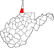 | |
| Unincorporated communities |
| |
| Ghost towns | ||
| Footnotes | ‡This populated place also has portions in an adjacent county or counties | |
The northern panhandle of West Virginia | ||
|---|---|---|
| Counties |  | |
| Communities | ||
| Casinos | ||
| College and Universities | ||
| Entertainment and Shopping | ||
| Historic Sites | ||
| Other Attractions | ||
| Parks | ||
| International | |
|---|---|
| National | |