
Pine Ridge, South Dakota
Pine Ridge
Wazíbló (Lakota) | |
|---|---|
 Holy Rosary Catholic Church at Red Cloud Indian School | |
 Pine Ridge Location of Pine Ridge within South Dakota.  Pine Ridge Pine Ridge (the United States) | |
| Coordinates: 43°01′37″N 102°33′08″W / 43.02694°N 102.55222°W | |
| Country | United States |
| State | South Dakota |
| County | Oglala Lakota |
| Area | |
| • Total | 2.83 sq mi (7.32 km2) |
| • Land | 2.83 sq mi (7.32 km2) |
| • Water | 0.00 sq mi (0.00 km2) |
| Elevation | 3,238 ft (987 m) |
| Population | |
| • Total | 3,138 |
| • Density | 1,110.01/sq mi (428.51/km2) |
| Time zone | UTC−7 (Mountain (MST)) |
| • Summer (DST) | UTC−6 (MDT) |
| ZIP code | 57770 |
| Area code | 605 |
| FIPS code | 46-49660 |
| GNIS feature ID | 2393187[2] |
Pine Ridge (Lakota: wazíbló[4]) is a census-designated place (CDP) and the most populous community in Oglala Lakota County, South Dakota, United States. The population was 3,138 at the 2020 census.[5] It is the tribal headquarters of the Oglala Sioux Tribe on the Pine Ridge Indian Reservation.[6]
History[edit]
The community was named for the pine trees on the ridge surrounding the town site.[7] An early variant name was Pine Ridge Agency.[2][8]
The Pine Ridge reservation was the location of a violent shootout between FBI and activist Native Americans in 1975. FBI agents Jack Coler and Ronald Williams were killed in the initial firefight, while activist native Joe Stuntz was later shot by a police sniper. Native/Activist Leonard Peltier was later convicted of the murder of the agents and sentenced to life in prison, but there has been debate around his innocence.[9]
Geography[edit]
According to the United States Census Bureau, the CDP has a total area of 3.2 square miles (8.2 km2), of which 3.1 square miles (7.9 km2) is land and 0.1 square mile (0.2 km2) (2.54%) is water.
Demographics[edit]
| Census | Pop. | Note | %± |
|---|---|---|---|
| 1960 | 1,256 | — | |
| 1970 | 2,768 | 120.4% | |
| 1980 | 3,059 | 10.5% | |
| 1990 | 2,596 | −15.1% | |
| 2000 | 3,171 | 22.1% | |
| 2010 | 3,308 | 4.3% | |
| 2020 | 3,138 | −5.1% | |
| U.S. Decennial Census[3] | |||
2020 census[edit]
The 2020 United States census counted 3,138 people, 755 households, and 564 families in Pine Ridge.[10][11] The population density was 1,106.1 per square mile (427.1/km2). There were 821 housing units at an average density of 289.4 per square mile (111.7/km2).[11][12] The racial makeup was 2.33% (73) white or European American (2.2% non-Hispanic white), 0.06% (2) black or African-American, 95.63% (3,001) Native American or Alaska Native, 0.13% (4) Asian, 0.0% (0) Pacific Islander or Native Hawaiian, 0.45% (14) from other races, and 1.4% (44) from two or more races.[13] Hispanic or Latino of any race was 2.64% (83) of the population.[14]
Of the 755 households, 53.9% had children under the age of 18; 19.3% were married couples living together; 46.1% had a female householder with no spouse or partner present. 21.2% of households consisted of individuals and 6.0% had someone living alone who was 65 years of age or older.[11] The average household size was 5.3 and the average family size was 5.7.[15] The percent of those with a bachelor’s degree or higher was estimated to be 3.9% of the population.[16]
36.6% of the population was under the age of 18, 10.7% from 18 to 24, 23.9% from 25 to 44, 20.3% from 45 to 64, and 8.5% who were 65 years of age or older. The median age was 27.1 years. For every 100 females, there were 95.6 males.[11] For every 100 females ages 18 and older, there were 104.4 males.[11]
The 2016-2020 5-year American Community Survey estimates show that the median household income was $37,198 (with a margin of error of +/- $14,292) and the median family income was $43,426 (+/- $17,824).[17] Males had a median income of $28,138 (+/- $11,572) versus $17,463 (+/- $6,072) for females. The median income for those above 16 years old was $20,509 (+/- $7,510).[18] Approximately, 33.8% of families and 41.1% of the population were below the poverty line, including 38.7% of those under the age of 18 and 18.2% of those ages 65 or over.[19][20]
2000 census[edit]
As of the census[21] of 2000, there were 3,171 people, 688 households, and 593 families living in the CDP. The population density was 1,035.4 inhabitants per square mile (399.8/km2). There were 742 housing units at an average density of 242.3 per square mile (93.6/km2). The racial makeup of the CDP was 94.20% Native American, 3.72% White, 0.09% African American, 0.03% Asian, 0.09% Pacific Islander, 0.50% from other races, and 1.36% from two or more races. Hispanic or Latino of any race were 1.80% of the population.
There were 688 households, out of which 53.9% had children under the age of 18 living with them, 32.1% were married couples living together, 40.7% had a female householder with no husband present, and 13.8% were non-families. 10.9% of all households were made up of individuals, and 2.2% had someone living alone who was 65 years of age or older. The average household size was 4.40 and the average family size was 4.63.
In the CDP, the population was spread out, with 46.9% under the age of 18, 11.0% from 18 to 24, 26.1% from 25 to 44, 12.4% from 45 to 64, and 3.6% who were 65 years of age or older. The median age was 20 years. For every 100 females, there were 100.2 males. For every 100 females aged 18 and over, there were 89.8 males.
The median income for a household in the CDP was $21,089, and the median income for a family was $20,170. Males had a median income of $26,875 versus $25,516 for females. The per capita income for the CDP was $6,067. About 49.2% of families and 61.0% of the population were below the poverty line, including 74.6% of those under age 18 and 18.8% of those age 65 or over.
Education[edit]
The area school district is Oglala Lakota County School District.[22] Lakota Tech High School is the public high school.
There is a Bureau of Indian Education (BIE) school, Pine Ridge School.
Red Cloud Indian School is a private K-12 Catholic school in the area.
Notable people[edit]
- SuAnne Big Crow, high school basketball star, leader of state championship team
- Beth Lydy, actress and singer on Broadway in 1910s
- Russell Means (1939-2012), American Indian Movement leader, activist and actor
- Billy Mills, born here, won the 10,000 meter gold medal at the 1964 Olympics
- Peri Pourier, member of the South Dakota House of Representatives
- Bobby Robertson, NFL Player
See also[edit]
References[edit]
- ^ "ArcGIS REST Services Directory". United States Census Bureau. Retrieved October 15, 2022.
- ^ a b c U.S. Geological Survey Geographic Names Information System: Pine Ridge, South Dakota
- ^ a b "Census Population API". United States Census Bureau. Retrieved October 15, 2022.
- ^ Ullrich, Jan F. (2014). New Lakota Dictionary (2nd ed.). Bloomington, IN: Lakota Language Consortium. ISBN 978-0-9761082-9-0. Archived from the original on October 18, 2016. Retrieved February 12, 2014.
- ^ "U.S. Census Bureau: Pine Ridge CDP, South Dakota". www.census.gov. United States Census Bureau. Retrieved May 28, 2022.
- ^ South Dakota Office of Tribal Government Relations Archived 2009-02-08 at the Wayback Machine Retrieved on 2009-02-08.
- ^ Federal Writers' Project (1940). South Dakota place-names, v.1-3. American guide series. University of South Dakota. p. 56.
- ^ Peterson, E. Frank (1904). Historical Atlas of South Dakota, Containing State and County Maps, Geologic Maps, Statistical Charts, Geography, Geology, History, Descriptive Notes, Tables, Etc. Vermillion, South Dakota. p. 3.
{{cite book}}: CS1 maint: location missing publisher (link) - ^ "RESMURS Case (Reservation Murders)".
- ^ "US Census Bureau, Table P16: HOUSEHOLD TYPE". data.census.gov. Retrieved January 10, 2024.
- ^ a b c d e "US Census Bureau, Table DP1: PROFILE OF GENERAL POPULATION AND HOUSING CHARACTERISTICS". data.census.gov. Retrieved January 10, 2024.
- ^ "Gazetteer Files". Census.gov. Retrieved December 30, 2023.
- ^ "US Census Bureau, Table P1: RACE". data.census.gov. Retrieved January 10, 2024.
- ^ "US Census Bureau, Table P2: HISPANIC OR LATINO, AND NOT HISPANIC OR LATINO BY RACE". data.census.gov. Retrieved January 10, 2024.
- ^ "US Census Bureau, Table S1101: HOUSEHOLDS AND FAMILIES". data.census.gov. Retrieved January 10, 2024.
- ^ "US Census Bureau, Table S1501: EDUCATIONAL ATTAINMENT". data.census.gov. Retrieved January 10, 2024.
- ^ "US Census Bureau, Table S1903: MEDIAN INCOME IN THE PAST 12 MONTHS (IN 2020 INFLATION-ADJUSTED DOLLARS)". data.census.gov. Retrieved January 10, 2024.
- ^ "US Census Bureau, Table S2001: EARNINGS IN THE PAST 12 MONTHS (IN 2020 INFLATION-ADJUSTED DOLLARS)". data.census.gov. Retrieved January 10, 2024.
- ^ "US Census Bureau, Table S1701: POVERTY STATUS IN THE PAST 12 MONTHS". data.census.gov. Retrieved January 10, 2024.
- ^ "US Census Bureau, Table S1702: POVERTY STATUS IN THE PAST 12 MONTHS OF FAMILIES". data.census.gov. Retrieved January 10, 2024.
- ^ "U.S. Census website". United States Census Bureau. Retrieved January 31, 2008.
- ^ "2020 CENSUS - SCHOOL DISTRICT REFERENCE MAP: Oglala Lakota County, SD" (PDF). U.S. Census Bureau. Retrieved August 1, 2021.
External links[edit]
- Pine Ridge at Curlie
Municipalities and communities of Oglala Lakota County, South Dakota, United States | ||
|---|---|---|
| Town | 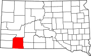 | |
| CDPs | ||
| Unincorporated communities | ||
| Indian reservation | ||
| Footnotes | ‡This populated place also has portions in an adjacent county or counties | |
| International | |
|---|---|
| National | |
| Other | |