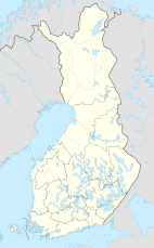
Pulju Wilderness Area
| Pulju Wilderness Area | |
|---|---|
IUCN category VI (protected area with sustainable use of natural resources) | |
| Location | Lapland, Finland |
| Coordinates | 68°18′N 24°43′E / 68.300°N 24.717°E |
| Area | 614 km2 (237 sq mi) |
| Established | 1991 |
| Governing body | Metsähallitus |
Pulju Wilderness Area (Finnish: Puljun erämaa) is a wilderness reserve in the municipalities of Enontekiö and Kittilä in Lapland, Finland. It is governed by Metsähallitus and covers 614 square kilometres (237 sq mi). It was established in 1991 like all the other wilderness areas in Lapland.[1]
The Pulju area is especially known for its peculiar landscape forms from (probably) the latest ice age: worm-like winding Pulju moraines. They are situated about 7 kilometres (4.3 mi) north from the Pulju village.
See also[edit]
References[edit]
- ^ "Pulju Wilderness Area". Outdoors.fi. Metsähallitus. Retrieved 2015-05-10.

