Oostpunt
Oostpunt
Land van Maal | |
|---|---|
 Landhuis Klein Sint Joris | |
| Coordinates: 12°03′31″N 68°46′51″W / 12.0587°N 68.7807°W | |
| State | Kingdom of the Netherlands |
| Country | Curaçao |
| District | Bandariba[1] |
| Area | |
| • Total | 54.24 km2 (20.94 sq mi) |
| Population (2011)[3] | |
| • Total | 555 |
| • Density | 10/km2 (27/sq mi) |
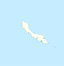
Oostpunt (also Land van Maal)[2] is a geozone (region) on the island of Curaçao. It is located on the easternmost point of the island.[2] Since the 1870s,[4] the area has been privately owned by the Maal family, and most of the area is off-limits,[5] with the exception of the villages of Oostpunt, Sint Joris, and Santa Catharina. The geozone of Oostpunt covers about 10% of the island.[6]
History[edit]
Plantation Klein Sint Joris (also San Juan) was founded in 1662 by Matthias Beck and is one of the oldest plantations on Curaçao.[7] Around 1840, Oostpunt was inhabited by 150 to 200 people, most of whom were slaves.[5] The Maal family, army officers from the Netherlands, arrived in Curaçao in the late 18th century[8] and had acquired five plantations by the 1870s. The plantations were used for agriculture, livestock, and mining,[4] however, the vast majority of land is pristine wilderness.[2][8] The coral reefs in Oostpunt are considered one of the best preserved reefs of the Caribbean.[9][10][11]
Settlements[edit]
The village of Oostpunt is only inhabited by Willy Maal and his mother.[12] Sint Joris consists of a collection of houses across Landhuis Klein Sint Joris, and is mainly inhabited by locals who have been born there. Santa Catharina is a recent addition which started to develop in the 1960s, and has attracted many Dutch citizens.[13] There are paved roads to Sint Joris and Santa Catharina. As of 2011[update], the remainder of Oostpunt can only be accessed via unpaved paths with large holes.[14]
National Park and Curaçao Marine Park[edit]
In 1987, the Government of Curaçao approached the Maal family to develop a conservation plan, and discuss the proposed development of a tourist resort in Oostpunt. In 1993, an area of 4,400 hectares (11,000 acres) was unilaterally declared a national park in which no development was possible.[4] Along the coast, the Curaçao Marine Park was announced to protect the coral reef.[15] The Maal family responded by suing the government for ƒ100 million (~US$56 million) for breach of contract.[16] A long legal battle followed, and the resort was built in the Bahamas instead.[4] On 7 June 1999, the Government of Curaçao was ordered to allow development in 50 percent of the area, and pay the Maal family ƒ20 million plus interest in damages.[17]
In 2010, the development plans of the Maal family were approved by the States of Curaçao.[18][4] The battle is not over, because CARMABI, the national institute for protected areas, wants to prevent any development,[19] and is backed by the International Coral Reef Society, National Geographic, NOAA, and others.[9] In April 2016, an attempt was made to stop the development plans using an outdated map[20] which resulted in a threat from the Maal family to resume litigation.[16] In December 2016, the development plans were once again approved by the States.[21]
References[edit]
- ^ "Where is Curaçao located". Villa Sea Shell. Retrieved 25 April 2021.
- ^ a b c d Buurtprofiel Oostpunt 2011, p. 10.
- ^ "Census 2011". Central Bureau of Statistics. Retrieved 25 April 2021.
- ^ a b c d e ""The Road To Economic Recovery, The Oostpunt Scenario"". Curaçao Chronicle. Retrieved 25 April 2021.
- ^ a b Buurtprofiel Oostpunt 2011, p. 8.
- ^ Buurtprofiel Oostpunt 2011, p. 6.
- ^ Buurtprofiel Oostpunt 2011, p. 9.
- ^ a b "De kwestie Maal (1)". Jan Thiel Blogspot (in Dutch). Retrieved 25 April 2021.
- ^ a b "CURAÇAO 1 of the 3 BEST REEFS IN THE CARIBBEAN" (PDF). Research Station Carmabi. p. 13. Retrieved 25 April 2021.
- ^ "Oogstrelend, Oostpunt van Curaçao". Duiken.nl. Retrieved 25 April 2021.
- ^ "Curaçao's Oostpunt Reef among the Best in the Caribbean". Repeating Islands. Retrieved 25 April 2021.
- ^ Buurtprofiel Oostpunt 2011, p. 24.
- ^ Buurtprofiel Oostpunt 2011, p. 25.
- ^ Buurtprofiel Oostpunt 2011, p. 22.
- ^ "Curaçao Marine Park". Beautiful Curaçao. Retrieved 25 April 2021.
- ^ a b "Schadeclaim Maal dreigt opnieuw". Antilliaans Dagblad (in Dutch). Retrieved 25 April 2021.
- ^ "Maal wil schadevergoeding voor niet nakomen afspraken Oostpunt in Curacao". Dutch Caribbean Legal Portal (in Dutch). Retrieved 25 April 2021.
- ^ "Groen licht voor bouwplan Oostpunt". Versgeperst (in Dutch). Retrieved 25 April 2021.
- ^ "'Reef will die with development at Oostpunt'". Research Station Carmabi. Retrieved 25 April 2021.
- ^ "Bestemming Oostpunt ondanks bezwaren ongewijzigd". Amigoe via Knipselkrant Curaçao (in Dutch). Retrieved 25 April 2021.
- ^ "Maal: Eindelijk gerechtigheid". Antilliaans Dagblad via Knipselkrant Curaçao (in Dutch). Retrieved 25 April 2021.
Bibliography[edit]
- "Buurtprofiel Oostpunt" (PDF). Government of Curaçao (in Dutch). 2011.

