
Wikipedia:WikiProject U.S. Roads/Maps task force/Review
| This page is currently inactive and is retained for historical reference. Either the page is no longer relevant or consensus on its purpose has become unclear. To revive discussion, seek broader input via a forum such as the village pump. |
This page is intended to be a Peer review for maps related to the maps task force. Any and all requests for critiquing, second opinions, or an assessment should be made here. Anyone can submit a request for review and anyone can comment on that request.
For quickest processing time and the greatest ease, please follow the instructions below:
- Add a new section by clicking here.
- For the section name, enter the name of the map for which a review is requested.
- In the section text, please briefly describe your request (basically what road the map is for and any concerns you may have). Please link to the map as well (width of 300px, please). All further comments regarding this request will be placed in that section.
Your cooperation in following the above instructions is greatly appreciated.
Vermont Route F-5[edit]

Here's another map that I've made using Stratosphere's proposal. My concern regarding this are the size of the US 7 and VT F-5 shields. Are they too small or should they be left as is? --TMF T - C 06:20, 26 September 2006 (UTC)
- Depends on the intended use. If the user is meant to click on the map and view it full-size, they're fine. Otherwise, they're too small by about half. Powers T 15:48, 26 September 2006 (UTC)
- That's true; the 20px/25px standard was meant for embedding in pages, not necessarily smaller thumbnails. But it would be silly to have a thumbnail version and a full sized version. What about 20px/25px based on a resolution of whatever the map size actually is (400x500 or something)? (I know it would result in some pretty big shields on the big maps.) —Rob (talk) 22:08, 26 September 2006 (UTC)
- There's no context at all - I'd use about 1/4 the scale so the surrounding areas can be seen, and ditch the shields. --NE2 20:06, 27 September 2006 (UTC)
- The reason that there's no context is that, honestly, there's nothing else in the area. VT F-5 is a simple 3-mile road in rural Vermont, so there's nothing to be seen even at 1/10th the scale. Also, I disagree about losing the shields, but this isn't the time or place for that discussion. --TMF T - C 00:06, 28 September 2006 (UTC)
- If you were to zoom out, someone familiar with Lake Champlain could more easily place the route. --NE2 00:41, 28 September 2006 (UTC)
- The reason that there's no context is that, honestly, there's nothing else in the area. VT F-5 is a simple 3-mile road in rural Vermont, so there's nothing to be seen even at 1/10th the scale. Also, I disagree about losing the shields, but this isn't the time or place for that discussion. --TMF T - C 00:06, 28 September 2006 (UTC)

Here's a requested map. Would like it reviewed. Thanks! 25or6to4 22:51, 26 September 2006 (UTC)
- One issue that I see is the background of the map. Instead of white, it should be the tan-ish color specified in the proposal. Otherwise, it looks good to me. --TMF T - C 23:08, 26 September 2006 (UTC)
- I don't suppose you can import the image Image:I-10.svg into the picture, can you? —Rob (talk) 03:38, 27 September 2006 (UTC)
The Gulf of Mexico and possibly the Rio Grande should probably be colored blue. Powers T 14:43, 27 September 2006 (UTC)
- The shields seem redundant, and are unreadable at this scale. This is going to be used only in the I-10 article, where the context is obvious. --NE2 19:58, 27 September 2006 (UTC)
- I dunno, putting the shields in makes it more useful for the reader and easier to understand Stratosphere (U T) 18:34, 28 September 2006 (UTC)
All righty. Background color: check. Removed sheilds: check. Removed coastal waters line: check. 25or6to4 11:45, 29 September 2006 (UTC)
- I haven't made any maps of Texas, what projection did you use? Stratosphere (U T) 13:58, 29 September 2006 (UTC)
- When I originally put my information together, it defaulted to GCS_North_America_1983. I had wondered if I should localize it more to a Texas scale, either a Texas centric or the TSMS. What are your thoughts? Would it be too late to convert it? 25or6to4 15:55, 29 September 2006 (UTC)
I put the map in the infobox at Interstate 10 in Texas to see how it looks on the page. --Holderca1 14:27, 29 September 2006 (UTC)
- I like this map a lot now. Looks sharp! No complaints/concerns here. Nice job. --TMF T - C 19:14, 29 September 2006 (UTC)
Virginia District 1, 1923-1928 and 1928-1933[edit]


These maps show the numbering systems used in Virginia from 1923 to 1928 and 1928 to 1933. I also plan to do a 1933-1940 one, as well as one showing the 1940 renumbering, and probably a current one. --NE2 20:09, 27 September 2006 (UTC)
- Hoo. No real good options here because as the state numbers get more and more scrunched up, the more arrows and lines will be needed to figure out what's what. It's not bad so long as it's presented 100% (or readable) all of the time. —Rob (talk) 20:41, 28 September 2006 (UTC)

Per request on MTF page, here is a map of CA SR 1. If you're knowledgable about the highway, please indicate any errors here. Stratosphere (U T) 23:30, 27 September 2006 (UTC)
- This looks pretty good. I don't think it's a good idea to make the U.S. Routes thicker, since, especially in California, a U.S. Route is just a state route with a different shield. The only U.S. Routes still in California are those that Caltrans has been "forced" to keep by other states; for example, the old US 6 to Los Angeles (now SR 14) is just as major as any real U.S. Route. I might however use a different color for US 101 to make it clear how closely linked SR 1 and US 101 are. --NE2 23:36, 27 September 2006 (UTC)
- One can see, by reading the article that CA SR 1 and US 101 are closely related. There is no need to make US 101 stand out in this map of CA SR 1 --Stratosphere (U T) 17:16, 28 September 2006 (UTC)
- To address your other issue, a US Route is still a US Route, per AASHTO, and as such should be designated so, whether or not it's really a state route in disguise. Stratosphere (U T) 17:20, 28 September 2006 (UTC)
- I'm trying to make the map more useful to the reader. If the rules prevent you from improving or maintaining Wikipedia, ignore them. --NE2 17:23, 28 September 2006 (UTC)
- The request I got was to make a map showing where CA SR 1 was in California. It didn't request to show how close it is to US 101 or if it ran through some parks, or changes in elevation...it's sole purpose is to show CA SR 1, a purpose which it meets very easily. If I had a request asking to show how CA SR 1 and US 101 are closely related, I would have done so. Feel free to make a map yourself or post a request for the task force. Stratosphere (U T) 17:46, 28 September 2006 (UTC)
- Can I request then that you color US 101, hmmm... purple, and double the width of SR 1? I think that would be more useful for the SR 1 article. --NE2 18:17, 28 September 2006 (UTC)
- Maps are not supposed to be the focal point of an article; the article itself is. The map is merely an illustration, and "special specs" for individual map, as you're hinting at both here and on the talk page, are not necessary and are, for the most part, defeating the entire purpose of the task force, which my understanding was to standardize the appearance of U.S. road maps across Wikipedia. --TMF T - C 18:49, 28 September 2006 (UTC)
- Yeah, you can request it here: WP:USRD/MTF/R. Whether or not someone takes it up, is another issue. --Stratosphere (U T) 18:19, 28 September 2006 (UTC)
- Can I request then that you color US 101, hmmm... purple, and double the width of SR 1? I think that would be more useful for the SR 1 article. --NE2 18:17, 28 September 2006 (UTC)
- The request I got was to make a map showing where CA SR 1 was in California. It didn't request to show how close it is to US 101 or if it ran through some parks, or changes in elevation...it's sole purpose is to show CA SR 1, a purpose which it meets very easily. If I had a request asking to show how CA SR 1 and US 101 are closely related, I would have done so. Feel free to make a map yourself or post a request for the task force. Stratosphere (U T) 17:46, 28 September 2006 (UTC)
- I'm trying to make the map more useful to the reader. If the rules prevent you from improving or maintaining Wikipedia, ignore them. --NE2 17:23, 28 September 2006 (UTC)
- To address your other issue, a US Route is still a US Route, per AASHTO, and as such should be designated so, whether or not it's really a state route in disguise. Stratosphere (U T) 17:20, 28 September 2006 (UTC)
- One can see, by reading the article that CA SR 1 and US 101 are closely related. There is no need to make US 101 stand out in this map of CA SR 1 --Stratosphere (U T) 17:16, 28 September 2006 (UTC)
- This is ideal. Red stands out, blue is important, orange is important, somewhat, but not right now. —Rob (talk) 20:39, 28 September 2006 (UTC)
I added the map to the article about (and by "about" I mean the primary subject of the article, not any related crap) CA SR 1 since there were no apparent factual errors regarding the map data. Stratosphere (U T) 16:22, 29 September 2006 (UTC)

A shieldless map of NY 317. The reason that I left shields off of this map was because of the large amount of roads depicted on this map. In red is NY 317. In light red is NY 31C, NY 317's predecessor. The New York State Thruway runs across the top in green. Comments welcome. --TMF T - C 04:14, 1 October 2006 (UTC)
- The map looks fine, but there's no context or scale. Even I, as a New Yorker, have absolutely no clue where this map is centered (except somewhere south of the Thruway) nor what the scale of the map is. I'm not sure if there's anything nearby to provide that scale, though. Is there at least a small city around, or a Thruway exit number? Maybe a county boundary? Powers T 17:23, 2 October 2006 (UTC)
- I agree with the above comment; if you could take a map of New York State, outline the box the current map represents, and overlay the existing map full scale on top of New York State (thus giving the map context) that would be awesome. —Rob (talk) 17:34, 3 October 2006 (UTC)
- Unfortunately, I lack the resources to do that, as any larger view would have a large amount of water bodies, roads, etc., and would make it impossible to draw by hand. If someone else wants to make a larger scale map (with NY 31C shown), go ahead, but this is the best I can do. --TMF T - C 19:00, 3 October 2006 (UTC)
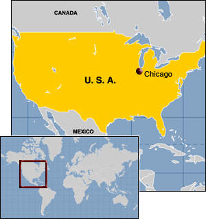
- It doesn't even have to be an SVG. :-p Here's an example of what I was thinking: http://www.kenclark.com/images/US_chicago.gif. Is every SVG map required to be done by hand? (I was under the impression there was some sort of GIS data --> SVG converter). —Rob (talk) 21:22, 3 October 2006 (UTC)
- Unfortunately, I lack the resources to do that, as any larger view would have a large amount of water bodies, roads, etc., and would make it impossible to draw by hand. If someone else wants to make a larger scale map (with NY 31C shown), go ahead, but this is the best I can do. --TMF T - C 19:00, 3 October 2006 (UTC)
 |
 |
Map of NY SR 481 and 104B as requested on WP:USRD/MTF/R. I have no direct knowledge of roads in New York, so please point out factual errors. Cheers. Stratosphere (U T) 05:50, 1 October 2006 (UTC)
Virginia's State Routes 296 and 298[edit]

For my first test of an SVG from ArcMap, I chose two useless routes - State Routes 296 and 298 (no articles yet; I'm thinking of writing one article for both). I hope to find a suitable file for water (the county lines are rivers), but otherwise this is ready.
Has anyone managed to fix the problem with text not lining up properly? I had to shift the text down in ArcMap to place it properly on the SVG. --NE2 07:02, 8 October 2006 (UTC)
Polaron found a water file, so the map now has water. --NE2 14:37, 9 October 2006 (UTC)
I made another one: Image:VASR 353 map.svg. Can someone please let me know if I'm doing anything wrong? --NE2 23:17, 9 October 2006 (UTC)
Interstate 410[edit]

Per request, the map of the I-410 loop around San Antonio. 25or6to4 03:49, 10 October 2006 (UTC)

Per request, the map of State Highway 151 on the west side of San Antonio. Decided to offset the highway a bit so that the downtown "loop" was included in the picture for reference. 25or6to4 03:54, 10 October 2006 (UTC)
- Looks good, but I think there may be too many streets shown on both of these maps. It becomes a big grey blob at this resolution. Powers T 20:13, 10 October 2006 (UTC)
- Agreed. I'd also thicken the routes, and make all freeways (or at least all completed freeways) blue. --NE2 15:13, 12 October 2006 (UTC)
- OK, here's what I'm working on currently. I agree that the gray streets should go. Here's my question. In the color scheme standards, we have blue (x3) for the limited access highways and orange (x2) for U.S. Routes. Now U.S. 90 running west of the downtown "loop" is a limited access highway. Which color should be used here? I had always assumed that the blue was for Interstate highways, and colored the highways on the map by highway type. 25or6to4 23:34, 14 October 2006 (UTC)
- If I was making it, I'd use the same width. The US 90 and US 281 freeways are practically identical in design to the Interstates, and were built and maintained by the same agency. --NE2 23:43, 14 October 2006 (UTC)
- (post edit conflict) 3x blue should be used in this case. I know it's not clear in the standards, but the limited-access class is intended to "override" the numbered route classes. Hope that makes sense. --TMF Let's Go Mets - Stats 23:45, 14 October 2006 (UTC)
- OK, here's what I'm working on currently. I agree that the gray streets should go. Here's my question. In the color scheme standards, we have blue (x3) for the limited access highways and orange (x2) for U.S. Routes. Now U.S. 90 running west of the downtown "loop" is a limited access highway. Which color should be used here? I had always assumed that the blue was for Interstate highways, and colored the highways on the map by highway type. 25or6to4 23:34, 14 October 2006 (UTC)
- Agreed. I'd also thicken the routes, and make all freeways (or at least all completed freeways) blue. --NE2 15:13, 12 October 2006 (UTC)
OK, I have made some updates. Gray streets are gone. All freeways are colored as such. I will have to wait to experiment with SVGs. 25or6to4 21:14, 15 October 2006 (UTC)
- The only problem that I see now is the map background color (it should be tan). Otherwise, it looks fine. --TMF Let's Go Mets - Stats 21:17, 15 October 2006 (UTC)
- Got it. I had the border color changed, not the background color. Silly me! 25or6to4 21:51, 15 October 2006 (UTC)

Does this do a good job of showing the bridge's location? --NE2 15:13, 12 October 2006 (UTC)
M-114[edit]

Anyone with a historical background, or perhaps, any information regarding M-114 as it was back in the 40s tell me if this is accurate. From what information I gathered, this is as complete as the Grand Rapids beltline appeared, never finishing the north leg before US-16 and US 131 byp took over in the mid 40s. Stratosphere (U T) 02:56, 30 October 2006 (UTC)
Various Oklahoma routes[edit]


Various maps in Oklahoma. —Scott5114↗ 16:07, 8 February 2007 (UTC)
- It's pretty hard to see where the route is; I'd thicken it. --NE2 01:34, 16 September 2007 (UTC)
 Is this a good zoom level? Note that going much further south would hit the South Carolina border. --NE2 01:30, 16 September 2007 (UTC)
Austin-area Maps[edit]
I've been working on some highway pages for the Austin, Texas area, and wanted to get a checkpoint on some maps that I've started before I placed them in the articles. Thanks.
Texas State Highway Loop 1[edit]

Texas Ranch to Market Road 2222[edit]

Texas Farm to Market Road 3177[edit]

Texas State Highway Spur 69[edit]

--Vollers 17:46, 17 September 2007 (UTC)
Does this need any improvement? — ComputerGuy890100Talk to meWhat I've done to help Wikipedia 02:52, 13 June 2008 (UTC)
Unweave the Weave project maps, review of quality scale grade needed[edit]
After figuring out that my article needed maps for some good reference and that it was a B-grade on Wikipedia's article quality scale, I added maps to try to make the article appear better. Here are my maps that could use a review:

