Winterthur Seen railway station
Winterthur Seen | ||||||||||||||||
|---|---|---|---|---|---|---|---|---|---|---|---|---|---|---|---|---|
 | ||||||||||||||||
| General information | ||||||||||||||||
| Location | Kanzleistrasse 60 8405 Winterthur Winterthur, Zürich Switzerland | |||||||||||||||
| Coordinates | 47°29′15″N 8°46′00″E / 47.48750°N 8.76667°E | |||||||||||||||
| Elevation | 468 m above the sea | |||||||||||||||
| Owned by | SBB-CFF-FFS | |||||||||||||||
| Operated by | SBB-CFF-FFS THURBO | |||||||||||||||
| Line(s) | Tösstalbahn Winterthur–Wil | |||||||||||||||
| Platforms | 2 | |||||||||||||||
| Connections | Winterthur buses | |||||||||||||||
| History | ||||||||||||||||
| Opened | 4 May 1875 | |||||||||||||||
| Services | ||||||||||||||||
| ||||||||||||||||
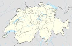
| Location | ||||||||||||||||
Winterthur Seen railway station (German: Bahnhof Winterthur Seen) is a railway station that serves Seen, which is district number 3 in Winterthur, a city in the canton of Zurich, Switzerland. It forms part of the Tösstalbahn section between Winterthur Grüze and Bauma.[1][2]
Location[edit]
Situated at the north eastern edge of central Seen, the station borders the quarter of Sonnenberg, on the other side of the tracks.
History[edit]
The station was opened on 4 May 1875, together with the rest of the first section of the Tösstalbahn, between Grüze and Bauma. One year later, the line was extended to Wald.
From 1882, the operating railway company also had a line of its own to Winterthur Hauptbahnhof.
On 10 June 1918, the station and the rest of the line were nationalized, and came under the control of the SBB-CFF-FFS.
Tracks[edit]
Winterthur Seen has two platform tracks.
Services[edit]
Zürich S-Bahn[edit]
The station is served by the following Zürich S-Bahn lines:
- S11 Aarau – Lenzburg – Dietikon – Zürich HB – Zürich Stettbach – Winterthur – Seuzach / Sennhof-Kyburg (– Wila)
Operates non stop between Stettbach and Winterthur; the lines to Seuzach and Sennhof-Kybourg are operated alternately at hourly intervals; supplementary trains to Wila. - S26 Winterthur – Bauma – Rüti ZH
Local transport[edit]
Stadtbus Winterthur serves the station with one Winterthur trolleybus line and one other bus line. Both lines terminate there.
| Line | Route |
|---|---|
| 2 | Wülflingen – Hauptbahnhof – Seen |
| 9 | Seen – Klösterli Iberg – Eidberg |
Line 3 (Rosenberg – Hauptbahnhof – Oberseen) has a bus stop about 200 m (660 ft) from the station.
See also[edit]
References[edit]
- ^ map.geo.admin.ch (Map). Swiss Confederation. Retrieved 2 December 2011.
- ^ Eisenbahnatlas Schweiz. Verlag Schweers + Wall GmbH. 2012. pp. 12–13. ISBN 978-3-89494-130-7.
External links[edit]
This article is based upon a translation of the German language version as at November 2011.

