
Zhuanghe
This article needs additional citations for verification. (February 2013) |
Zhuanghe
庄河市 Chwangho | ||||||||||||||||||||||||||||||||||
|---|---|---|---|---|---|---|---|---|---|---|---|---|---|---|---|---|---|---|---|---|---|---|---|---|---|---|---|---|---|---|---|---|---|---|
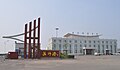
 Zhuanghe City Government, Xinhua Square | ||||||||||||||||||||||||||||||||||
 Zhuanghe Location in Liaoning | ||||||||||||||||||||||||||||||||||
| Coordinates (Zhuanghe government): 39°40′52″N 122°58′01″E / 39.681°N 122.967°E | ||||||||||||||||||||||||||||||||||
| Country | People's Republic of China | |||||||||||||||||||||||||||||||||
| Province | Liaoning | |||||||||||||||||||||||||||||||||
| Sub-provincial city | Dalian | |||||||||||||||||||||||||||||||||
| Seat | No. 1 Century Square (世纪广场1号) | |||||||||||||||||||||||||||||||||
| Area | ||||||||||||||||||||||||||||||||||
| • County-level city | 3,655.70 km2 (1,411.47 sq mi) | |||||||||||||||||||||||||||||||||
| • Urban | 239.00 km2 (92.28 sq mi) | |||||||||||||||||||||||||||||||||
| Population (2010)[3] | ||||||||||||||||||||||||||||||||||
| • County-level city | 841,321 | |||||||||||||||||||||||||||||||||
| • Estimate (2017) | 885,000 | |||||||||||||||||||||||||||||||||
| • Density | 230/km2 (600/sq mi) | |||||||||||||||||||||||||||||||||
| • Urban | 347,800 | |||||||||||||||||||||||||||||||||
| Time zone | UTC+8 (China Standard) | |||||||||||||||||||||||||||||||||
| Postal code | 116400 | |||||||||||||||||||||||||||||||||
| Dalian district map |
| |||||||||||||||||||||||||||||||||
| Division code | 210283 | |||||||||||||||||||||||||||||||||
| Website | www | |||||||||||||||||||||||||||||||||

| Zhuanghe | |||||||||
|---|---|---|---|---|---|---|---|---|---|
| Simplified Chinese | 庄河 | ||||||||
| Traditional Chinese | 莊河 | ||||||||
| Postal | Chwangho | ||||||||
| |||||||||
Zhuanghe (simplified Chinese: 庄河; traditional Chinese: 莊河; pinyin: Zhuānghé) is one of the two "northern county-level cities", the other being Wafangdian, under the administration of Dalian, located in the south of Liaoning province, People's Republic of China. Its area is 3,655.70 square kilometres (1,411.47 sq mi) and its permanent population as of 2010[update] is 841,321, making it Dalian's most spacious county-level division.[1][3]
Geography and climate[edit]
Zhuanghe occupies the northeastern corner of Dalian City on the Liaodong Peninsula, with latitude ranging from 39° 25' to 40° 12' N and longitude ranging from 122° 29' to 123° 31' E. It covers an area of 6,968 square kilometres (2,690 sq mi), 4,073 km2 (1,573 sq mi) of which is land; the natural coastline measures 285 km (177 mi).[4] It borders Donggang City to the east, Pulandian City to the west, Gaizhou City and Xiuyan Manchu Autonomous County to the north, and Changhai County in the Yellow Sea to the south. Elevations increase from south to north, with the northern part of the city being part of the southern Qian Mountains; the highest elevation in Zhuanghe City is 1,130.7 m (3,710 ft).[4]
Zhuanghe has a monsoon-influenced humid continental climate (Köppen Dwa), with long, cold, but dry winters, and humid and very warm summers. Due to the location on the Liaodong Peninsula, there is a seasonal delay in spring and summer, and extremes in heat are moderated; however, low temperatures peak in July. The monthly 24-hour average temperature ranges from −7.3 °C (18.9 °F) in January to 23.7 °C (74.7 °F) in August, and the annual mean is 9.3 °C (48.7 °F). Precipitation is generous but a majority of the annual total falls in July and Average. There is an average 2,415.6 hours of bright sunshine annually, and the frost-free period averages 165 days. Extremes in temperature range from −28.1 °C (−19 °F) to 36.0 °C (97 °F).
| Climate data for Zhuanghe (1991–2020 normals, extremes 1971–2010) | |||||||||||||
|---|---|---|---|---|---|---|---|---|---|---|---|---|---|
| Month | Jan | Feb | Mar | Apr | May | Jun | Jul | Aug | Sep | Oct | Nov | Dec | Year |
| Record high °C (°F) | 10.0 (50.0) |
12.4 (54.3) |
19.3 (66.7) |
29.3 (84.7) |
31.2 (88.2) |
36.0 (96.8) |
35.0 (95.0) |
35.0 (95.0) |
34.3 (93.7) |
28.1 (82.6) |
18.9 (66.0) |
12.0 (53.6) |
36.0 (96.8) |
| Mean daily maximum °C (°F) | −0.9 (30.4) |
2.1 (35.8) |
7.6 (45.7) |
14.8 (58.6) |
20.7 (69.3) |
24.1 (75.4) |
27.0 (80.6) |
28.1 (82.6) |
24.6 (76.3) |
17.7 (63.9) |
8.6 (47.5) |
0.7 (33.3) |
14.6 (58.3) |
| Daily mean °C (°F) | −6.9 (19.6) |
−3.6 (25.5) |
2.4 (36.3) |
9.6 (49.3) |
15.8 (60.4) |
20.1 (68.2) |
23.6 (74.5) |
24.0 (75.2) |
19.2 (66.6) |
11.7 (53.1) |
3.2 (37.8) |
−4.6 (23.7) |
9.5 (49.2) |
| Mean daily minimum °C (°F) | −11.8 (10.8) |
−8.3 (17.1) |
−2.1 (28.2) |
4.9 (40.8) |
11.2 (52.2) |
16.6 (61.9) |
20.7 (69.3) |
20.4 (68.7) |
14.2 (57.6) |
6.4 (43.5) |
−1.4 (29.5) |
−8.9 (16.0) |
5.2 (41.3) |
| Record low °C (°F) | −28.1 (−18.6) |
−25.2 (−13.4) |
−12.1 (10.2) |
−5.2 (22.6) |
3.3 (37.9) |
9.0 (48.2) |
14.4 (57.9) |
9.7 (49.5) |
2.7 (36.9) |
−5.8 (21.6) |
−14.2 (6.4) |
−23.4 (−10.1) |
−28.1 (−18.6) |
| Average precipitation mm (inches) | 5.0 (0.20) |
10.0 (0.39) |
15.9 (0.63) |
39.6 (1.56) |
69.9 (2.75) |
94.5 (3.72) |
163.6 (6.44) |
193.1 (7.60) |
68.0 (2.68) |
36.9 (1.45) |
29.0 (1.14) |
10.2 (0.40) |
735.7 (28.96) |
| Average precipitation days (≥ 0.1 mm) | 3.1 | 3.2 | 4.5 | 6.7 | 8.2 | 10.9 | 14.6 | 11.4 | 7.1 | 5.7 | 5.2 | 3.0 | 83.6 |
| Average snowy days | 3.9 | 3.4 | 2.0 | 0.5 | 0 | 0 | 0 | 0 | 0 | 0 | 1.9 | 3.8 | 15.5 |
| Average relative humidity (%) | 56 | 57 | 59 | 62 | 68 | 80 | 86 | 84 | 75 | 68 | 63 | 60 | 68 |
| Mean monthly sunshine hours | 207.8 | 196.3 | 238.1 | 239.4 | 256.3 | 207.6 | 175.9 | 212.7 | 235.4 | 217.3 | 175.1 | 184.6 | 2,546.5 |
| Percent possible sunshine | 69 | 64 | 64 | 60 | 58 | 47 | 39 | 51 | 64 | 64 | 59 | 64 | 59 |
| Source 1: China Meteorological Administration[5][6] | |||||||||||||
| Source 2: Weather China[4] | |||||||||||||
Administrative divisions[edit]
There are 5 subdistricts, 15 towns, 4 townships, and 2 ethnic townships under the city's administration:[7]
Subdistricts[edit]
- Chengguan Subdistrict (城关街道)
- Xinhua Subdistrict (新华街道)
- Xingda Subdistrict (兴达街道)
- Changsheng Subdistrict (昌盛街道)
- Mingyang Subdistrict (明阳街道)
Towns[edit]
|
Townships[edit]
- Anzishan Township (鞍子山乡)
- Buyunshan Township (步云山乡)
- Landian Township (兰店乡)
- Shicheng Township (Shihcheng) (石城乡)
Ethnic Townships[edit]
- Taipingling Manchu Ethnic Township (太平岭满族乡)
- Guiyunhua Manchu Ethnic Township (桂云花满族乡)
Demography[edit]
Zhuanghe has a population of over 900,000 and its area is 3,866 km2 (1,493 sq mi).
Transportation[edit]


- Zhuanghe Bus Station
- Zhuanghe Railway Station
- Zhuanghe Port
- China National Highway 201, running parallel to G15 and through downtown
- China National Highway 305, of which Zhuanghe is the terminus, provides access to the interior of the Liaodong Peninsula, Yingkou, and points beyond before terminating at Linxi, Inner Mongolia.
- G11 Hegang–Dalian Expressway, the main road to central Dalian, passing to the north of downtown
Economy[edit]
A base of the national commodity grain, Zhuanghe has very abundant agricultural and natural resources. Besides, it is one of the most important fruit bases in eastern Liaodong Peninsula. The Port of Zhuanghe is under construction.
Zhuanghe is also increasingly promoting its furniture manufacturing industry. The Huafeng Furniture Manufacturing Company has been one of the largest furniture manufacturing companies all over the country.
The Huayuankou Industrial Zone in the westernmost part of Zhuanghe City is one of "Five Points, One Line" projects of the province.
Sightseeing[edit]
The tourism has gradually developed to be rising support structure in the county.
- Chengshan Ancient Town (城山古城)
- Bingyu Valley (冰峪沟): Guilin of northern China
- Yinshitan National Forest Park (银石滩国家森林公园)
- Buyun Mountain (步云山), the highest peak in Dalian, at 1,130 metres (3,710 ft) above sea level, and Buyun Mountain Hot Spring
- Sea King Nine Islands (海王九岛)
- Xianrendong National Nature Reserve (仙人洞国家级自然保护区)
Gallery[edit]
-
 Zhuanghe Port
 -
 Zhuanghe City Xinhua Christian Church
 -
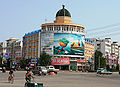 Downtown Zhuanghe on Huanghe Avenue at Xinhua (2007)


References[edit]
- ^ a b 大连统计年鉴2012 [Dalian Statistical Yearbook 2012]. Huaihua Statistical Bureau. 2012.
- ^ a b Ministry of Housing and Urban-Rural Development, ed. (2019). China Urban Construction Statistical Yearbook 2017. Beijing: China Statistics Press. p. 50.
- ^ a b 怀化市2010年第六次全国人口普查主要数据公报 (in Chinese). Huaihua Statistical Bureau/怀化市统计局. Archived from the original on 14 July 2014. Retrieved 9 July 2014.
- ^ a b c 庄河城市介绍 [Zhuanghe city introduction] (in Chinese). Weather China. Retrieved 2022-08-30.
- ^ 中国气象数据网 – WeatherBk Data (in Simplified Chinese). China Meteorological Administration. Retrieved 29 July 2023.
- ^ 中国气象数据网 (in Simplified Chinese). China Meteorological Administration. Retrieved 29 July 2023.
- ^ 2011年统计用区划代码和城乡划分代码:庄河市 (in Chinese). National Bureau of Statistics of the People's Republic of China. Retrieved 2013-02-18.
