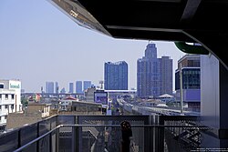
Bang Sue subdistrict
Appearance
(Redirected from Bang Sue Subdistrict)
Bang Sue
บางซื่อ | |
|---|---|
 | |
 Location in Bang Sue District | |
| Coordinates: 13°48′23.04″N 100°31′17.61″E / 13.8064000°N 100.5215583°E | |
| Country | |
| Province | Bangkok |
| Khet | Bang Sue |
| Area | |
| • Total | 5.762 km2 (2.225 sq mi) |
| Population (2020) | |
| • Total | 79,405 |
| Time zone | UTC+7 (ICT) |
| Postal code | 10800 |
| TIS 1099 | 102901 |
Bang Sue (Thai: บางซื่อ, pronounced [bāːŋ sɯ̂ː]) is a khwaeng (subdistrict) of Bang Sue District, in Bangkok, Thailand. In 2020, it had a total population of 79,405 people.[2]
Geography
[edit]Bang Sue is the southern part of the district. The west bank is all connected to the Chao Phraya River. It borders Wong Sawang to the north (Southern Railway Line is a borderline), Chatuchak to the east (Khlong Prapa is a borderline), Thanon Nakhon Chai Si to the south (Khlong Bang Sue is a borderline), Bang O (across the Chao Phraya River) to the west.
References
[edit]- ^ Administrative Strategy Division, Strategy and Evaluation Department, Bangkok Metropolitan Administration (2021). สถิติกรุงเทพมหานครประจำปี 2563 [Bangkok Statistics 2020] (PDF) (in Thai). Retrieved 27 November 2021.
{{cite web}}: CS1 maint: multiple names: authors list (link) - ^ "Population statistics 2020" (in Thai). Department of Provincial Administration. Retrieved 12 October 2021.
