
Euabalong West
| Euabalong West New South Wales | |
|---|---|
 Uabba Street, the main street of Euabalong West | |
 Euabalong West | |
| Coordinates | 33°04′S 146°24′E / 33.067°S 146.400°E |
| Population | 66 (2016 census)[1] |
| Established | 1870s |
| Postcode(s) | 2877 |
| LGA(s) | Cobar Shire |
Euabalong West is a small town on the Broken Hill Railway Line that was founded to serve the residents of nearby Euabalong, which was a crossing point for the Lachlan River founded in the 1870s. The town has approximately 70 people, and its main industries are cropping, grazing, and railway-related employment.[2]
Euabalong West railway station opened in 1919[3] and is served by the weekly Indian Pacific train between Sydney and Perth. NSW TrainLink's weekly Outback Xplorer also serves the town.[4]
The town was the scene of a major freight derailment in January 2007, when a freight train carrying chemicals derailed and spilled wreckage over a 1.5 km zone, blocking all rail traffic between Adelaide and Sydney.[5]
Gallery[edit]
-
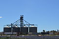 Euabalong Grain Elevator
 -
 Euabalong West


References[edit]
- ^ Australian Bureau of Statistics (27 June 2017). "Euabalong West (State Suburb)". 2016 Census QuickStats. Retrieved 21 March 2018.
- ^ Cobar Shire Council, "Cobar Shire: Villages" Archived 5 February 2007 at the Wayback Machine. Accessed 9 April 2007.
- ^ "Euabalong West railway station". www.nswrail.net. Retrieved 7 April 2008.
- ^ "Western timetable". NSW TrainLink. 7 September 2019.
- ^ Australian Broadcasting Corporation, "Euabalong West derailment cuts track" Archived 3 June 2011 at the Wayback Machine, 15 January 2007. Accessed 9 April 2007.
External links[edit]
![]() Media related to Euabalong West at Wikimedia Commons
Media related to Euabalong West at Wikimedia Commons
This Central West geography article is a stub. You can help Wikipedia by expanding it. |